
Radtour zum Nordkapp
Reisebericht: Og Finland på langs/And along the length of Finland
Aktionen
![]()
Bitte warten - Kartendaten werden geladen
Erstellt am 03.03.2014,
zuletzt geändert von Ottocolor am 22.04.2014
Aktionen
Strecken-Merkmale
geplant
gefahren
Gesamtlänge in km
2.157
2.264
Gesamthöhenmeter Aufstieg
17.288
18.155
Durchschn. Steigung Aufstieg %
0,80
0,80
Gesamthöhenmeter Abstieg
17.037
17.904
Informationen zu Rechten an den GPS-Track-Daten | |
|---|---|
Rechte-Inhaber | |
Rechte-Ausprägung / Lizenz | by-sa: CREATIVE COMMONS Namensnennung, Weitergabe unter gleichen Bedingungen |
Link zur Rechtebeschreibung | |
gpx-Datei hochgeladen | durch Ottocolor am 03.03.2014
|
Gesamtzahl Trackpoints
22.595
23.052
Trackpoint-Dichte per km
6
10
Endorte
Start
Odense, Region Syddanmark, DK (7 m NHN)
Ziel
Nordkapp, Finnmark, NO (258 m NHN)
Charakter
It was the fulfillment of an old dream: to ride on a bicycle to Europe's northernmost point of the North Cape. That was the main goal. At the same time, I had an idea to cycle through Finland from the southernmost to the northernmost point. My keen interest in Finland and the Finnish language was the obvious choice to do it: Hangosta Utsjoelle, (from Hanko to Utsjoki) as the trip is called in Finnish. In fact, Finland's northernmost point is 45 km further, in Nuorgam. Utsjoki / Nuorgam meant a detour of 200 km compared to the straight route via Karigasniemi and Karasjok. In addition, the detour involved the mountain range of Ifjord fjellet. From there I inteded to go to Lakselv and continue along the beaten path to the North Cape.
The first challenge was to get to Finland with my bike the easiest and fastest way. The solution was the ferry from Travemünde in Germany to Helsinki/Vuosaari. Now remained the task of getting to Travemünde. I chose to bike the stretch as a kind of warm up via ferries Spodsbierg - Tars and Rodby - Puttgarden and then down along the east coast of Schleswig-Holstein.
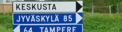
The route in Finland, which made up for three-quarters of the entire trip, I had planned in advance using purchased Finnish cycling maps. I planned to cycle between two and six stages in a row and then take a day off in between. I wanted to see some sights of the towns, such as Tampere, Jyväskylä, Oulu and Rovaniemi, but they also invited to plain rest, lying on my back in my tent, plus, particularly in the north, a little civilization like shops and pubs outside the wilderness. One place I had booked a hotel room, namely in Oulu, where I would rest on my birthday, 3 June. That plan was later changed. Instead, I booked into a hotel in Forssa due to poor weather and a very late arrival in the dark. In the other countries I did not plan any rest days. I had to take one in Northern Norway, however, due to the aforementioned technical problems.
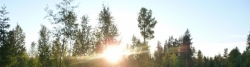
My time plan was scheduled for exactly one month, from mid-May to mid-June. At this time I could most easily spend my sabbatical leave on TV2. Another advantage was that the midget plague of the north was not as bad as later in the summer and that the light would be close to optimal. There would be light around the clock up north.
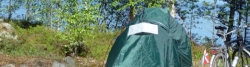
So after buying a new tent, a sleeping bag and a mattress, which I tested on a three-day training session in April to the Danish north cape of Skagen, I was ready. Apart from that Skagen is not a cape. Jutland runs almost into the sand up there. The temperatures during the training trip was very low, as they of course, can be far to the north in the summer, so it was a good test.
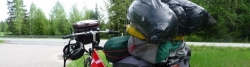
The bike for the trip was to be my normal Kildemoes Street with a Shimano 7 speed. I had already equipped it with a front pannier hold and the back panniers just sat on the regular luggage rack. My bike was made fit by a specialist who replaced all wear parts and equipped me with tubes and a folding tyre. I took all equipment to make my own way in the wilderness incl. two gas boilers. The idea was to be as much independent as long as possible. It obviously cost some weight on the bike. Furthermore, I'm sweating a lot and had the principle not to creep unwashed down into the bag. So it took some clothes too.
I guess my pack weighed almost 50 kg without food shopping and water. Fortunately I had not especially challenging terrain to expect. Finland is at most hilly in the central and northern part and rather flat in between. These challenges I would meet only in Northern Norway.
All in all, I was well prepared for the big challenge I had planned meticulously. I was going to miss my two children Alexander on 15 and Simon 12 My girlfriend Jeanette broke up with me just before the trip, so I was a single man on the trip in more than one way. It was to be a journey to the north and into myself. I needed to 'find myself', as one may say. And a long trip alone is an excellent opportunity for that.
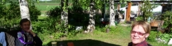
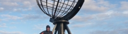
Another unique fact was that my mother, my beloved Mutti, had decided to sail to the North Cape with Hurtigruten and we had agreed to meet on the North Cape itself. I would arrive by bike there the night before her arrival and she would take a bus trip there from Honningsvåg where her ship, M / S Lofoten, had docked. It would be great to greet each other up there. For my mother it was also a huge challenge to make the long trip up there, not least because of the good ship Lofoten turned out to be very, very far from a comfortable cruise ship. More a floating hostel. But we did not know when we were planning her journey.
One minor thing was that the World Cup in South Africa would start while I was on the way, so I planned to see a few games in the evening. Otherwise, I equipped myself with a radio. The hope was to catch the signal from, for example, BBC World Service and listen to football in English. Well, it was not a big issue, but it was included anyway in my planning.
This was my situation when I cycled out of the driveway on Næsbygårdsvej on May 17, 2010.
Informationen zu Urheber-Rechten | |
|---|---|
Rechte-Ausprägung / Lizenz | by-sa: CREATIVE COMMONS Namensnennung, Weitergabe unter gleichen Bedingungen |
Link zur Rechtebeschreibung | |
übernommen / bearbeitet am | 02.04.2014 - 07.04.2014
|
übernommen / bearbeitet durch |
|
Landschaft
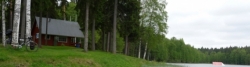
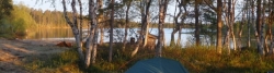
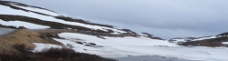
The landscape features were definitely one of the tour's forces. Only a slow transport as on a bike will let you experience the shift from our well tempered and very civilized latitudes to the great forest solitude up north. It was also a journey into the vast empty landscape that attracted me. Alone in the wild. Not against it, as that would have meant a failure, but a gradual adaptation to and use of ones limited opportunities fortunately.
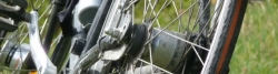
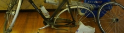
Twice it looked as if the journey was not feasible, but both times I overcame the challenges. The first time was in Central Finland, where a shin splints cost me a lot of pain and a doctor at the main hospital in Jyväskylä was close to rule me out. But penicillin can be a wonder drug. The second time the bike failed after the violent and long way over the Ifjord mountain ridge. It made my rear wheel bearing break and the balls rolled out of it. But after a transport stage in a bus I found a bicycle mechanic who changed the bearing and I could go the last 150 km to the North Cape.
But first I had first to make to Finland and the forest loneliness. I really missed it a lot on the stretch along the densely populated and very touristic coast of Schleswig-Holstein. There were cars, people and campgrounds everywhere. But I knew that the good girl Finnmaid would take me to Helsinki, so it was a part of the landscape character of the trip.
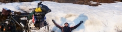
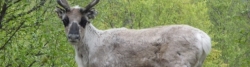
The end of the trip with the main objective North Cape was also the absolute scenic highlight of the trip. I saw it even stronger, because the day before I was almost sure that my trip was over, when it initially was not possible to have my bike fixed. When it worked again, I rode my bicycle up a lonely, wide and winding coastal road with the wide inlet Porsangen to one and high mountains on the other. I saw porpoises in the water and eagles over my head. And a fox came close to me. Plus the ubiquitous reindeer who often raced with my bike and leaped onto the road in front of my front wheel. They had to make it in FRONT of me instead of letting me pass and quietly cross the road behind me. Strange reindeer logic. The pleasure to ride again that daylight night I will never forget in my life.
The final stage was very mountainous, and it was challenging enough, but the single biggest challenge was the North Cape tunnel. It was really disgusting. First three kilometers of furious descent into the narrow tunnel. The cars could not overtake me, because I rode right out in the middle of the road and I drove also easily fast enough to do so. But when the bottom was reached, and the strait between the mainland and the island of Magerøy is several hundred feet deep, my problems began, for now, I was overtaken all the time on the narrow road, and it was impossible to hear if the car came from the front or from behind and if it was far away or close. Furthermore, the air in the tunnel was bad and it was hard to breathe. This in addition to the tough, tough climb and the darkness and the cold. All in all it meeans, that I never ever in my life will cycle through that tunnel again. The only mitigating factor was that it was free for cyclists, but cost money for the damned cars. Also the two increases of Magerøy were a tall order. North Cape is located on a 300 m high plateau. I knew that, but I did not know that after the initial rise I went almost down to sea level again before the ascent to the plateau began. But now I was at the North Cape and all landscape challenges shrank for the joy of having reached my goal.
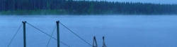
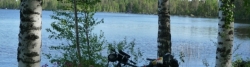
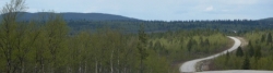
Otherwise, the memory of the huge, almost endless forests of northern Finland stand strongest. Through it leads a lonely road quietly rolling up and down very long flat hills with changing road surface, asphalt or oil gravel. Once every quarter or so, I would meet a car. In the evenings, sometimes a full hour between two cars. The temperature is low, the wind light head wind, the cold iceocean wind, which was prevalent throughout the northern half of my trip. One advantage of the cold was the absence of mosquitoes. As soon as the temperature was over 10 degrees, apparently a kind of operating temperature for mosquitoes, the little bastards were there. As long as I cycled, it was fine, but any small break in warmer air made it troublesome. Then I had to smear mosquito repellent on the skin. But mostly it was all too cold for them. The cold made the evening bath in a lake, the sea (once, in Kemi) or a river to another scenic challenge of the harsh kind. Chattering teeth!
Further south in Finland was the almost infinite amount of lakes surrounded by beautiful deciduous forest, and here the birch is the character tree, prevailed. the four-day stretch from Jyvaskyla to Oulu was characterized by sunny, warm weather, and here the typical Finnish combination of lakes and woods were a pleasure to cycle through.
Otherwise, I was not very lucky with the weather. In the south, there was often rain. Day rain as on the stages to Forssa and Jyväskylä and squall weather the other days. Also on the other side of Oulu thee weather was unfavourable, except that it kept the mosquitoes away. The peak of this was a snow flurry right after Kemi. In addition I had the constant headwind. But it's what you can expect when you are on your way for a whole month at northern latitudes.
Informationen zu Urheber-Rechten | |
|---|---|
Rechte-Ausprägung / Lizenz | by-sa: CREATIVE COMMONS Namensnennung, Weitergabe unter gleichen Bedingungen |
Link zur Rechtebeschreibung | |
übernommen / bearbeitet am | 02.04.2014
|
übernommen / bearbeitet durch |
|
An- und Abreise
There was no travel to the starting point as such, as I left from home. However, the trip was planned in that way that I on the route from my home to Finland's southernmost town of Hanko could use public transport. After that the plan was to go all the way to the North Cape by bike. Therefore, the stretch Næsby - Hanko includes two train rides (Odense - Svendborg and Helsinki - Hanko) and three ferry crossings (Spodsbierg - Tars, Rodby - Puttgarden and Travemünde-Helsinki/Vuosaari). The whole of Finland was thus done on the bike while I had to take a transport stage in a bus in northern Norway (about 125 km) due to technical problems on the bike.
The return journey was planned as a sea voyage from Honningsvåg on Magerøy to Bergen with Hurtigruten along with Mutti. From Bergen we had booked a flight incl. bicycle transportation to Copenhagen. From there respectively to Odense and Sønderborg by train. It turned out somewhat different, as the floating hostel M/F Lofoten, on which Mutti had come sailing all the way to Honningsvåg, 35 km from the North Cape, suffered serious mechanical problems in the port of Kirkenes. The trip was therefore initially cancelled. We learned about that an early, early Sunday morning by way of an announcement on the Hurtigruten's office in the port of Honningsvåg. Any contact to Hurtigruten in terms of rebooking was not possible. Fortunately the staff at Rica Hotel Honningsvåg helped us further by finding a bus to Hammerfest, where we, after some negotiations on the phone with the Hurtigruten's next southbound ship M/F Midnatssol, would be allowed to board the ship and get a cabin. It required a difficult bus trip with a tiresome interchange in Olderfjord in pouring rain. It must be remembered that I had all my luggage from one month of cycling holiday with me, mind you, not loaded on the bike. Then it it takes up a great deal of space. Luckily we got in contact with a Japanese couple who had fallen into the same problems as us. We helped each other as they could not understand much English, let alone Norwegian, and they could help Mutti, who was slightly walking-impaired and well up in her years at this time with her own luggage and also me with all my panniers and plastic sacks. The new plan also requested a hotel accommodation in Hammerfest and of course meals there. It must be said to the Hurtigruten defense that they paid the bus transportation, meals and the hotel accommodation for us, and after some negotiation on board Midnatssol, also a flight from Trondheim to Bergen. The latter was necessary, because we would arrive a day late to Bergen, and after intensive research on the internet it proved impossible to book a flight to Copenhagen that day. That was okay service by Hurtigruten However, their level of information in the port of Honningsvåg was beneath contempt poor. They claimed I had not given them my cell phone number. In that case they had contacted me, I was told. I chewed a little on that. For the time being especially my Mom was happy to board the lovely and luxurious ship of M/F Midnatssol (Midnight Sun) with glass elevators like on the Titanic in the port of Hammerfest and enjoy four days of crossing in and out of the north and west Norwegian fjords. We got a fairly good interior cabin, the catering was opulent and the cinema showed the matches from the football World Cup in South Africa. So life was glorious. Also our booked excursions, the midnight concert in the Arctic Cathedral in Tromso and, for my part, one memorable sea eagle safari in the Lofoten Islands, were carried out to our great satisfaction. It was altogether a great experience to sail by the mountains (instead of cycling up and down them) and enjoy the luxury of the ship. In the ports there was every time a few hours stay, so especially I could take the opportunity to look at towns behind the ports, including a visit to the Hurtigruten museum in Stokmarknes in the islands of Vesteralen. The eagle safari, which was conducted in a fast little boat, unfortunately in cold, rainy and misty weather, was the highlight of the voyage. And I really saw eagles which were so clever to get close to us, as they were fed with fat salmon. Unfortunately, my camera failed here, probably because of the rain, so all my pictures were destroyed. I felt it a big loss and chewed a lot on that. Seasickness was also a challenge to me, although the ship mostly sailed in fjords and sounds, so I did with vomiting once, when she crossed a stretch of open sea, namely Lopphavet north of Tromsø. The crossing of the open West Fjord from Lofoten to Bodo took place at night and caused no qualms for me. The weather on the whole voyage was cold, wet and windy. On 23 June we saw Midsummer bonfires flapping on the coast. Highlights from the west coast of Norway was the mountain with a hole through it, Torghatten, and the incredibly beautifully situated town of Brønnøysund. But as we, in the course of the four days of sailing, approached Trondheim, we had to think about saying goodbye to the ship. Due to a day's delay we would be cheated for another day's of sailing through Kristiansund, Aalesund and Molde to Bergen. We were sad about that, because the fault was not ours, but then I, Mutti chose to remain seated in the port, could take a closer look at Trondheim with the amazing Nidaros Cathedral, once the capiltal of entire Scandinavia. I had of course my bike and was independent and free. Until it was time to find Mutti on a bench in the sun (!) at the port and find a bus to the airport. Bicycle transportation per aircraft proved a bit tricky, since I didn't, as the regulations say, manage to turn the pedals of the bicycle. But it went anyway. It was wrapped in plastic and disappeared out of my control. In Bergen, I got it handed over, thankfully in one piece. Here we changed our flight in order to make it for our booked flight to Copenhagen. It was cumbersome and tiring for us with all that luggage. The Japanese couple had, of course, stayed aboard the ship in Trondheim, so we had to make ourselves the best possible way. Furthermore, I made a mistake at the interchange at Copenhagen Central Station, so I ended up struggling my heavy, as reloaded, bike down a flight of stairs to the waiting train to Odense/Sønderborg on the platform. Mutti was tired like a whole retirement home when she was at home where my brother fortunately drove her the last little piece home and to bed. I cycled the five kilometres out to my house in Næsby and was after six weeks of northern odyssey finally home again. I immediately switched on the TV set in my bedroom as Denmark played a vital World Cup match against Japan after a win and a defeat in the first two group matches. Unfortunately, ours lost 1-3 and goodnight to them in South Africa. And to me in my bed in Næsby.
Bemerkungen
The whole of the cycle trip can be divided into three major parts: Initial haul: Naesby-Hanko, 6 days/4 stages, Finland: Hanko-Nuorgam, 22 days/17 stages and Northern Norway: Nuorgam-North Cape, 5 days/3 stages. In total 33 days/24 stages. The major part og Finland can be further divided into 5 parts, each with a rest day in between: Part 1: Hanko-Tampere, 3 days, part 2: Tampere-Jyväskylä, 2 days, part 3: Jyväskylä-Oulu, 4 days, part 4: Oulu-Rovaniemi, 2 days and part 5: Rovaniemi-Nuorgam, 7 days/6 stages. That makes five rest days in Finland, nine over all.
Etappen
Informationen zu Urheber-Rechten | |
|---|---|
Rechte-Inhaber | |
Rechte-Ausprägung / Lizenz | by-sa: CREATIVE COMMONS Namensnennung, Weitergabe unter gleichen Bedingungen |
Link zur Rechtebeschreibung | |
Bild hochgeladen | durch Ottocolor am 05.03.2014
|
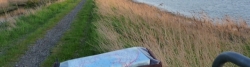
44 km
Næsby-Nakskov
Informationen zu Urheber-Rechten | |
|---|---|
Rechte-Inhaber | |
Rechte-Ausprägung / Lizenz | by-sa: CREATIVE COMMONS Namensnennung, Weitergabe unter gleichen Bedingungen |
Link zur Rechtebeschreibung | |
Bild hochgeladen | durch Ottocolor am 05.03.2014
|
93 km
Nakskov-Kellenhusen
Informationen zu Urheber-Rechten | |
|---|---|
Rechte-Inhaber | |
Rechte-Ausprägung / Lizenz | by-sa: CREATIVE COMMONS Namensnennung, Weitergabe unter gleichen Bedingungen |
Link zur Rechtebeschreibung | |
Bild hochgeladen | durch Ottocolor am 05.03.2014
|
57 km
Kellenhusen-Travemünde
Informationen zu Urheber-Rechten | |
|---|---|
Rechte-Inhaber | |
Rechte-Ausprägung / Lizenz | by-sa: CREATIVE COMMONS Namensnennung, Weitergabe unter gleichen Bedingungen |
Link zur Rechtebeschreibung | |
Bild hochgeladen | durch Ottocolor am 05.03.2014
|
Dag på havet/day at sea
Informationen zu Urheber-Rechten | |
|---|---|
Rechte-Inhaber | |
Rechte-Ausprägung / Lizenz | by-sa: CREATIVE COMMONS Namensnennung, Weitergabe unter gleichen Bedingungen |
Link zur Rechtebeschreibung | |
Bild hochgeladen | durch Ottocolor am 05.03.2014
|
26 km
Vuosaari-Helsinki-Hanko
Informationen zu Urheber-Rechten | |
|---|---|
Rechte-Inhaber | |
Rechte-Ausprägung / Lizenz | by-sa: CREATIVE COMMONS Namensnennung, Weitergabe unter gleichen Bedingungen |
Link zur Rechtebeschreibung | |
Bild hochgeladen | durch Ottocolor am 05.03.2014
|
31 km
Hanko
Informationen zu Urheber-Rechten | |
|---|---|
Rechte-Inhaber | |
Rechte-Ausprägung / Lizenz | by-sa: CREATIVE COMMONS Namensnennung, Weitergabe unter gleichen Bedingungen |
Link zur Rechtebeschreibung | |
Bild hochgeladen | durch Ottocolor am 05.03.2014
|
68 km
Hanko-Kirakanjärvi
Informationen zu Urheber-Rechten | |
|---|---|
Rechte-Inhaber | |
Rechte-Ausprägung / Lizenz | by-sa: CREATIVE COMMONS Namensnennung, Weitergabe unter gleichen Bedingungen |
Link zur Rechtebeschreibung | |
Bild hochgeladen | durch Ottocolor am 05.03.2014
|
110 km
Kirakanjärvi-Forssa
Informationen zu Urheber-Rechten | |
|---|---|
Rechte-Inhaber | |
Rechte-Ausprägung / Lizenz | by-sa: CREATIVE COMMONS Namensnennung, Weitergabe unter gleichen Bedingungen |
Link zur Rechtebeschreibung | |
Bild hochgeladen | durch Ottocolor am 05.03.2014
|
99 km
Forssa-Tampere

Informationen zu Urheber-Rechten | |
|---|---|
Rechte-Inhaber | |
Rechte-Ausprägung / Lizenz | by-sa: CREATIVE COMMONS Namensnennung, Weitergabe unter gleichen Bedingungen |
Link zur Rechtebeschreibung | |
Bild hochgeladen | durch Ottocolor am 05.03.2014
|
25 km
Tampere
Informationen zu Urheber-Rechten | |
|---|---|
Rechte-Inhaber | |
Rechte-Ausprägung / Lizenz | by-sa: CREATIVE COMMONS Namensnennung, Weitergabe unter gleichen Bedingungen |
Link zur Rechtebeschreibung | |
Bild hochgeladen | durch Ottocolor am 06.03.2014
|
94 km
Tampere-Längelmäki
Informationen zu Urheber-Rechten | |
|---|---|
Rechte-Inhaber | |
Rechte-Ausprägung / Lizenz | by-sa: CREATIVE COMMONS Namensnennung, Weitergabe unter gleichen Bedingungen |
Link zur Rechtebeschreibung | |
Bild hochgeladen | durch Ottocolor am 06.03.2014
|
107 km
Längelmäki-Jyväskylä
Informationen zu Urheber-Rechten | |
|---|---|
Rechte-Inhaber | |
Rechte-Ausprägung / Lizenz | by-sa: CREATIVE COMMONS Namensnennung, Weitergabe unter gleichen Bedingungen |
Link zur Rechtebeschreibung | |
Bild hochgeladen | durch Ottocolor am 06.03.2014
|
28 km
Jyväskylä
Informationen zu Urheber-Rechten | |
|---|---|
Rechte-Inhaber | |
Rechte-Ausprägung / Lizenz | by-sa: CREATIVE COMMONS Namensnennung, Weitergabe unter gleichen Bedingungen |
Link zur Rechtebeschreibung | |
Bild hochgeladen | durch Ottocolor am 06.03.2014
|
122 km
Jyväskylä-Huopanankoski
Informationen zu Urheber-Rechten | |
|---|---|
Rechte-Inhaber | |
Rechte-Ausprägung / Lizenz | by-sa: CREATIVE COMMONS Namensnennung, Weitergabe unter gleichen Bedingungen |
Link zur Rechtebeschreibung | |
Bild hochgeladen | durch Ottocolor am 06.03.2014
|
111 km
Huopanankoski-Haapajärvi
Informationen zu Urheber-Rechten | |
|---|---|
Rechte-Inhaber | |
Rechte-Ausprägung / Lizenz | by-sa: CREATIVE COMMONS Namensnennung, Weitergabe unter gleichen Bedingungen |
Link zur Rechtebeschreibung | |
Bild hochgeladen | durch Ottocolor am 06.03.2014
|
113 km
Haapajärvi-Mankila
Informationen zu Urheber-Rechten | |
|---|---|
Rechte-Inhaber | |
Rechte-Ausprägung / Lizenz | by-sa: CREATIVE COMMONS Namensnennung, Weitergabe unter gleichen Bedingungen |
Link zur Rechtebeschreibung | |
Bild hochgeladen | durch Ottocolor am 06.03.2014
|
59 km
Mankila-Oulu
Informationen zu Urheber-Rechten | |
|---|---|
Rechte-Inhaber | |
Rechte-Ausprägung / Lizenz | by-sa: CREATIVE COMMONS Namensnennung, Weitergabe unter gleichen Bedingungen |
Link zur Rechtebeschreibung | |
Bild hochgeladen | durch Ottocolor am 06.03.2014
|
14 km
Oulu
Informationen zu Urheber-Rechten | |
|---|---|
Rechte-Inhaber | |
Rechte-Ausprägung / Lizenz | by-sa: CREATIVE COMMONS Namensnennung, Weitergabe unter gleichen Bedingungen |
Link zur Rechtebeschreibung | |
Bild hochgeladen | durch Ottocolor am 06.03.2014
|
123 km
Oulu-Kemi
Informationen zu Urheber-Rechten | |
|---|---|
Rechte-Inhaber | |
Rechte-Ausprägung / Lizenz | by-sa: CREATIVE COMMONS Namensnennung, Weitergabe unter gleichen Bedingungen |
Link zur Rechtebeschreibung | |
Bild hochgeladen | durch Ottocolor am 06.03.2014
|
125 km
Kemi-Rovaniemi

Informationen zu Urheber-Rechten | |
|---|---|
Rechte-Inhaber | |
Rechte-Ausprägung / Lizenz | by-sa: CREATIVE COMMONS Namensnennung, Weitergabe unter gleichen Bedingungen |
Link zur Rechtebeschreibung | |
Bild hochgeladen | durch Ottocolor am 06.03.2014
|
Rovaniemi. Til fods/on foot
Informationen zu Urheber-Rechten | |
|---|---|
Rechte-Inhaber | |
Rechte-Ausprägung / Lizenz | by-sa: CREATIVE COMMONS Namensnennung, Weitergabe unter gleichen Bedingungen |
Link zur Rechtebeschreibung | |
Bild hochgeladen | durch Ottocolor am 06.03.2014
|
82 km
Rovaniemi-Molkoköngäs
Informationen zu Urheber-Rechten | |
|---|---|
Rechte-Inhaber | |
Rechte-Ausprägung / Lizenz | by-sa: CREATIVE COMMONS Namensnennung, Weitergabe unter gleichen Bedingungen |
Link zur Rechtebeschreibung | |
Bild hochgeladen | durch Ottocolor am 06.03.2014
|
76 km
Molkoköngäs-Kittilä
Informationen zu Urheber-Rechten | |
|---|---|
Rechte-Inhaber | |
Rechte-Ausprägung / Lizenz | by-sa: CREATIVE COMMONS Namensnennung, Weitergabe unter gleichen Bedingungen |
Link zur Rechtebeschreibung | |
Bild hochgeladen | durch Ottocolor am 06.03.2014
|
88 km
Kittilä-Pokka
Informationen zu Urheber-Rechten | |
|---|---|
Rechte-Inhaber | |
Rechte-Ausprägung / Lizenz | by-sa: CREATIVE COMMONS Namensnennung, Weitergabe unter gleichen Bedingungen |
Link zur Rechtebeschreibung | |
Bild hochgeladen | durch Ottocolor am 08.03.2014
|
108 km
Pokka-Inari
Informationen zu Urheber-Rechten | |
|---|---|
Rechte-Inhaber | |
Rechte-Ausprägung / Lizenz | by-sa: CREATIVE COMMONS Namensnennung, Weitergabe unter gleichen Bedingungen |
Link zur Rechtebeschreibung | |
Bild hochgeladen | durch Ottocolor am 08.03.2014
|
38 km
Inari-Kaamanen
Informationen zu Urheber-Rechten | |
|---|---|
Rechte-Inhaber | |
Rechte-Ausprägung / Lizenz | by-sa: CREATIVE COMMONS Namensnennung, Weitergabe unter gleichen Bedingungen |
Link zur Rechtebeschreibung | |
Bild hochgeladen | durch Ottocolor am 08.03.2014
|
133 km
Kaamanen-Nuorgam
Informationen zu Urheber-Rechten | |
|---|---|
Rechte-Inhaber | |
Rechte-Ausprägung / Lizenz | by-sa: CREATIVE COMMONS Namensnennung, Weitergabe unter gleichen Bedingungen |
Link zur Rechtebeschreibung | |
Bild hochgeladen | durch Ottocolor am 08.03.2014
|
10 km
Nuorgam
Informationen zu Urheber-Rechten | |
|---|---|
Rechte-Inhaber | |
Rechte-Ausprägung / Lizenz | by-sa: CREATIVE COMMONS Namensnennung, Weitergabe unter gleichen Bedingungen |
Link zur Rechtebeschreibung | |
Bild hochgeladen | durch Ottocolor am 08.03.2014
|
111 km
Nuorgam-Ifjord
Informationen zu Urheber-Rechten | |
|---|---|
Rechte-Inhaber | |
Rechte-Ausprägung / Lizenz | by-sa: CREATIVE COMMONS Namensnennung, Weitergabe unter gleichen Bedingungen |
Link zur Rechtebeschreibung | |
Bild hochgeladen | durch Ottocolor am 08.03.2014
|
Lakselv
Informationen zu Urheber-Rechten | |
|---|---|
Rechte-Inhaber | |
Rechte-Ausprägung / Lizenz | by-sa: CREATIVE COMMONS Namensnennung, Weitergabe unter gleichen Bedingungen |
Link zur Rechtebeschreibung | |
Bild hochgeladen | durch Ottocolor am 08.03.2014
|
83 km
Gåradak-Repvåg
Informationen zu Urheber-Rechten | |
|---|---|
Rechte-Inhaber | |
Rechte-Ausprägung / Lizenz | by-sa: CREATIVE COMMONS Namensnennung, Weitergabe unter gleichen Bedingungen |
Link zur Rechtebeschreibung | |
Bild hochgeladen | durch Ottocolor am 08.03.2014
|
86 km
Repvåg-Nordkap
Informationen zu Urheber-Rechten | |
|---|---|
Rechte-Inhaber | |
Rechte-Ausprägung / Lizenz | by-sa: CREATIVE COMMONS Namensnennung, Weitergabe unter gleichen Bedingungen |
Link zur Rechtebeschreibung | |
Bild hochgeladen | durch Ottocolor am 08.03.2014
|
Nordkap
Fahrradfreundliche Unterkünfte, Sehenswertes und Infrastruktur
Name u. Anschrift
Breite / Länge
Tel.
Fax.
Mobile
Art d. Unterkunft
Radler-freund-lichkeit
Strecken-km
km zur Strecke
Höhe
6 km
0,2 km
26 m
6 km
0,6 km
13 m
6 km
0,5 km
15 m
Informationen zu Urheber-Rechten | |
|---|---|
Rechte-Inhaber | Hansjorn at da.wikipedia |
Rechte-Ausprägung / Lizenz | by-sa: CREATIVE COMMONS Namensnennung, Weitergabe unter gleichen Bedingungen |
Link zur Rechtebeschreibung | |
Bild übernommen aus | |
Bild hochgeladen | durch Ottocolor am 06.04.2013
|
Informationen zu Urheber-Rechten | |
|---|---|
Rechte-Inhaber | Fingalo |
Rechte-Ausprägung / Lizenz | by-sa: CREATIVE COMMONS Namensnennung, Weitergabe unter gleichen Bedingungen |
Link zur Rechtebeschreibung | |
Bild übernommen aus | |
Bild hochgeladen | durch Ottocolor am 06.04.2013
|
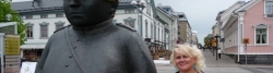
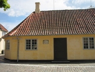
H. C. Andersens Hus ist die dänische Bezeichnung für das Haus, in dem der dänische Dichter Hans Christian Andersen wahrscheinlich geboren wurde. Das Haus liegt in der Altstadt von Odense ![]() in der „Bangs Boder“ Straße.
in der „Bangs Boder“ Straße.
Obwohl der Geburtsort von Andersen nicht mit Sicherheit ermittelt werden kann, ist es wahrscheinlich, dass er in dem Haus geboren wurde. In diesem Haus wohnte die Großmutter von Andersen und 1805, als der spätere Dichter geboren wurde, wohnte die Tante von Andersen dort. Sie war die einzige Verwandte von Andersens Eltern, die in der Region wohnte. Andersen lebte auf jedem Fall nicht lange in dem Haus. Seine Kindheit verbrachte er in einem Haus in der Munke Møllestræde. Dort wurde 1930 das Museum „H.C. Andersens Barndomshjem ![]() “ errichtet.
“ errichtet.
1905, 100 Jahre nach der Geburt von Andersen, beschloss die Stadt Odense, ein Museum im wahrscheinlichen Geburtshaus des Dichters zu errichten. Die Stadt restaurierte das Haus und eröffnete das Museum 1908 am Geburtstag des Dichters.
2005 wurde das Museum erweitert. Es besteht aus einem Neubau. In diesem wird anhand zahlreicher Dokumente das Leben und das Werk des Dichters dargestellt. Der alte Teil des Museums ist das eigentliche Geburtshaus. Dies ist so eingerichtet, wie es 1805 wahrscheinlich ausgesehen hat.
Informationen zu Urheber-Rechten | |
|---|---|
Rechte-Ausprägung / Lizenz | by-sa: CREATIVE COMMONS Namensnennung, Weitergabe unter gleichen Bedingungen |
Link zur Rechtebeschreibung | |
Text(e) übernommen von: |
Seite „H. C. Andersens Hus“. In: Wikipedia, Die freie Enzyklopädie. Bearbeitungsstand: 1. April 2013, 08:52 UTC. URL: http://de.wikipedia.org/w/index.php?title=H._C._Andersens_Hus&oldid=116459742 (Abgerufen: 6. April 2013, 20:47 UTC) |
übernommen / bearbeitet am | 06.04.2013
|
übernommen / bearbeitet durch |
|
Öffnungszeiten
1. Januar - 30. Juni, Dienstag bis Sonntag 10 - 16 Uhr
1. Juli - 1. September, Montag bis Sonntag 10 - 17 Uhr
2. September - 31. Dezember, Dienstag bis Sonntag 10 - 16 Uhr
Geöffnet am 2. Ostertag und 2. Pfingsttag sowie montags in den Wochen 7, 8, 13 und 42.
Geschlossen am 24, 25. und 31. Dezember sowie am 1. Januar.
6 km
0,7 km
13 m
Informationen zu Urheber-Rechten | |
|---|---|
Rechte-Inhaber | LWich |
Rechte-Ausprägung / Lizenz | by-sa: CREATIVE COMMONS Namensnennung, Weitergabe unter gleichen Bedingungen |
Link zur Rechtebeschreibung | |
Bild übernommen aus | commons.wikimedia.org/wiki/File:Odense_-_Sankt_Knuds_kirke_2005-07-16.jpeg |
Bild hochgeladen | durch Ottocolor am 20.03.2013
|
Informationen zu Urheber-Rechten | |
|---|---|
Rechte-Inhaber | Niels Elgaard Larsen |
Rechte-Ausprägung / Lizenz | by-sa: CREATIVE COMMONS Namensnennung, Weitergabe unter gleichen Bedingungen |
Link zur Rechtebeschreibung | |
Bild übernommen aus | |
Bild hochgeladen | durch Ottocolor am 20.03.2013
|
Informationen zu Urheber-Rechten | |
|---|---|
Rechte-Inhaber | Kåre Thor Olsen |
Rechte-Ausprägung / Lizenz | by-sa: CREATIVE COMMONS Namensnennung, Weitergabe unter gleichen Bedingungen |
Link zur Rechtebeschreibung | |
Bild übernommen aus | |
Bild hochgeladen | durch Ottocolor am 20.03.2013
|
Informationen zu Urheber-Rechten | |
|---|---|
Rechte-Inhaber | Gunnar Bach Pedersen |
Rechte-Ausprägung / Lizenz | by-sa: CREATIVE COMMONS Namensnennung, Weitergabe unter gleichen Bedingungen |
Link zur Rechtebeschreibung | |
Bild übernommen aus | |
Bild hochgeladen | durch Ottocolor am 20.03.2013
|
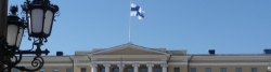
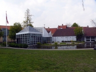
Odense ([ˈoːðənse], [ˈoð̞ˀn̩se]; deutsch: Ottensee) ist eine Großstadt mit 168.798 Einwohnern in der Odense Kommune ![]() auf der Insel Fyn
auf der Insel Fyn ![]() (dt.: Fünen) in Dänemark (Stand 1. Januar 2012). Die drittgrößte dänische Stadt war vor der Kommunalreform 2007 Verwaltungssitz des ehemaligen Fyns Amt, außerdem ist sie Bischofssitz und Standort des Hauptcampus der Süddänischen Universität.
(dt.: Fünen) in Dänemark (Stand 1. Januar 2012). Die drittgrößte dänische Stadt war vor der Kommunalreform 2007 Verwaltungssitz des ehemaligen Fyns Amt, außerdem ist sie Bischofssitz und Standort des Hauptcampus der Süddänischen Universität.
Durch die Stadt verläuft der Fluss Odense Å ![]() . Über den Odense-Kanal
. Über den Odense-Kanal ![]() ist sie mit dem Odense-Fjord verbunden.
ist sie mit dem Odense-Fjord verbunden.
Sehenswürdigkeiten
Museen und Ausstellungen
- Die Hans-Christian-Andersen-Museen (H. C. Andersens Hus
 und H. C. Andersens Barndomshjem) bieten Einblick in das Leben und Werk des Dichters. Hierzu gehört auch Fyrtøjet, in dem sich Kinder aktiv mit den Märchen des Dichters beschäftigen. Sie können sich dort verkleiden und die Geschichten von Andersen nachspielen.
 - Das Danmarks Jernbanemuseum zeigt die größte Sammlung von Eisenbahnen und Fähren in Nordeuropa auf über 10.000 m².
- Das Haus Brandts besteht aus einer Kunsthalle, einem Museum für Fotokunst und Dänemarks Medienmuseum. Außerdem befindet sich in diesem Haus die einzige Kunstbuchhandlung der Insel Fünen.
- Das Bymuseet Møntergården zeigt eine archäologische Sammlung über die Geschichte von Fünen.
- Im Freilichtmuseum Den Fynske Landsby können 25 ländliche Bauten des 18. und 19. Jahrhunderts besichtigt werden.
- Im Freilichtmuseum Jernalderlandsbyen (Das Eisenzeitdorf) im Vorort Næsby sind zahlreiche Rekonstruktionen von eingerichteten Häusern und eine historische Werkstatt der Eisenzeit zu sehen.
- Das Europæisk Automobilmuseum zeigt etwa 120 Automobile, die hauptsächlich aus der Periode 1945 bis 1960 stammen.
- Odense Zoo zeigt eine Vielzahl von Tieren aus allen Erdteilen. Der Zoo ist besonders bekannt für sein Ozeaneum.
Bauwerke
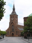
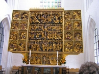
- Der Dom, die gotische Sankt Knuds Kirke aus dem 14. Jahrhundert mit dem berühmten Altar des Lübeckers Claus Berg (1520) zählt zu den bedeutendsten dänischen Sakralbauten.
- Die katholische frühgotische Sankt Albani Kirke mit romanischem Portal hat einen 54 m hohem Glockenturm.
- Die Klosterkirche der Johanniter Sankt Hans wurde 1250 im gotischen Stil erbaut.
- Im Konzerthaus der Stadt befindet sich das Carl Nielsen-Museum. Es gibt einen chronologischen Überblick über das Leben des Komponisten.
- Das Theater von Odense wurde 1796 gebaut und ist das zweitälteste Theater in Dänemark. Es verfügt über fünf verschiedene Bühnen und eine Theaterschule. Hans Christian Andersen debütierte als Kind an diesem Theater.
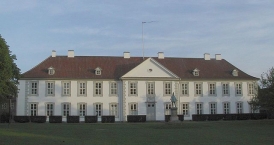
- Das Schloss von Odense (Odense Slot) wurde 1280 als Hospital für den Johanniterorden gebaut. Später wurde es als Kloster verwendet. 1579 wurde es auf Befehl von Frederik II. zum Schloss umgebaut. Heute wird das Gebäude von der Kommunalverwaltung genutzt.
- Das Rathaus der Stadt wurde 1880 errichtet.
- Das Universitätsklinikum Odense ist die größte Klinik Dänemarks. Das Hauptgebäude des vormaligen Kreis- und Stadtkrankenhauses wurde 1912 errichtet.
- Auf dem parkartigen Assistenzfriedhof sind viele bedeutende Bürger beigesetzt.
Informationen zu Urheber-Rechten | |
|---|---|
Rechte-Ausprägung / Lizenz | by-sa: CREATIVE COMMONS Namensnennung, Weitergabe unter gleichen Bedingungen |
Link zur Rechtebeschreibung | |
Text(e) übernommen von: |
Seite „Odense“. In: Wikipedia, Die freie Enzyklopädie. Bearbeitungsstand: 14. März 2013, 12:07 UTC. URL: http://de.wikipedia.org/w/index.php?title=Odense&oldid=115388385 (Abgerufen: 20. März 2013, 21:02 UTC) |
übernommen / bearbeitet am | 20.03.2013
|
übernommen / bearbeitet durch |
|
6 km
0,7 km
13 m
Informationen zu Urheber-Rechten | |
|---|---|
Rechte-Inhaber | VisitOdense |
Rechte-Ausprägung / Lizenz | © Alle Rechte vorbehalten. |
Bild hochgeladen | durch Ottocolor am 20.03.2013
|
Öffnungszeiten
| 02/01/2013 - 30/06/2013 | Montag - Freitag | 09:30 - 16:30 |
| 02/01/2013 - 30/06/2013 | Samstag | 10:00 - 13:00 |
| 01/07/2013 - 31/08/2013 | Montag - Freitag | 09:30 - 18:00 |
| 01/07/2013 - 31/08/2013 | Samstag | 10:00 - 15:00 |
| 01/07/2013 - 31/08/2013 | Sonntag | 11:00 - 14:00 |
| 01/09/2013 - 30/06/2014 | Montag - Freitag | 09:30 - 16:30 |
| 01/09/2013 - 30/06/2014 | Samstag | 10:00 - 13:00 |
![]()