
Cycle Route Tallinn - Valga
No. of cycle route EE4
Actions
![]()
Please wait - map data are loading
Added on 05 Jun 2011,
last edited by biroto-Redaktion on 03 Dec 2020
Actions
Cycle route metrics
Total distance in km
590
Information about rights to the gps-track data | |
|---|---|
Rights owner | OpenStreetMap and Contributors + biroto-Redaktion (biroto.eu) |
Rights characteristic / license | Contains information from OpenStreetMap, which is made available here under the Open Database License(ODbL) |
Link to the description of the license | |
GPX file taken from | |
GPX file uploaded | by biroto-Redaktion on 03 Dec 2020
|
Track points in total
5.387
Track points per km (avg)
9
Start/endpoint
Start location
Kesklinna linnaosa, EE (7 m NHN)
End location
Valga, EE (51 m NHN)
Character
Those heading for Tartu from Valga may choose this alternative route, which makes a longer roundabout to visit Paganamaa (the Devil’s Land), Haanja Highlands and Setumaa.
Note: The description is opposite to the direction of the cycle route on the map above and the accommodation, sights and infrastructure on the left.
The first 45 km are covered on a fairly quiet asphalt-covered forest road. In Vastse-Roosa next to the Latvian border an entertaining sight is Metsavenna (Guerrilla’s) Farm with a recreation centre. Through Paganamaa we arrive at the banks of pretty lakes in the primeval valley of Rõuge, from which a meandering gravel road takes us to the foot of the highest peak in the Baltics – Suur Munamägi (Great Egg Mount). The roads of Haanja region, while mostly gravelled, present much variety.
The 85-km lap from Vastse-Roosa to Orava contains 47 km of gravel roads; then comes a relatively light-traffic asphalt road for virtually the whole length to Tartu. Those seeking closer contact with nature may turn to the signposted Route 281 to bike from Vahtseliina to Piusa along scenic forest roads on the banks of the Piusa River.
Departure from Tartu starts out on 12 km of gravel roads due to a delay in the scheduled road works. After reaching the scenic Lake Saadjärv and the undulating terrain of Vooremaa the cyclists have to pedal a further 8 km on gravel roads; from there on there are only asphalt roads right up to the northern seacoast. Vooremaa around Palamuse is another diverse cycling area. A closer acquaintance with the drumlin-shaped hills and the lakes in between can be made on the local bike routes No. 201-205, marked with signposts.
Cycling from Jõgeva towards Rakvere you have to put up with a slightly heavier traffic of the Piibe road for 20 km; as a reward, however, the road leads to the vicinity of Endla Bog and Emumäe Hill, the pearls of this section of the journey.
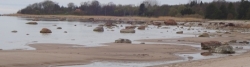
Before entering Lahemaa National Park it is worthwhile to take a tour of the historic town of Rakvere. In Lahemaa, our route overlaps with Route 1. The prime tourist attraction in North Estonia, Lahemaa deserves a closer look. It presents noble manor complexes, picturesque coastlines, pleasurable mossy forest floors and a number of exciting nature trails. At the approach to Loksa we come upon stretches of gravel road totalling about 20 km; however, the local sights are rewarding enough for such small inconveniences.
The lap from Lahemaa to Tallinn is fairly peaceful at first; the closer to Tallinn, however, the heavier the traffic. Accordingly, you must again become a careful and accurate cyclist.
Information about copyright | |
|---|---|
Rights characteristic / license | © all rights reserved. |
Input taken over from: |
Copied from Esto Velo, permission received from Rein Lepik on 13 Oct. 2013. |
taken over / edited on | 13 Oct 2013
|
taken over / edited by |
|
Signposting
|

Sources of information
Travel reports about cycle tours
Information about copyright | |
|---|---|
Rights owner | |
Rights characteristic / license | by-sa: CREATIVE COMMONS Attribution-ShareAlike |
Link to the description of the license | |
Image has been uploaded | by Ottocolor on 07 Jul 2017
|
18 May 2017
107 km
A stage of the tour »Iron Curtain Tour, part 1: Klaipeda-Grense Jakobselv« of user Ottocolor
Beds4Cyclists, worth visiting and infrastructure
Name and address
Latitude / Longitude
Phone
Fax
Mobile
Type of accommodation
Rating for cyclists
Route km
Dist. to route
Elevation
0 km
1,0 km
17 m
0 km
0,8 km
0 km
2,0 km
7 m
Hours of opening
Monday to Friday 10-18h
Saturday 11-15h
0 km
0,4 km
11 m
0 km
0,4 km
15 m
![]()