Cycle Route EuroVelo: Mediterranean Route - Part Cueno-Cádiz
No. of cycle route EV8
Actions
![]()
Please wait - map data are loading
Added on 05 Oct 2011,
last edited by biroto-Redaktion on 20 Oct 2023
Actions
Cycle route metrics
Total distance in km
2.904
Information about rights to the gps-track data | |
|---|---|
Rights owner | OpenStreetMap and Contributors + biroto-Redaktion (biroto.eu) |
Rights characteristic / license | Contains information from OpenStreetMap, which is made available here under the Open Database License(ODbL) |
Link to the description of the license | |
GPX file taken from | |
GPX file uploaded | by biroto-Redaktion on 26 May 2023
|
Track points in total
49.342
Track points per km (avg)
17
Start/endpoint
Start location
Cuneo, 21, IT (547 m NHN)
End location
Cádiz, AN, ES (5 m NHN)
Signposting
Logo des Radweges |
|
Beschilderung in Frankreich |
|
Sources of information
Connecting cycle path
Aktuelle Abschnitte des EuroVelo 8 in diesem Portal:
- Teilstück Athen-Cueno (3.536 km)
Ehemalige Abschnitte des EuroVelo 8 in diesem Portal:
- Variante in Kroatien Benkovac-Triest (310 km)
Remarks
The route described here is compiled based on the route as published by EuroVelo (as of Nov. 2023). In doing so, parts of the EV8 published in OpenCycleMap and routes of the national or regional cycling networks were taken into account. If sections of the course as published at EuroVelo do not follow existing cycle routes, these sections have been filled up by self-created tracks.
Significant deviations from the route of EuroVelo.com are
- between Cuneo and Ventimiglia
The planned route runs here over long distances on a former railway line that has not yet been developed as a cycle path. There is no reasonable alternative close to the planned course. The route described here leads from Cueno to Carrú and from there on the BI 15 to Imperia. Along the Mediterranean coast mainly on a former railway line to Ventimiglia. - in France several deviations on shorter segments.
The route described here follows the concept proposal 2018 of the French. - between Vidreres and Barcelona
The route according to Eurovelo.com has not yet been determined and should run here on forest paths over the mountain ridge. The route described here leads a little further north of the mountains to Barcelona. - between Barcelona and Tarragona
The route according to Eurovelo.com has not yet been determined and should run north of the Parc Natural del Garraf and meet the coast at La Platja. The route described here follows roads and paths roughly on this line, but already meets the coast at Villanovai.
Travel reports about cycle tours
03 Jul 2018
101 km
A stage of the tour »Canal des 2 mers - Mediterranean route - Cycle route Switzerland-Mediterranean« of user ThimbleU
02 Jul 2018
54 km
A stage of the tour »Canal des 2 mers - Mediterranean route - Cycle route Switzerland-Mediterranean« of user ThimbleU
01 Jul 2018
101 km
A stage of the tour »Canal des 2 mers - Mediterranean route - Cycle route Switzerland-Mediterranean« of user ThimbleU
30 Jun 2018
74 km
A stage of the tour »Canal des 2 mers - Mediterranean route - Cycle route Switzerland-Mediterranean« of user ThimbleU
29 Jun 2018
100 km
A stage of the tour »Canal des 2 mers - Mediterranean route - Cycle route Switzerland-Mediterranean« of user ThimbleU
28 Jun 2018
71 km
A stage of the tour »Canal des 2 mers - Mediterranean route - Cycle route Switzerland-Mediterranean« of user ThimbleU
27 Jun 2018
84 km
A stage of the tour »Canal des 2 mers - Mediterranean route - Cycle route Switzerland-Mediterranean« of user ThimbleU
Information about copyright | |
|---|---|
Rights owner | |
Rights characteristic / license | © all rights reserved. |
Image has been uploaded | by ThimbleU on 13 Aug 2018
|
25 Jun 2018
83 km
A stage of the tour »Canal des 2 mers - Mediterranean route - Cycle route Switzerland-Mediterranean« of user ThimbleU
24 Jun 2018
91 km
A stage of the tour »Canal des 2 mers - Mediterranean route - Cycle route Switzerland-Mediterranean« of user ThimbleU
Information about copyright | |
|---|---|
Rights owner | |
Rights characteristic / license | © all rights reserved. |
Image has been uploaded | by ThimbleU on 13 Aug 2018
|
23 Jun 2018
80 km
A stage of the tour »Canal des 2 mers - Mediterranean route - Cycle route Switzerland-Mediterranean« of user ThimbleU
Beds4Cyclists, worth visiting and infrastructure
Name and address
Latitude / Longitude
Phone
Fax
Mobile
Type of accommodation
Rating for cyclists
Route km
Dist. to route
Elevation
1 km
0,2 km
553 m
Hours of opening
- Mon–Fri: 8.30a.m.-1.00p.m. / 2.30-6.00p.m.
- Sat: 10.00a.m.-12.30p.m. / 2.30-6.00p.m. (from April to October), 10.00a.m.-1.00p.m. / 2.00p.m.-5.00p.m. (from November to March).
2 km
0,1 km
544 m
Information about copyright | |
|---|---|
Rights owner | |
Rights characteristic / license | by-sa: CREATIVE COMMONS Attribution-ShareAlike |
Link to the description of the license | |
Image taken over from | commons.wikimedia.org/wiki/File:Cuneo_Piazza_Galimberti.jpeg |
Image has been uploaded | by biroto-Redaktion on 07 Dec 2014
|
Information about copyright | |
|---|---|
Rights owner | |
Rights characteristic / license | by-sa: CREATIVE COMMONS Attribution-ShareAlike |
Link to the description of the license | |
Image taken over from | |
Image has been uploaded | by biroto-Redaktion on 07 Dec 2014
|
Information about copyright | |
|---|---|
Rights owner | Gian Francesco Fanti |
Rights characteristic / license | by-sa: CREATIVE COMMONS Attribution-ShareAlike |
Link to the description of the license | |
Image taken over from | |
Image has been uploaded | by biroto-Redaktion on 07 Dec 2014
|
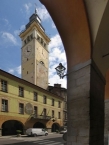
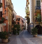
Cuneo (Coni in Piedmontese) is a city and comune in Piedmont, Northern Italy, the capital of the province of Cuneo.
Cuneo became an important stronghold of the expanding Savoy state, and was thus besieged by France several times: first in 1515 by Swiss troops of Francis I of France, then again in 1542, 1557, 1639, 1641, 1691 and, during the War of Austrian Succession, in 1741. In all the sieges Cuneo resisted successfully. Cuneo was conquered by France only during the Napoleonic Wars, when it was made the capital of the Stura department. After the restoration of the Kingdom of Sardinia, and the unification of Italy, Cuneo became the capital of its namesake province in 1859.
Main sights
- Villa Oldofredi Tadini, built in the 14th and 15th centuries as a watchtower. It is now a museum housing collections of the owners, the Mocchia and Oldofredi Tadini families.
- Villa Tornaforte, surrounded by an English-style park.
- Civic Museum
- Railway Museum
- Churches of Santa Croce, San Giovanni Decollato and Santissima Annunziata, housing paintings by Giovan Francesco Gaggini.
- Panoramic funicolar that connects plateau to Gesso river.
- Monument of Stura and Gesso in Torino Square
- The median way of the plateau (Rome Avenue, Galimberti Square and Nice Avenue): the commercial heart of Cuneo.
- Nuvolari Libera Tribù: the longest summer's musical festival, near river Gesso
- Monument at Peano's curve
- Palazzo Uffici Finanziari (PUF), highest edifice in the city at about 50 metres (160 ft)
Information about copyright | |
|---|---|
Rights characteristic / license | by-sa: CREATIVE COMMONS Attribution-ShareAlike |
Link to the description of the license | |
Input taken over from: |
Wikipedia contributors, 'Cuneo', Wikipedia, The Free Encyclopedia, 31 October 2014, 07:55 UTC, <http://en.wikipedia.org/w/index.php?title=Cuneo&oldid=631861501> [accessed 7 December 2014] |
taken over / edited on | 07 Dec 2014
|
taken over / edited by |
|
2 km
0,0 km
547 m
2 km
0,1 km
550 m
82 km
0,6 km
604 m
![]()


