
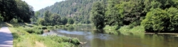
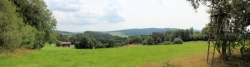
Regen Valley Cycle Route
Actions
![]()
Please wait - map data are loading
Added on 12 Apr 2012,
last edited by biroto-Redaktion on 16 Nov 2020
Actions
Cycle route metrics
Total distance in km
168
Information about rights to the gps-track data | |
|---|---|
Rights owner | OpenStreetMap and Contributors + biroto-Redaktion (biroto.eu) |
Rights characteristic / license | Contains information from OpenStreetMap, which is made available here under the Open Database License(ODbL) |
Link to the description of the license | |
GPX file taken from | |
GPX file uploaded | by biroto-Redaktion on 16 Nov 2020
|
Track points in total
3.138
Track points per km (avg)
19
Start/endpoint
Start location
Železná Ruda, Southwest, CZ (769 m NHN)
End location
Regensburg, Bayern, DE (335 m NHN)
Signposting
|

Travel reports about cycle tours
23 Jul 2020
83 km
A stage of the tour »Regen - Ilz - Danube - Isar - Danube« of user ThimbleU
24 Jul 2020
74 km
A stage of the tour »Regen - Ilz - Danube - Isar - Danube« of user ThimbleU
Beds4Cyclists, worth visiting and infrastructure
Name and address
Latitude / Longitude
Phone
Fax
Mobile
Type of accommodation
Rating for cyclists
Route km
Dist. to route
Elevation
0 km
0,5 km
784 m
0 km
4,0 km
1.033 m
0 km
0,4 km
756 m
0 km
3,8 km
1.062 m
3 km
0,5 km
743 m
![]()