
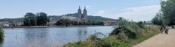
Cycle Route La Voie Bleue
No. of cycle route V50
Actions
![]()
Please wait - map data are loading
Added on 19 May 2012,
last edited by biroto-Redaktion on 26 Feb 2023
Actions
Cycle route metrics
Total distance in km
677
Information about rights to the gps-track data | |
|---|---|
Rights owner | OpenStreetMap and Contributors + biroto-Redaktion (biroto.eu) |
Rights characteristic / license | Contains information from OpenStreetMap, which is made available here under the Open Database License(ODbL) |
Link to the description of the license | |
GPX file taken from | |
GPX file uploaded | by biroto-Redaktion on 26 Feb 2023
|
Track points in total
9.307
Track points per km (avg)
14
Start/endpoint
Start location
Lyon, ARA, FR (163 m NHN)
End location
Apach, GES, FR (164 m NHN)
Signposting
Der Radwanderweg ist ab Lyon bis Sierck-les-Bains durchgehend ausgeschildert, allerdings wird die Strecke noch mit unterschiedlichen Namen bezeichnet. Von Süden nach Norden finden sich Schilder mit folgenden Bezeichnungen: Voie Bleue, EuroVelo 6, Échappée Bleue, Charles le Téméraire, Moselle-Saône à vélo, V50. |
|

Travel reports about cycle tours
Information about copyright | |
|---|---|
Rights owner | |
Rights characteristic / license | by-sa: CREATIVE COMMONS Attribution-ShareAlike |
Link to the description of the license | |
Image has been uploaded | by ThimbleU on 24 Aug 2023
|
08 Jul 2023
71 km
A stage of the tour »Aachen - Vennbahn - Mosel - Saar - Mosel - Erft - Solingen« of user ThimbleU

Information about copyright | |
|---|---|
Rights owner | |
Rights characteristic / license | by-sa: CREATIVE COMMONS Attribution-ShareAlike |
Link to the description of the license | |
Image has been uploaded | by ThimbleU on 24 Aug 2023
|
07 Jul 2023
74 km
A stage of the tour »Aachen - Vennbahn - Mosel - Saar - Mosel - Erft - Solingen« of user ThimbleU
Beds4Cyclists, worth visiting and infrastructure
Name and address
Latitude / Longitude
Phone
Fax
Mobile
Type of accommodation
Rating for cyclists
Route km
Dist. to route
Elevation
2 km
0,4 km
233 m
3 km
0,7 km
182 m
3 km
0,5 km
190 m
3 km
1,2 km
172 m
4 km
0,5 km
164 m
Hours of opening
7 days a week from 9 to 18 clock
![]()