Cabbage and Turnips Cycle Route
Actions
![]()
Please wait - map data are loading
Added on 08 Nov 2013,
last edited by biroto-Redaktion on 24 Nov 2020
Actions
Cycle route metrics
Total distance in km
139
Information about rights to the gps-track data | |
|---|---|
Rights owner | OpenStreetMap and Contributors + biroto-Redaktion (biroto.eu) |
Rights characteristic / license | Contains information from OpenStreetMap, which is made available here under the Open Database License(ODbL) |
Link to the description of the license | |
GPX file taken from | |
GPX file uploaded | by biroto-Redaktion on 24 Nov 2020
|
Track points in total
1.617
Track points per km (avg)
12
Start/endpoint
Start location
Schweigen-Rechtenbach, Rheinland-Pfalz, DE (219 m NHN)
End location
Bockenheim an der Weinstraße, Rheinland-Pfalz, DE (159 m NHN)
Sources of information
Portale:
- Offiziellles Portal des Kraut und Rüben Radweges
Beds4Cyclists, worth visiting and infrastructure
Name and address
Latitude / Longitude
Phone
Fax
Mobile
Type of accommodation
Rating for cyclists
Route km
Dist. to route
Elevation
0 km
4,3 km
289 m
Hours of opening
Mo, We, Th, Fr 09:00-12:00, Sep 01-Oct 31: Sa 09:00-12:00
0 km
4,1 km
307 m
0 km
0,0 km
216 m
0 km
1,8 km
169 m
Hours of opening
Monday to Saturday: 9:30-12:00 and 14:00-17:30
Sunday and bank holidays: closed
0 km
1,7 km
154 m
Information about copyright | |
|---|---|
Rights owner | |
Rights characteristic / license | by: CREATIVE COMMONS Attribution |
Link to the description of the license | |
Image taken over from | |
Image has been uploaded | by biroto-Redaktion on 15 Mar 2014
|
Information about copyright | |
|---|---|
Rights owner | |
Rights characteristic / license | by-sa: CREATIVE COMMONS Attribution-ShareAlike |
Link to the description of the license | |
Image taken over from | commons.wikimedia.org/wiki/File:Wissembourg_StPierre-Paul088.JPG |
Image has been uploaded | by biroto-Redaktion on 15 Mar 2014
|
Information about copyright | |
|---|---|
Rights owner | |
Rights characteristic / license | by: CREATIVE COMMONS Attribution |
Link to the description of the license | |
Image taken over from | |
Image has been uploaded | by biroto-Redaktion on 15 Mar 2014
|
Information about copyright | |
|---|---|
Rights owner | |
Rights characteristic / license | by-sa: CREATIVE COMMONS Attribution-ShareAlike |
Link to the description of the license | |
Image taken over from | |
Image has been uploaded | by biroto-Redaktion on 15 Mar 2014
|
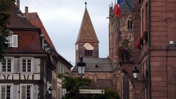
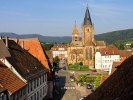
Wissembourg (French pronunciation: [visɑ̃buʁ]; South Franconian: Weisseburch, pronounced [ˈvaɪsəbʊʁç]; (German:Weißenburg)) is a commune in the Bas-Rhin department in Alsace in northeastern France.
Sights
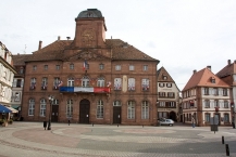
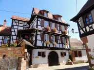
The picturesque town, set in a landscape of rolling wheat fields, retains a former Augustinian convent (1279) with its large-scale Gothic church, now the parish of Saints-Pierre-et-Paul ; other medieval churches are the Église Saint-Jean, and the Église Saint-Ulrich. Its Grenier aux Dîmes (tithe barn) belonging to the Abbey is 18th-century but an ancient foundation. Noteworthy houses are the medieval "Salt house", the Renaissance "House of l'Ami Fritz" and the imposing classicist City Hall, a work byJoseph Massol.
Information about copyright | |
|---|---|
Rights characteristic / license | by-sa: CREATIVE COMMONS Attribution-ShareAlike |
Link to the description of the license | |
Input taken over from: |
Wikipedia contributors, 'Wissembourg', Wikipedia, The Free Encyclopedia, 27 December 2013, 22:06 UTC, http://en.wikipedia.org/w/index.php?title=Wissembourg&oldid=587980810 |
taken over / edited on | 15 Mar 2014 - 26 May 2021
|
taken over / edited by |
|
![]()


