
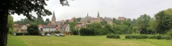
Diemel Cycle Route
Actions
![]()
Please wait - map data are loading
Added on 06 Feb 2012,
last edited by biroto-Redaktion on 15 Nov 2020
Actions
Cycle route metrics
Total distance in km
109
Information about rights to the gps-track data | |
|---|---|
Rights owner | OpenStreetMap and Contributors + biroto-Redaktion (biroto.eu) |
Rights characteristic / license | Contains information from OpenStreetMap, which is made available here under the Open Database License(ODbL) |
Link to the description of the license | |
GPX file taken from | |
GPX file uploaded | by biroto-Redaktion on 15 Nov 2020
|
Track points in total
1.823
Track points per km (avg)
17
Start/endpoint
Start location
Willingen (Upland), Hessen, DE (686 m NHN)
End location
Bad Karlshafen, Hessen, DE (103 m NHN)
Signposting
|

Travel reports about cycle tours
13 Jul 2019
93 km
A stage of the tour »Hirschhorn - Solingen« of user ThimbleU
Beds4Cyclists, worth visiting and infrastructure
Name and address
Latitude / Longitude
Phone
Fax
Mobile
Type of accommodation
Rating for cyclists
Route km
Dist. to route
Elevation
0 km
2,7 km
604 m
0 km
2,8 km
621 m
1 km
0,5 km
645 m
1 km
0,4 km
634 m
4 km
4,0 km
589 m
![]()