
Isar Cycle Route
Actions
![]()
Please wait - map data are loading
Added on 26 Apr 2012,
last edited by biroto-Redaktion on 14 Mar 2024
Actions
Cycle route metrics
Total distance in km
299
Information about rights to the gps-track data | |
|---|---|
Rights owner | OpenStreetMap and Contributors + biroto-Redaktion (biroto.eu) |
Rights characteristic / license | Contains information from OpenStreetMap, which is made available here under the Open Database License(ODbL) |
Link to the description of the license | |
GPX file taken from | |
GPX file uploaded | by biroto-Redaktion on 14 Mar 2024
|
Track points in total
5.675
Track points per km (avg)
19
Start/endpoint
Start location
Scharnitz, Tirol, AT (1217 m NHN)
End location
Osterhofen, Bayern, DE (312 m NHN)
Character
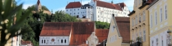
Die Isar ist sicherlich der bayrische Alpenfluss mit den größten Gegensätzen an seinen Ufern. Vom schroffen Hochgebirge des Karwendels bis zur Metropole München reicht hier die Bandbreite. Dazwischen gibt es viel Landschaft sowie gemütliche Städte und Dörfer zu entdecken.
Der Isarradweg führt von der Landesgrenze bei Scharnitz an Mittenwald vorbei um das Karwendelgebirge herum zum Sylvensteinsee. Durch das Voralpengebiet des Oberlandes, entlang des bekannten Naturschutzgebietes Pupplinger Au, geht es in die Landeshauptstadt München. Hinter München geht es auf absolut ruhigen Auwegen weiter. Bei Niederalteich (süd-östlich von Deggendorf) mündet der Isarradweg in den Donauradweg ein.
Information about copyright | |
|---|---|
Rights characteristic / license | by-sa: CREATIVE COMMONS Attribution-ShareAlike |
Link to the description of the license | |
Input taken over from: |
Wikivoyage-Bearbeiter, 'Isarradweg', Wikivoyage, Freie Reiseinformationen rund um die Welt, 14. September 2017, 16:21 UTC, https://de.wikivoyage.org/w/index.php?title=Isarradweg&oldid=1049843 |
taken over / edited on | 23 Nov 2018 - 14 Mar 2024
|
taken over / edited by |
|
Signposting
|

Travel reports about cycle tours
Information about copyright | |
|---|---|
Rights owner | |
Rights characteristic / license | by-sa: CREATIVE COMMONS Attribution-ShareAlike |
Link to the description of the license | |
Image has been uploaded | by Ottocolor on 16 Nov 2013
|
03 Aug 2013
67 km
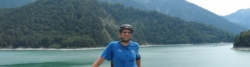
A stage of the tour »Tour in the Alps 2013« of user Ottocolor
27 Jul 2020
91 km
A stage of the tour »Regen - Ilz - Danube - Isar - Danube« of user ThimbleU
Beds4Cyclists, worth visiting and infrastructure
Name and address
Latitude / Longitude
Phone
Fax
Mobile
Type of accommodation
Rating for cyclists
Route km
Dist. to route
Elevation
15 km
0,1 km
962 m
21 km
0,9 km
971 m
22 km
0,5 km
912 m
27 km
0,4 km
984 m
28 km
2,4 km
933 m
![]()