Volcanos Cycle Route
Actions
![]()
Please wait - map data are loading
Added on 03 Apr 2013,
last edited by biroto-Redaktion on 23 Nov 2020
Actions
Cycle route metrics
Total distance in km
97
Information about rights to the gps-track data | |
|---|---|
Rights owner | OpenStreetMap and Contributors + biroto-Redaktion (biroto.eu) |
Rights characteristic / license | Contains information from OpenStreetMap, which is made available here under the Open Database License(ODbL) |
Link to the description of the license | |
GPX file taken from | |
GPX file uploaded | by biroto-Redaktion on 23 Nov 2020
|
Track points in total
1.601
Track points per km (avg)
17
Start/endpoint
Start location
Schlitz, Hessen, DE (227 m NHN)
End location
Altenstadt, Hessen, DE (128 m NHN)
Beds4Cyclists, worth visiting and infrastructure
Name and address
Latitude / Longitude
Phone
Fax
Mobile
Type of accommodation
Rating for cyclists
Route km
Dist. to route
Elevation
2 km
0,2 km
239 m
2 km
0,1 km
244 m
2 km
0,1 km
238 m
Information about copyright | |
|---|---|
Rights owner | Paul Odörfer |
Rights characteristic / license | by-sa: CREATIVE COMMONS Attribution-ShareAlike |
Link to the description of the license | |
Image taken over from | |
Image has been uploaded | by biroto-Redaktion on 06 Jul 2012
|
Information about copyright | |
|---|---|
Rights owner | |
Rights characteristic / license | by-sa: CREATIVE COMMONS Attribution-ShareAlike |
Link to the description of the license | |
Image taken over from | |
Image has been uploaded | by biroto-Redaktion on 06 Jul 2012
|
Information about copyright | |
|---|---|
Rights owner | |
Rights characteristic / license | cc0: Public Domain no Rights reserved |
Link to the description of the license | |
Image taken over from | |
Image has been uploaded | by biroto-Redaktion on 06 Jul 2012
|
Information about copyright | |
|---|---|
Rights owner | |
Rights characteristic / license | by-sa: CREATIVE COMMONS Attribution-ShareAlike |
Link to the description of the license | |
Image taken over from | commons.wikimedia.org/wiki/File:Schlitz_markt_pano_wvwp_ds_05_2008.jpg |
Image has been uploaded | by biroto-Redaktion on 06 Jul 2012
|
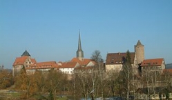
Schlitz ist eine Kleinstadt im Vogelsbergkreis in Osthessen, Deutschland.
Bauwerke
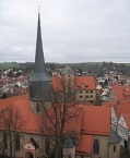
- Ev. Stadtkirche
(ehem. St. Margarethen), 812 geweiht
- Vorderburg
- Hinterburg
- Hinterturm (36m Höhe) mit Turmauffahrt per Aufzug, in der Adventszeit: größte „Kerze“
der Welt. Dabei wird der Hinterturm in ein rotes seidenes Tuch gehüllt und eine Kerzenspitze aus mehreren hunderten Glühbirnen aufgesetzt, die schon von weitem sichtbar ist.
- Schachtenburg
- Ottoburg
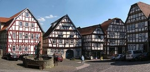
- Marktbrunnen
- Rathhaus
- Auerhahn-Brauerei
- Schlitzer Kornbrennerei
- Kath. Pfarrkirche Christkönig
- Sandkirche auf dem städt. Friedhof, 1612
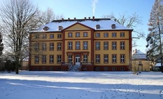
- Schloss Hallenburg
Museen
Heimatmuseum
Information about copyright | |
|---|---|
Rights characteristic / license | by-sa: CREATIVE COMMONS Attribution-ShareAlike |
Link to the description of the license | |
Input taken over from: |
Seite „Schlitz (Vogelsbergkreis)“. In: Wikipedia, Die freie Enzyklopädie. Bearbeitungsstand: 25. Juni 2012, 10:49 UTC. URL: http://de.wikipedia.org/w/index.php?title=Schlitz_(Vogelsbergkreis)&oldid=104787360 (Abgerufen: 6. Juli 2012, 16:04 UTC) |
taken over / edited on | 06 Jul 2012
|
taken over / edited by |
|
4 km
2,1 km
228 m
12 km
1,0 km
286 m
![]()


