Pianura and Natisone Cycle Route
No. of cycle route FVG-4
Actions
![]()
Please wait - map data are loading
Added on 19 Jul 2020,
last edited by biroto-Redaktion on 01 Jan 2021
Actions
Cycle route metrics
Total distance in km
105
Information about rights to the gps-track data | |
|---|---|
Rights owner | OpenStreetMap and Contributors + biroto-Redaktion (biroto.eu) |
Rights characteristic / license | Contains information from OpenStreetMap, which is made available here under the Open Database License(ODbL) |
Link to the description of the license | |
GPX file taken from | |
GPX file uploaded | by biroto-Redaktion on 19 Jul 2020
|
Track points in total
1.609
Track points per km (avg)
15
Start/endpoint
Start location
Caneva, Friuli Venezia Giulia, IT (46 m NHN)
End location
Povoletto, Friuli Venezia Giulia, IT (132 m NHN)
Beds4Cyclists, worth visiting and infrastructure
Name and address
Latitude / Longitude
Phone
Fax
Mobile
Type of accommodation
Rating for cyclists
Route km
Dist. to route
Elevation
11 km
0,0 km
19 m
Information about copyright | |
|---|---|
Rights owner | |
Rights characteristic / license | by-sa: CREATIVE COMMONS Attribution-ShareAlike |
Link to the description of the license | |
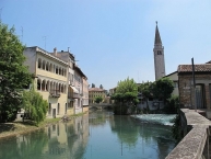
Image taken over from | https://commons.wikimedia.org/wiki/File:Sacile_(5786906271).jpg |
Image has been uploaded | by biroto-Redaktion on 19 Jul 2020
|
Information about copyright | |
|---|---|
Rights owner | |
Rights characteristic / license | by-sa: CREATIVE COMMONS Attribution-ShareAlike |
Link to the description of the license | |
Image taken over from | |
Image has been uploaded | by biroto-Redaktion on 19 Jul 2020
|
Information about copyright | |
|---|---|
Rights owner | |
Rights characteristic / license | by-sa: CREATIVE COMMONS Attribution-ShareAlike |
Link to the description of the license | |
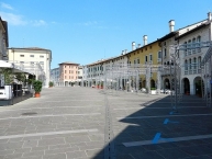
Image taken over from | https://commons.wikimedia.org/wiki/File:4430SacilePzaDelPopolo.JPG |
Image has been uploaded | by biroto-Redaktion on 19 Jul 2020
|
Information about copyright | |
|---|---|
Rights owner | |
Rights characteristic / license | by-sa: CREATIVE COMMONS Attribution-ShareAlike |
Link to the description of the license | |
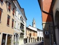
Image taken over from | https://commons.wikimedia.org/wiki/File:4419SacileViaGaribaldi.JPG |
Image has been uploaded | by biroto-Redaktion on 19 Jul 2020
|
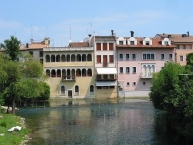
Sacile (Venetian: Sathìl [saˈtsil]; Liventina: Sacìl; Western Friulian: Sacîl) is a town and comune in the province of Pordenone, in the Friuli-Venezia Giulia region of north-east Italy. It is known as the "Garden of the Serenissima " after the many palaces that were constructed along the river Livenza for the nobility of the Most Serene Republic of Venice.
History
Sacile developed in the seventh century as a strong-point on the route from Veneto to Friuli. A cathedral and a castle were built on the larger island, while the smaller had the port and commercial area.
The town became part of the Patriarchal State of Friuli on its creation in 1077; in 1190 the Patriarch conferred on it city rights. Sacile was the first city in Friuli to have a Communal Statute. The city was besieged on a number of occasions by troops of Venice and Treviso.
In 1420 Sacile, along with the rest of Friuli, was annexed by the Republic of Venice. Under Venetian rule the river trade expanded and many noble families built palaces on the banks of the Livenza.
The fall of the Republic in 1797 caused an economic crisis in Sacile. On 16 April 1809 French troops were defeated by the Austrians in the Battle of Sacile which took place in the nearby hamlet of Camolli. In 1815, under the terms of the Congress of Vienna, Sacile became part of the Kingdom of Lombardy-Venetia.
The coming of the railway in 1855 did much to restore the economic position of Sacile. In 1866 Sacile was annexed by the Kingdom of Italy and saw the beginnings of industrial activity.
During the First and Second World Wars the town was repeatedly bombarded on account of the strategic importance of the Venice–Udine railway. The earthquake of 18 October 1936 caused great damage to the town's buildings and to its ancient city walls.
Information about copyright | |
|---|---|
Rights characteristic / license | by-sa: CREATIVE COMMONS Attribution-ShareAlike |
Link to the description of the license | |
Input taken over from: |
Wikipedia contributors, 'Sacile', Wikipedia, The Free Encyclopedia, 1 March 2020, 18:11 UTC, https://en.wikipedia.org/w/index.php?title=Sacile&oldid=943400568 [accessed 19 July 2020] |
taken over / edited on | 19 Jul 2020
|
taken over / edited by |
|
23 km
0,3 km
26 m
94 km
1,0 km
107 m
95 km
0,4 km
110 m
96 km
0,0 km
110 m
Hours of opening
From Monday to Saturday: 9:00 to 13:00 and 14:00 to 18:00
Sunday and holidays: 9:00 to 13:00
![]()


