Cycle Route Shottland - Dover
No. of cycle route 1
Actions

Please wait - map data are loading
Added on 19 May 2012,
on 06 Sep 2026
Actions
Cycle route metrics
Total distance in km
2.088
Information about rights to the gps-track data | |
|---|---|
Rights owner | OpenStreetMap and Contributors + biroto-Redaktion (biroto.eu) |
Rights characteristic / license | Contains information from OpenStreetMap, which is made available here under the Open Database License(ODbL) |
Link to the description of the license | |
GPX file taken from | |
GPX file uploaded | by biroto-Redaktion on 06 Sep 2026
|
Track points in total
35.960
Track points per km (avg)
17
Start/endpoint
Start location
Tain, Scotland, GB (24 m NHN)
End location
Dover, England, GB (6 m NHN)
Signposting
|
|

Connecting cycle path
- in Shetland North Sea Cycle Route (EV12)
- in Inverness Sunderland - Inverness (UK7)
- near Tynemouth
- Cockermouth to Tynemouth (UK10)
- Hadrians Cycle Route (UK72)
- near Sunderland
- Sunderland - Inverness (UK7)
- Walney - Wear (UK70)
- near Middlesbrough Middlesbrough - Hornsea (UK65)
- near Hull Middlesbrough - Hornsea (UK65)
- near Wisbech Burton upon Trent - Leicester - Oakham - Peterborough - Wisbech (UK63)
- near London St. Davidʹs in Wales - London (UK4)
- near Dover
Remarks
This route is part of the EuroVelo Route 12 "North Sea Cycle Route".
Beds4Cyclists, worth visiting and infrastructure
Name and address
Latitude / Longitude
Phone
Fax
Mobile
Type of accommodation
Rating for cyclists
Route km
Dist. to route
Elevation
60 km
0,0 km
23 m
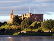
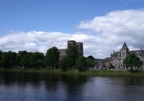
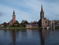
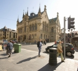
Inverness is a city at the heart of the Scottish Highlands and the principal centre for administration and commerce. It is the most northerly city in the British Isles.
Understand
Advertised as "the Gateway to the Highlands" by the local authority, and long regarded as the capital of the Highlands, Inverness is the centre for commerce and industry in the Scottish Highlands, with continuing new investment in traditional industries and new hi-tech industries. It is also said to be one of the fastest growing cities in Europe.
See
- ⊙Inverness Castle. At the end of the western pedestrian zone. It is a relatively new castle built in 1847 to replace a medieval castle blown up by the Jacobites. It houses the Sheriff Court and cannot be seen as a visitor (you at least should try to never see it from the inside).

- ⊙Inverness Museum & Art Gallery, Castle Wynd (base of Inverness Castle), ☎ +44 1463 237114. The museum has a collection of Pictish stones and wildlife dioramas, as well as historic weapons. Underwent a major refurbishment in 2006, and now contains many artefacts on loan from the National Museum of Scotland in Edinburgh.
- ⊙Old High Church, Church Street. Oldest Church in Inverness, the 'Town Church' of the city. Historic Tour each Friday at 11.30am, June to August. Sunday services at 11.15am, Prayers for Peace and Justice every Friday at 1.05pm, and occasional evening services in the summer, with guest preachers, as advertised.
- ⊙Ship Space, 16 Clachnaharry Road, IV3 8QH, ☎ +44 1463 716839. 10AM - 3PM daily. An interactive and evolving museum in Inverness with nautical artefacts & large ships: e.g. 1:10 scale Titanic, Buckie drifter, RNLI lifeboat & more. Free entry.
- ⊙Inverness Botanic Gardens (formerly: Floral Hall and Gardens), Bught Lane (next to the sports centre), ☎ +44 1463 713553. Glasshouse and gardens, with a range of exotic plants, plus a cafe. Free.
- ⊙Inverness Cathedral (St Andrew’s Cathedral). Scottish Episcopal (Anglican) cathedral, built in 1869. (updated Jul 2015)
Information about copyright | |
|---|---|
Rights characteristic / license | by-sa: CREATIVE COMMONS Attribution-ShareAlike |
Link to the description of the license | |
Input taken over from: |
Wikivoyage contributors, "Inverness," Wikivoyage, The FREE worldwide travel guide that anyone can edit, https://en.wikivoyage.org/w/index.php?title=Inverness&oldid=3196503 (accessed May 8, 2017). |
taken over / edited on | 08 May 2017 - 12 Apr 2018
|
taken over / edited by |
|
109 km
0,4 km
49 m
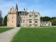
Brodie Castle is a well-preserved Z plan castle located about 3 1⁄2 miles (5.5 kilometres) west of Forres , in Moray, Scotland. The castle is a Category A listed building and the grounds are included in the Inventory of Gardens and Designed Landscapes in Scotland.
The Brodie family
The original Z-plan castle was built in 1567 by Clan Brodie but was destroyed by fire in 1645 by Lewis Gordon of Clan Gordon, the 3rd Marquis of Huntly. In 1824, architect William Burn was commissioned to convert it into a large mansion house in the Scots Baronial style, but these additions were never completed and were later remodelled by James Wylson (c. 1845).
The Brodie family called the castle home until the early 21st century. It is widely accepted that the Brodies have been associated with the land on which the castle is built since around 1160, when it is believed that King Malcolm IV gave the land to the family.
Ninian Brodie of Brodie (The Brodie of Brodie), the castle's last resident member of the family, died in 2003. The former family wing is being[when? ] prepared for holiday letting.
The castle today
Architecturally, the castle has a very well-preserved 16th-century central keep with two 5-storey towers on opposing corners. The interior of the castle is also well preserved, containing fine antique furniture, oriental artifacts and painted ceilings, largely dating from the 17th–19th centuries.
Today the castle and surrounding policies, including a national daffodil collection, are owned by the National Trust for Scotland and are open to the public to visit throughout the year. The castle may be hired for weddings and indoor or outdoor events. An ancient Pictish monument known as Rodney's Stone can be seen in the castle grounds.
Information about copyright | |
|---|---|
Rights characteristic / license | by-sa: CREATIVE COMMONS Attribution-ShareAlike |
Link to the description of the license | |
Input taken over from: |
Wikipedia contributors, 'Brodie Castle', Wikipedia, The Free Encyclopedia, 3 August 2020, 18:22 UTC, https://en.wikipedia.org/w/index.php?title=Brodie_Castle&oldid=971018402 [accessed 12 December 2020] |
taken over / edited on | 12 Dec 2020
|
taken over / edited by |
|
Hours of opening
Castle
Guided tours only
2 Jan–29 Feb 2020, Thurs–Sun, 10.00–16.00
1 Mar–19 Mar, daily, 10.00–17.00
20 Mar–31 Dec, closed.
Playful Garden
1 Aug–15 Sep, Wed–Sun, 10.00–17.00
16 Sep–25 Oct, Wed–Sun, 10.00–16.00
26 Oct–31 Dec, Sat & Sun, 10.00–16.00
Garden and grounds
6 Jul–31 Dec, open daily
142 km
0,3 km
33 m
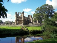
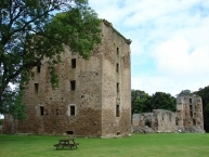
Elgin is the county town of Moray  in north-east Scotland, best known for its ruined cathedral which made it a "city". Together with nearby Lossiemouth it's the service town for two nearby RAF bases.
The "Elgin Marbles" have only the most tenuous connection with this place. It was the 7th Earl of Elgin who in the early 19th century removed (or looted or legally purchased or rescued from destruction, take your pick) many friezes and sculptures from the Acropolis in Athens - they're now in the British Museum. But the family residences were in Fife and elsewhere, and none of the Earls of Elgin lived here.
See
- ⊙Elgin Cathedral. Apr - Sep: Daily, 9.30am to 5.30pm; Oct - Mar: Daily 10am to 4pm. Ruins of a cathedral dating from 1224. £5.50. (updated Nov 2016)
- ⊙Elgin Museum, 1 High Street, IV30 1EQ, ☎ +44 1343 543675. Apr - Oct: Mon - Fri 10am to 5pm, Sat 11am - 4pm. Contains local history, archaeology, fossils and watercolours. donation.
- ⊙Spynie Palace (2 miles north of Elgin). Apr - Sep: Daily 9:30 - 17:30. Bishop's palace from the late 12th century. (updated Nov 2016)
Do
- ⊙The Glen Moray Distillery, Bruceland Road (West of town, Soth of the A96), ☎ +44 1343 550900. Tours Mon - Fri 9:30 , 11:00 , 12:30 , 14:00 and 15:30 Sat (May-Sep) 10:30 , 12:00 , 13:30 and 15:00. Whisky distillery just west of town. £5 (Inc, Tour and Tasting).
Information about copyright | |
|---|---|
Rights characteristic / license | by-sa: CREATIVE COMMONS Attribution-ShareAlike |
Link to the description of the license | |
Input taken over from: |
Wikivoyage contributors, 'Elgin', Wikivoyage, The FREE worldwide travel guide that anyone can edit, 27 May 2020, 14:13 UTC, https://en.wikivoyage.org/w/index.php?title=Elgin&oldid=3979417 [accessed 12 December 2020] |
taken over / edited on | 12 Dec 2020
|
taken over / edited by |
|
358 km
0,5 km
18 m


Dunnottar Castle (Scottish Gaelic: Dùn Fhoithear, "fort on the shelving slope") is a ruined medieval fortress located upon a rocky headland on the northeastern coast of Scotland, about 2 miles (3 kilometres) south of Stonehaven . The surviving buildings are largely of the 15th and 16th centuries, but the site is believed to have been fortified in the Early Middle Ages. Dunnottar has played a prominent role in the history of Scotland through to the 18th-century Jacobite risings because of its strategic location and defensive strength.
Dunnottar is best known as the place where the Honours of Scotland, the Scottish crown jewels, were hidden from Oliver Cromwell's invading army in the 17th century. The property of the Keiths from the 14th century, and the seat of the Earl Marischal, Dunnottar declined after the last Earl forfeited his titles by taking part in the Jacobite rebellion of 1715. The castle was restored in the 20th century and is now open to the public.
The ruins of the castle are spread over 1.4 hectares (3 1⁄2 acres), surrounded by steep cliffs that drop to the North Sea, 160 feet (50 metres) below. A narrow strip of land joins the headland to the mainland, along which a steep path leads up to the gatehouse. The various buildings within the castle include the 14th-century tower house as well as the 16th-century palace. Dunnottar Castle is a scheduled monument, and twelve structures on the site were listed buildings.
Information about copyright | |
|---|---|
Rights characteristic / license | by-sa: CREATIVE COMMONS Attribution-ShareAlike |
Link to the description of the license | |
Input taken over from: |
Wikipedia contributors, 'Dunnottar Castle', Wikipedia, The Free Encyclopedia, 17 November 2020, 13:24 UTC, https://en.wikipedia.org/w/index.php?title=Dunnottar_Castle&oldid=989170842 [accessed 12 December 2020] |
taken over / edited on | 12 Dec 2020
|
taken over / edited by |
|
484 km
0,5 km
16 m