
Cycle Tour Copenhagen-Nykoebing F
Dag 3: Vordingborg-Nykøbing F
![]()
Please wait - map data are loading
Added on 19 Apr 2015
last edited by Ottocolor on 03 Apr 2018
Cycle route metrics
ridden
Total distance in km
40
Cumulative elevation gain in m
196
Avg. slope uphill in %
0,49
Cumulative elevation loss in m
177
Information about rights to the gps-track data | |
|---|---|
Rights owner | |
Rights characteristic / license | by-sa: CREATIVE COMMONS Attribution-ShareAlike |
Link to the description of the license | |
GPX file uploaded | by Ottocolor on 20 Apr 2015
|
Track points in total
415
Track points per km (avg)
10
Start/endpoint
Start location
Masnedø, Region Zealand, DK (-28 m NHN)
End location
Nykøbing Falster, Region Zealand, DK (-9 m NHN)
ridden on
17 Apr 2015
Weather
Still sunny, but cool and windy spring weater. The wind had calmed down sligthly and was more northernly, on Funen from northeast.
Properties
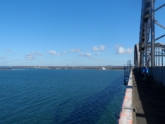
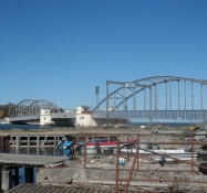
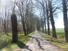
Bikelane along the road across the Great Stream Bridge and on along the main road to Guldborg. From there on the Sound Route on earth trails through woods and on gravel paths with short sections of tarmac road in between until Kirstinebjerg manor. From there on tarmac, minor roads or bike lanes into the town of Nykoebing F. On Funen mostly in moderate traffic on the trunk road No 8 between Kvaerndrup and Oerbaek. From there on a double bike path to Refsvindinge Brewery.
Slope Gradient Distribution
Remarks
The route was changed to follow the Sound Route between Guldborg and Nykoebing F in stead of going round eastern Falster, as I had slept in Vordingborg in stead of Stubbekoebing and still had to get the bus to Funen in Nykoebing F at 1.40pm.
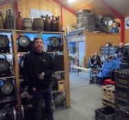
Travel report
Information about copyright | |
|---|---|
Rights owner | |
Rights characteristic / license | by-sa: CREATIVE COMMONS Attribution-ShareAlike |
Link to the description of the license | |
Image has been uploaded | by Ottocolor on 22 Apr 2015
|
Information about copyright | |
|---|---|
Rights owner | |
Rights characteristic / license | by-sa: CREATIVE COMMONS Attribution-ShareAlike |
Link to the description of the license | |
Image has been uploaded | by Ottocolor on 22 Apr 2015
|
Information about copyright | |
|---|---|
Rights owner | |
Rights characteristic / license | by-sa: CREATIVE COMMONS Attribution-ShareAlike |
Link to the description of the license | |
Image has been uploaded | by Ottocolor on 22 Apr 2015
|
Information about copyright | |
|---|---|
Rights owner | |
Rights characteristic / license | by-sa: CREATIVE COMMONS Attribution-ShareAlike |
Link to the description of the license | |
Image has been uploaded | by Ottocolor on 22 Apr 2015
|
Information about copyright | |
|---|---|
Rights owner | |
Rights characteristic / license | by-sa: CREATIVE COMMONS Attribution-ShareAlike |
Link to the description of the license | |
Image has been uploaded | by Ottocolor on 22 Apr 2015
|
Information about copyright | |
|---|---|
Rights owner | |
Rights characteristic / license | by-sa: CREATIVE COMMONS Attribution-ShareAlike |
Link to the description of the license | |
Image has been uploaded | by Ottocolor on 22 Apr 2015
|
Information about copyright | |
|---|---|
Rights owner | |
Rights characteristic / license | by-sa: CREATIVE COMMONS Attribution-ShareAlike |
Link to the description of the license | |
Image has been uploaded | by Ottocolor on 22 Apr 2015
|
Information about copyright | |
|---|---|
Rights owner | |
Rights characteristic / license | by-sa: CREATIVE COMMONS Attribution-ShareAlike |
Link to the description of the license | |
Image has been uploaded | by Ottocolor on 22 Apr 2015
|
Information about copyright | |
|---|---|
Rights owner | |
Rights characteristic / license | by-sa: CREATIVE COMMONS Attribution-ShareAlike |
Link to the description of the license | |
Image has been uploaded | by Ottocolor on 22 Apr 2015
|