
Cycle Tour Summer trip to southern Langeland
Dag 2 Langeland og Taasinge: Skovsgaard-Taasinge-Svendborg
![]()
Please wait - map data are loading
Added on 05 Aug 2014
last edited by Ottocolor on 10 Aug 2014
Cycle route metrics
ridden
Total distance in km
63
Cumulative elevation gain in m
335
Avg. slope uphill in %
0,53
Cumulative elevation loss in m
325
Information about rights to the gps-track data | |
|---|---|
Rights owner | |
Rights characteristic / license | by-sa: CREATIVE COMMONS Attribution-ShareAlike |
Link to the description of the license | |
GPX file uploaded | by Ottocolor on 05 Aug 2014
|
Track points in total
711
Track points per km (avg)
11
Start/endpoint
Start location
Hennetved, Region of Southern Denmark, DK (0 m NHN)
End location
Svendborg, Region of Southern Denmark, DK (11 m NHN)
ridden on
17 Jul 2014
Weather
Again warm and sunny all day long. The wind light to moderate from south westerly directions.
Properties
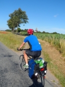
On gravel roads and small tarmac roads to the manor of Skovsgaard and the same from there. Minor tarmac roads back to the tent site and across Langeland to the town of Rudkoebing. Bike land along the main road across the Langeland bridge and the island om Sioe. On the island of Taasing we cycled on small, rural roads via the villages of Skovsballe and Landet and through the palace of Valdemarsslot. Across the Svendborg Sound bridge on the bike lane and down into Svendborg on town roads without bike lane to the station.
Slope Gradient Distribution
Remarks
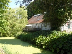
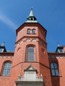
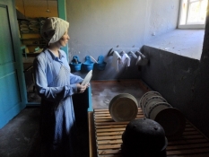
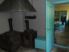
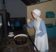
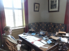
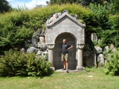
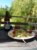
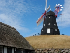
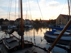
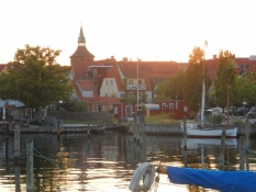
The second day of the bike trip, which offered a visit at the manor of Skovsgaard with a couple of museums, a glance at the wind mill and back to the tent site in order to take down the tents. Then a couple of hours spent on the beach before the trip home with two detours on the island of Taasinge, first to Skovsballe with a bathing stop and then via the palace of Valdemarsslot and the village of Troense back to Svendborg across the bridge. From there we took the train home to Odense.
Travel report
Information about copyright | |
|---|---|
Rights owner | |
Rights characteristic / license | by-sa: CREATIVE COMMONS Attribution-ShareAlike |
Link to the description of the license | |
Image has been uploaded | by Ottocolor on 10 Aug 2014
|
Information about copyright | |
|---|---|
Rights owner | |
Rights characteristic / license | by-sa: CREATIVE COMMONS Attribution-ShareAlike |
Link to the description of the license | |
Image has been uploaded | by Ottocolor on 10 Aug 2014
|
Information about copyright | |
|---|---|
Rights owner | |
Rights characteristic / license | by-sa: CREATIVE COMMONS Attribution-ShareAlike |
Link to the description of the license | |
Image has been uploaded | by Ottocolor on 10 Aug 2014
|
Information about copyright | |
|---|---|
Rights owner | |
Rights characteristic / license | by-sa: CREATIVE COMMONS Attribution-ShareAlike |
Link to the description of the license | |
Image has been uploaded | by Ottocolor on 10 Aug 2014
|
Information about copyright | |
|---|---|
Rights owner | |
Rights characteristic / license | by-sa: CREATIVE COMMONS Attribution-ShareAlike |
Link to the description of the license | |
Image has been uploaded | by Ottocolor on 10 Aug 2014
|
Information about copyright | |
|---|---|
Rights owner | |
Rights characteristic / license | by-sa: CREATIVE COMMONS Attribution-ShareAlike |
Link to the description of the license | |
Image has been uploaded | by Ottocolor on 10 Aug 2014
|
Information about copyright | |
|---|---|
Rights owner | |
Rights characteristic / license | by-sa: CREATIVE COMMONS Attribution-ShareAlike |
Link to the description of the license | |
Image has been uploaded | by Ottocolor on 10 Aug 2014
|
Information about copyright | |
|---|---|
Rights owner | |
Rights characteristic / license | by-sa: CREATIVE COMMONS Attribution-ShareAlike |
Link to the description of the license | |
Image has been uploaded | by Ottocolor on 10 Aug 2014
|
Information about copyright | |
|---|---|
Rights owner | |
Rights characteristic / license | by-sa: CREATIVE COMMONS Attribution-ShareAlike |
Link to the description of the license | |
Image has been uploaded | by Ottocolor on 10 Aug 2014
|
Information about copyright | |
|---|---|
Rights owner | |
Rights characteristic / license | by-sa: CREATIVE COMMONS Attribution-ShareAlike |
Link to the description of the license | |
Image has been uploaded | by Ottocolor on 10 Aug 2014
|
Information about copyright | |
|---|---|
Rights owner | |
Rights characteristic / license | by-sa: CREATIVE COMMONS Attribution-ShareAlike |
Link to the description of the license | |
Image has been uploaded | by Ottocolor on 10 Aug 2014
|
Information about copyright | |
|---|---|
Rights owner | |
Rights characteristic / license | by-sa: CREATIVE COMMONS Attribution-ShareAlike |
Link to the description of the license | |
Image has been uploaded | by Ottocolor on 10 Aug 2014
|
Information about copyright | |
|---|---|
Rights owner | |
Rights characteristic / license | by-sa: CREATIVE COMMONS Attribution-ShareAlike |
Link to the description of the license | |
Image has been uploaded | by Ottocolor on 10 Aug 2014
|
Information about copyright | |
|---|---|
Rights owner | |
Rights characteristic / license | by-sa: CREATIVE COMMONS Attribution-ShareAlike |
Link to the description of the license | |
Image has been uploaded | by Ottocolor on 10 Aug 2014
|
Information about copyright | |
|---|---|
Rights owner | |
Rights characteristic / license | by-sa: CREATIVE COMMONS Attribution-ShareAlike |
Link to the description of the license | |
Image has been uploaded | by Ottocolor on 10 Aug 2014
|
Information about copyright | |
|---|---|
Rights owner | |
Rights characteristic / license | by-sa: CREATIVE COMMONS Attribution-ShareAlike |
Link to the description of the license | |
Image has been uploaded | by Ottocolor on 10 Aug 2014
|
Information about copyright | |
|---|---|
Rights owner | |
Rights characteristic / license | by-sa: CREATIVE COMMONS Attribution-ShareAlike |
Link to the description of the license | |
Image has been uploaded | by Ottocolor on 10 Aug 2014
|
Information about copyright | |
|---|---|
Rights owner | |
Rights characteristic / license | by-sa: CREATIVE COMMONS Attribution-ShareAlike |
Link to the description of the license | |
Image has been uploaded | by Ottocolor on 10 Aug 2014
|