Cycle Tour Bike holiday along the Rhine and to Amsterdam
Dag 4, etape 2: Spay-Remagen
![]()
Please wait - map data are loading
Added on 07 Aug 2016
last edited by Ottocolor on 08 Aug 2016
Cycle route metrics
ridden
Total distance in km
73
Cumulative elevation gain in m
670
Avg. slope uphill in %
0,92
Cumulative elevation loss in m
684
Min. height
53
Max. height
98
Information about rights to the gps-track data | |
|---|---|
Rights owner | |
Rights characteristic / license | cc0: Public Domain no Rights reserved |
Link to the description of the license | |
GPX file uploaded | by Ottocolor on 07 Aug 2016
|
Track points in total
874
Track points per km (avg)
12
Start/endpoint
Start location
Boppard, Rheinland-Pfalz, DE (70 m NHN)
End location
Remagen, Rheinland-Pfalz, DE (56 m NHN)
ridden on
19 Jul 2016
Weather
A very hot day from early morning til late evening. Light wind from West and North.
Accommodation
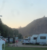
Rheincamping Siebengebirgsblick
Wickchenstraße
DE-53424 Remagen-Rolandswerth
Properties
Another day on the superbly signposted and mostly tarmac Rhine cycle route in Germany. Like all German bike routes it is often in need of repair, as the trees along the roads ruin the tarmac with their roots and make it very bumpy. But no problem at all today.
Remarks
The second stage of the first three day stretch from Wiesbaden to Cologne.
Travel report
Information about copyright | |
|---|---|
Rights owner | |
Rights characteristic / license | by-sa: CREATIVE COMMONS Attribution-ShareAlike |
Link to the description of the license | |
Image has been uploaded | by Ottocolor on 08 Aug 2016
|
Information about copyright | |
|---|---|
Rights owner | |
Rights characteristic / license | by-sa: CREATIVE COMMONS Attribution-ShareAlike |
Link to the description of the license | |
Image has been uploaded | by Ottocolor on 08 Aug 2016
|
Information about copyright | |
|---|---|
Rights owner | |
Rights characteristic / license | by-sa: CREATIVE COMMONS Attribution-ShareAlike |
Link to the description of the license | |
Image has been uploaded | by Ottocolor on 08 Aug 2016
|
Information about copyright | |
|---|---|
Rights owner | |
Rights characteristic / license | by-sa: CREATIVE COMMONS Attribution-ShareAlike |
Link to the description of the license | |
Image has been uploaded | by Ottocolor on 08 Aug 2016
|
Information about copyright | |
|---|---|
Rights owner | |
Rights characteristic / license | by-sa: CREATIVE COMMONS Attribution-ShareAlike |
Link to the description of the license | |
Image has been uploaded | by Ottocolor on 08 Aug 2016
|
Information about copyright | |
|---|---|
Rights owner | |
Rights characteristic / license | by-sa: CREATIVE COMMONS Attribution-ShareAlike |
Link to the description of the license | |
Image has been uploaded | by Ottocolor on 08 Aug 2016
|
Information about copyright | |
|---|---|
Rights owner | |
Rights characteristic / license | by-sa: CREATIVE COMMONS Attribution-ShareAlike |
Link to the description of the license | |
Image has been uploaded | by on 08 Aug 2016
|
Information about copyright | |
|---|---|
Rights owner | |
Rights characteristic / license | by-sa: CREATIVE COMMONS Attribution-ShareAlike |
Link to the description of the license | |
Image has been uploaded | by on 08 Aug 2016
|
Information about copyright | |
|---|---|
Rights owner | |
Rights characteristic / license | by-sa: CREATIVE COMMONS Attribution-ShareAlike |
Link to the description of the license | |
Image has been uploaded | by on 08 Aug 2016
|

