Print the page content is only available to registered and logged in users and only as a tourbook!

Cycle Tour Bike holiday in the Alps 2014

Dag 2, etape/stage 1: St. Moritz-Maloja-St. Moritz

busy


Please wait - map data are loading

1750195021502350255027502950
Elevation profile Cycle Tour Bike holiday in the Alps 20141750195021502350255027502950020406080100120

Added on 05 Aug 2014

on 11 Aug 2014

Cycle route metrics

ridden

Total distance in km

35

Cumulative elevation gain in m

1.340

Avg. slope uphill in %

3,83

Cumulative elevation loss in m

1.342

Min. height

1.793

Max. height

2.650

GPS track data

Information about rights to the gps-track data

Rights owner

Ottocolor

Rights characteristic / license

by-sa: CREATIVE COMMONS Attribution-ShareAlike

Link to the description of the license

creativecommons.org/licenses/by-sa/3.0/

GPX file uploaded

by Ottocolor on 09 Aug 2014

Track points in total

771

Track points per km (avg)

22

Start/endpoint

Start location

Sankt Moritz, Graubünden, CH (1796 m NHN)

End location

Sankt Moritz, Graubünden, CH (1795 m NHN)

ridden on

22 Jul 2014

Weather

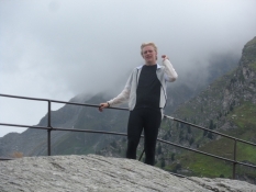
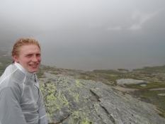
Overcast and very cool all day long. In the valley mostly dry. On the mountain walk to the Lunghin pass is was really cold (2-3°C) with light rain and foggy. On the bike trip 'home' to St. Moritz a light north easterly (head)wind.

Accommodation

Campingplatz Olympiaschanze
Via San Gian
CH-7500 St. Moritz

Properties

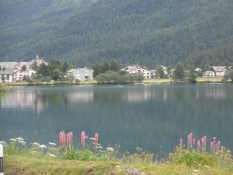
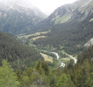
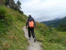
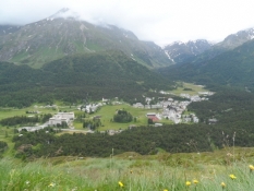
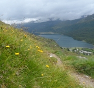
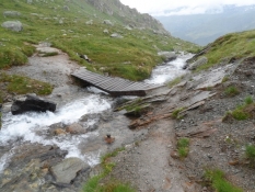
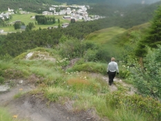
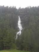
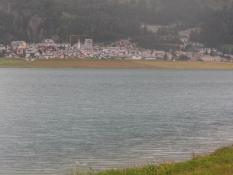
The outbound trip to Maloja we rode mainly on the main road in light, but fast going traffic. Short stretches on gravel paths. In the village og Maloja on the main road to the top point of the Maloja pass and then on a steeply ascending gravel path to Pila. From here we made a four-hour mountainwalk on a fairly taxing trail up to the Lunghin pass and back down again. From Pila cycled back to St. Moritz on the sighnposted cycle route (No. 6, 65 og Inn-Radweg), which followed the main road north of the Segl lake. Then through Segl Maria on a tarmac road. Then around the lakes of Silvaplauna and Champfér on a rather poor wet gravel path with wooden or metal rain drains across the trail.

Slope Gradient Distribution

Remarks

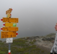
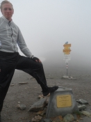
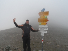
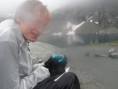
The first stage performed as a day trip from the the tent site a St. Moritz. Our goal was the top of the Maloja pass in 1,815 m. elevation and then a mountain walk to the well of the Inn at the Lunghin pass (2640 m) via the Lunghin lake. Outbound we rode on the main road, homebound on the official cycle route.

Travel report

Udsigt over Silser-søen mod byen Segl Baselgia/A view across the lake Segl towards Segl Baselgia
Simon på toppen af Maloja-passet/Simon on the top of the Maloja pass
Et kig ned i dalen for bunden af passet/A view into the valley at the bottom of the pass
På bjergvandring med hjemmelavet rygsæk/On the mountain walk with a self-made backpack
Udsigt mod Maloja fra bjergsiden/View towards Maloja from the mountain slope
Silser-søen og bjergtoppe, indhyllet i skyer/Lake Segl and mountain tops, covered in clouds
Den første bro over den endnu unge Inn/The first bridge across the still young river Inn
Simon foran Lunghin-søen i 2484 m.ʹs højde/Simon at lake Lunghin at 2,484 m elevation
Vandreruterne er godt skiltede/The walking routes are well signposted
Simon ved vandskellet på Lunghin-passet/Simon at the watershed on the Lunghin pass
Herfra løber vandet mod tre forskellige have/From here the water runs into three different seas
Der er koldt ved Lunghin-søen og vi får kaffe/te/Itʹs cold at lake Lunghin and we have coffee or tea
Fra den lange vej ned ad bjerget/From the long way down the mountain
Mange vandfald spæder den unge Inn/The young Inn is fed by many waterfalls
Udsigt mod Silvaplauna ved søen af samme navn/View towards Silvaplauna at the lake of the same name