Radtour Rad-Urlaub in den Alpen 2014
Dag 13, hviledag/rest day: München, dag 2
![]()
Bitte warten - Kartendaten werden geladen
Erstellt am 05.08.2014
zuletzt geändert von Ottocolor am 15.08.2014
Strecken-Merkmale
gefahren
Gesamtlänge in km
20
Gesamthöhenmeter Aufstieg
112
Durchschn. Steigung Aufstieg %
0,56
Gesamthöhenmeter Abstieg
160
min. Höhe
507
max. Höhe
564
Informationen zu Rechten an den GPS-Track-Daten | |
|---|---|
Rechte-Inhaber | |
Rechte-Ausprägung / Lizenz | by-sa: CREATIVE COMMONS Namensnennung, Weitergabe unter gleichen Bedingungen |
Link zur Rechtebeschreibung | |
gpx-Datei hochgeladen | durch Ottocolor am 09.08.2014
|
Gesamtzahl Trackpoints
509
Trackpoint-Dichte per km
25
Endorte
Start
München, Bayern, DE (521 m NHN)
Ziel
München, Bayern, DE (520 m NHN)
gefahren am
02.08.2014
Wetter
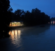
In the morning sunny and warm, but then suddenly overcast and rain, that ceases only late in the evening. A sharp cooling down.
Unterkunft
Campingplatz Thalkirchen
Zentralländstraße 49
DE-81379 München
Beschaffenheit
Along gravel paths and the long Marienklausen bridge across the Isar, wheeled up the steep brink on the other side and along minor residential roads to Saebener Strasse. From here on a small road and then on bike lanes (partly on the wrong side of the road!) past the stadium on the Gruenwalder Strasse and across the Brudermuehl bridge. Then a short stretch on the gravel path along the river Isar just to turn left towards the Octoberfeast area, again all the roads had bike lanes all the way up to the Bavariapark with the Traffic museum. Back the same route to the camp site.
Steigungs-Verteilung
Bemerkungen
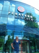
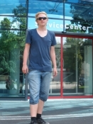
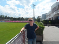
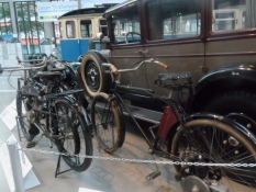
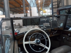
The lasst whole day in Munich. The morning we spent looking for a good bathing spot at the Isar. In vain, it turned out, so a swim park with a natural pool near the camp site was a good solution. In the afternoon a trip to Bayern Munich's training site, a glance at the club's original stadium and then a visit to Deutsches Museum's department for traffic. The evening we spent at the camp site.
Reisebericht
Informationen zu Urheber-Rechten | |
|---|---|
Rechte-Inhaber | |
Rechte-Ausprägung / Lizenz | by-sa: CREATIVE COMMONS Namensnennung, Weitergabe unter gleichen Bedingungen |
Link zur Rechtebeschreibung | |
Bild hochgeladen | durch Ottocolor am 15.08.2014
|
Informationen zu Urheber-Rechten | |
|---|---|
Rechte-Inhaber | |
Rechte-Ausprägung / Lizenz | by-sa: CREATIVE COMMONS Namensnennung, Weitergabe unter gleichen Bedingungen |
Link zur Rechtebeschreibung | |
Bild hochgeladen | durch Ottocolor am 15.08.2014
|
Informationen zu Urheber-Rechten | |
|---|---|
Rechte-Inhaber | |
Rechte-Ausprägung / Lizenz | by-sa: CREATIVE COMMONS Namensnennung, Weitergabe unter gleichen Bedingungen |
Link zur Rechtebeschreibung | |
Bild hochgeladen | durch Ottocolor am 15.08.2014
|
Informationen zu Urheber-Rechten | |
|---|---|
Rechte-Inhaber | |
Rechte-Ausprägung / Lizenz | by-sa: CREATIVE COMMONS Namensnennung, Weitergabe unter gleichen Bedingungen |
Link zur Rechtebeschreibung | |
Bild hochgeladen | durch Ottocolor am 15.08.2014
|
Informationen zu Urheber-Rechten | |
|---|---|
Rechte-Inhaber | |
Rechte-Ausprägung / Lizenz | by-sa: CREATIVE COMMONS Namensnennung, Weitergabe unter gleichen Bedingungen |
Link zur Rechtebeschreibung | |
Bild hochgeladen | durch Ottocolor am 15.08.2014
|
Informationen zu Urheber-Rechten | |
|---|---|
Rechte-Inhaber | |
Rechte-Ausprägung / Lizenz | by-sa: CREATIVE COMMONS Namensnennung, Weitergabe unter gleichen Bedingungen |
Link zur Rechtebeschreibung | |
Bild hochgeladen | durch Ottocolor am 15.08.2014
|
Informationen zu Urheber-Rechten | |
|---|---|
Rechte-Inhaber | |
Rechte-Ausprägung / Lizenz | by-sa: CREATIVE COMMONS Namensnennung, Weitergabe unter gleichen Bedingungen |
Link zur Rechtebeschreibung | |
Bild hochgeladen | durch Ottocolor am 15.08.2014
|
Informationen zu Urheber-Rechten | |
|---|---|
Rechte-Inhaber | |
Rechte-Ausprägung / Lizenz | by-sa: CREATIVE COMMONS Namensnennung, Weitergabe unter gleichen Bedingungen |
Link zur Rechtebeschreibung | |
Bild hochgeladen | durch Ottocolor am 15.08.2014
|
Informationen zu Urheber-Rechten | |
|---|---|
Rechte-Inhaber | |
Rechte-Ausprägung / Lizenz | by-sa: CREATIVE COMMONS Namensnennung, Weitergabe unter gleichen Bedingungen |
Link zur Rechtebeschreibung | |
Bild hochgeladen | durch Ottocolor am 15.08.2014
|

