
Cycle Tour Canal des 2 mers - Mediterranean route - Cycle route Switzerland-Mediterranean
6. Etappe: Narbonne - Agde
![]()
Please wait - map data are loading
Added on 13 Jun 2018
last edited by ThimbleU on 27 Aug 2018
Cycle route metrics
ridden
Total distance in km
80
Cumulative elevation gain in m
363
Avg. slope uphill in %
0,45
Cumulative elevation loss in m
366
Total cycling hours
4,9
Avg. pace in km/h
16,3
Min. height
3
Max. height
73
Information about rights to the gps-track data | |
|---|---|
Rights owner | |
Rights characteristic / license | cc0: Public Domain no Rights reserved |
Link to the description of the license | |
GPX file uploaded | by ThimbleU on 14 Jul 2018
|
Track points in total
1.291
Track points per km (avg)
16
Start/endpoint
Start location
Narbonne, Occitania, FR (22 m NHN)
End location
Agde, Occitania, FR (19 m NHN)
ridden on
23 Jun 2018
Accommodation
Chambres dʹhôtes Rosa
62 chemin de Janin
FR-34300 Agde
Signposting
Neither signposted as cycle route V80 "le canal de 2 mers à vélo" nor as EuroVelo 8. |
Properties
asphalt | 75 km | 93,5 % |
chippings road good to ride | 3,1 km | 3,9 % |
gravel path bad to ride | 1,1 km | 1,4 % |
gravel path very bad to ride | 1 km | 1,2 % |
The information relates to the track as traveled!
Slope Gradient Distribution
Travel report
After we left the old town of Narbonne we soon changed over a narrow pedestrian bridge to the western side of the "Canal de la Robine" and cycled mainly directly along the canal bank. The way is paved at first, later having a water-bound surface in good quality.
On road D13 to Cuxac the traffic was already considerable. From the junction of road D369 until Cuxac there is a new bike path on the southwest side.
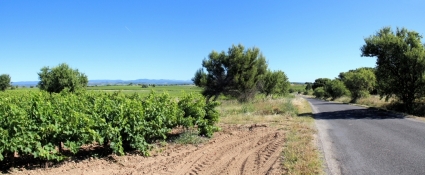
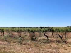
Behind Cuxac traffic is becoming more moderate. To the left and right of the road one vineyard after another. The short tour through the more than 1000-year-old town Sallèles was not worth it.
We continued through the vineyards to Ouvellian and again through vineyards to road D16. We passed the Château du Terral which is hidden in a castle park. From the château itself we only saw the tops of the roof sticking out of the trees.
Information about copyright | |
|---|---|
Rights characteristic / license | by-sa: CREATIVE COMMONS Attribution-ShareAlike |
Link to the description of the license | |
taken over / edited on | 27 Aug 2018
|
taken over / edited by |
|
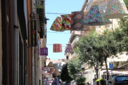
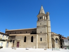
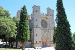
On road D16 among the shades of the plane trees we arrived to Capestang. It was there that the collegiate Saint-Étienne from the 13th century stood out with its 43-meter high bell tower. Similar to the Cathédrale in Narbonne, this church has also been unfinished and unexpectedly completed with a smooth wall on the west side.
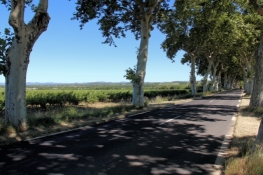
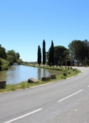
On a narrow road we cycled southeast out of the city and later on road D37 to Poilhes. Here we met the "Canal du Midi" for the first time today, but we left it again after 500 meters.
Information about copyright | |
|---|---|
Rights characteristic / license | by-sa: CREATIVE COMMONS Attribution-ShareAlike |
Link to the description of the license | |
taken over / edited on | 27 Aug 2018
|
taken over / edited by |
|

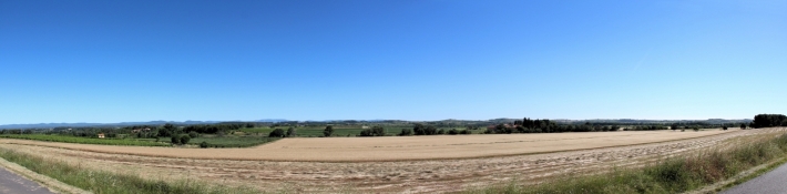
It went down the hillside, of course again through vineyards, and soon again on narrow side roads in the direction of Columbians. In the village we winded our way through the narrow alleys because of a road block. At the harbour we were back to the canal bank for a short while. On the opposite bank, we saw a group of cyclists cycling on the planned route of EuroVelo 8. But we were on the paved minor road on much better surface on the move.
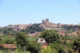
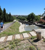
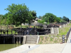
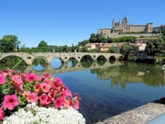
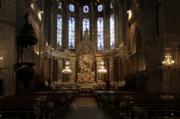
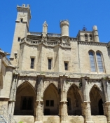
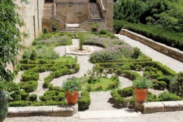
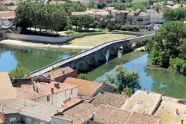
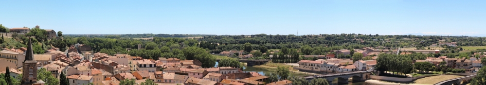
Outside Béziers, we also had to go to the former towpath. In the dry weather now it was not problematic. At the beginning of the flight of locks at Fonsérannes, we already had an impressive view of the Cathédrale of Béziers. It went down to the river Orb and on the other side back up to the old town of Béziers. We mainly visited the Cathédrale Saint-Nazaire, the cloister and the garden terraces of the Episcopal Palace.
Information about copyright | |
|---|---|
Rights characteristic / license | by-sa: CREATIVE COMMONS Attribution-ShareAlike |
Link to the description of the license | |
taken over / edited on | 27 Aug 2018
|
taken over / edited by |
|
Information about copyright | |
|---|---|
Rights owner | |
Rights characteristic / license | © all rights reserved. |
Image has been uploaded | by ThimbleU on 27 Aug 2018
|
Information about copyright | |
|---|---|
Rights owner | |
Rights characteristic / license | © all rights reserved. |
Image has been uploaded | by ThimbleU on 27 Aug 2018
|
Information about copyright | |
|---|---|
Rights owner | |
Rights characteristic / license | © all rights reserved. |
Image has been uploaded | by ThimbleU on 27 Aug 2018
|
Information about copyright | |
|---|---|
Rights owner | |
Rights characteristic / license | © all rights reserved. |
Image has been uploaded | by ThimbleU on 27 Aug 2018
|
Then it went down again to the river Orb and continued along the "Canal du Midi". The track was now well paved over about 13 kilometers, but we now had the wind from the front. Until Vias then followed a touristically very developed area, amongst others with amusement park, several campsites, go-cart track, etc. The short trip to the old town of Vias was not worth it. Essentially narrow streets with gloomy houses. In the center a small square, crowded with tables.
Then we turned southeast to river Hérault. At its western shore we reached Agde after 2½ kilometers.
Information about copyright | |
|---|---|
Rights characteristic / license | by-sa: CREATIVE COMMONS Attribution-ShareAlike |
Link to the description of the license | |
taken over / edited on | 27 Aug 2018
|
taken over / edited by |
|