Radtour Canal des 2 mers - Mittelmeer-Route - Radroute Schweiz-Mittelmeer
12. Etappe: Manosque - Meyrargues - Flayosc
![]()
Bitte warten - Kartendaten werden geladen
Erstellt am 13.06.2018
zuletzt geändert von ThimbleU am 25.09.2018
Strecken-Merkmale
gefahren
Gesamtlänge in km
100
Gesamthöhenmeter Aufstieg
946
Durchschn. Steigung Aufstieg %
0,95
Gesamthöhenmeter Abstieg
887
Gesamtsattelstunden
6,2
Durchschnittsgeschwindigkeit in km/Std.
16,1
min. Höhe
201
max. Höhe
413
Informationen zu Rechten an den GPS-Track-Daten | |
|---|---|
Rechte-Inhaber | |
Rechte-Ausprägung / Lizenz | cc0: Public Domain keine Rechte vorbehalten |
Link zur Rechtebeschreibung | |
gpx-Datei hochgeladen | durch ThimbleU am 14.07.2018
|
Gesamtzahl Trackpoints
1.425
Trackpoint-Dichte per km
14
Endorte
Start
Manosque, Provence-Alpes-Côte d'Azur, FR (393 m NHN)
Ziel
Flayosc, Provence-Alpes-Côte d'Azur, FR (305 m NHN)
gefahren am
29.06.2018
Wetter
Sonnig mit wenigen kleinen Wolken.
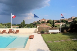
Unterkunft
Chambres dʹhôtes La Vieille Bastide
306 Route Du Peyron
FR-83780 Flayosc
Wegweisung
Ab fünf Kilometer vor Rians bis vor Flayosc Beschilderung provisorischer Radweg EV8. |
|
|
|
Ansonsten ohne Beschilderung. |


Beschaffenheit
Asphalt | 97,6 km | 97,5 % |
wassergeb. schlecht | 1,2 km | 1,2 % |
Asphalt sehr schlecht | 1,0 km | 1,0 % |
Erdweg sehr schlecht | 0,3 km | 0,3 % |
Die Angaben beziehen sich auf die gefahrene Strecke!
Steigungs-Verteilung
Reisebericht
Wir haben sehr gut geschlafen in unserem Hotel. Aber das Wecken war ja heute früher als gewöhnlich nötig, weil die Zugfahrt von Manosque nach Meyrargues anstand. Um 8:00 Uhr waren wir auf den Rädern, um 8:34 Uhr fuhr der Zug los. Dazwischen war noch das Tragen der Räder über die Überführungsbrücke von Gleis 1 nach Gleis 2 angesagt. Der Fahrstuhl war außer Betrieb.
Einundzwanzig Minuten später waren wir 28 Kilometer weiter in Meyrargues. Eine Empfehlung aus dem „Carnet de route“ für den EuroVelo 8 in 2018.
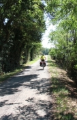
Vom Bahnhof in Meyrargues sind wir nach ein paar Metern auf einer Nebenstraße und radeln bald am Kanal entlang nach Osten. Auf der etwas verkehrsreicheren D561 können wir auf einem Streifen neben der Fahrbahn relativ sicher den einen Kilometer zurücklegen, bevor wir über einen schmalen Verbindungsweg wieder auf eine Nebenstraße (D61) gelangen. Auf dieser radeln wir bis Jouques, fast ohne Verkehr. Dort queren wir auf die andere Flussseite und gelangen über die Avenue de la Gare für drei Kilometer auf das erste Stück Bahnradweg. Es folgen 2½ Kilometer auf der inzwischen weniger frequentierten D561. Das Tal ist eingeschnitten und insbesondere auf der linken Seite karstig.
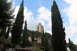
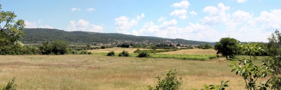
Dann verlassen wir die Departement-Straße nach links auf die ehemalige Bahntrasse. Hier beginnt auch die Beschilderung mit dem Logo des EV8. Die Landschaft wird offener und die landwirtschaftliche Nutzung intensiver. Nach rund fünf Kilometern erreichen wir Rians. Die Kirche sehen wir schon von weitem auf der Anhöhe, darunter die Häuser der Altstadt.
Für ein sehr kurzes Stückmüssen wir auf die D3, dann sind wir für weitere zwei Kilometer wieder auf der Bahntrasse unterwegs.
Dann weisen uns die Schilder des EV8 rechts in die Hügel. Hier fehlt nach wenigen Metern an einer Abzweigung die Wegweisung. Beide Richtungen führen zum Ziel, der linke Weg ist etwas kürzer. Knapp fünfzig Höhenmeter radeln wir hinauf, das letzte Stück schattig durch den Wald, dann geht es flott wieder hinunter zur D561.
Informationen zu Urheber-Rechten | |
|---|---|
Rechte-Ausprägung / Lizenz | by-sa: CREATIVE COMMONS Namensnennung, Weitergabe unter gleichen Bedingungen |
Link zur Rechtebeschreibung | |
übernommen / bearbeitet am | 30.06.2018 - 24.09.2018
|
übernommen / bearbeitet durch |
|
Nach zwei Kilometern steht der Wegweiser auf Geradeaus. Von links kommt aber der Radweg vom asphaltierten Bahndamm. Wir wählen den Bahndamm und sind damit auf einem ordentlichen Radweg unterwegs.
Hinweis: Die Beschilderung soll offensichtlich für gegensätzliche Richtungen die Radfahrer auf unterschiedliche Trassen lenken. |
Hinweis: Die D561/D554/D560 sind grundsätzlich aufgrund des geringen Verkehrsaufkommens gut fahrbar und können immer auch alternativ zum ausgeschilderten Radweg gefahren werden. |
Nach einem kurzen Stück leichten Anstiegs fällt die Bahntrasse 25 Meter, bevor sie an einem Tor endet. Weiterfahrt auf der Bahntrasse nicht möglich. Stattdessen geht es auf einer Nebenstraße 35 Meter wieder hinauf. Vor uns auf dem Berg sehen wir dann das Château De Saint-Martin-de-Pallières und die Häuser des gleichnamigen Ortes.
Wir sind wieder auf der D651 angekommen. Nach 600 Metern ein missverständliches Schild. Es zeigt den Radweg geradeaus an, aufgestellt vor einer Biegung der D651. Gemeint ist wohl auf der D651 zu bleiben und nicht die geradeaus abbiegende Nebenstraße zu nehmen.
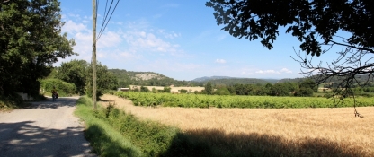
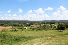
Die D651 verliert hier schnell an Höhe, für acht Kilometer rollen wir talabwärts. Zunächst durch Felder, dann durch ein waldiges Tal. Hier ist die ehemalige Eisenbahntrasse immer wieder rechts neben der Straße als zugewachsener Damm auszumachen. Vor Varages steigt die Straße wieder an. Am Ortsanfang wieder eine unzureichende Wegweisung. Offensichtlich kommt ein Radweg von links. Wo wir aber weiterradeln sollen ist nicht ausgeschildert. Richtig ist die Straße rechts nach Barjols. Dazu müssen wir nochmals 50 Höhenmeter hinauf. Von oben haben wir einen schönen Blick über das mit Nadelgehölzen bewachsene Tal. Einen Kilometer hinter dem höchsten Punkt biegt der Radweg nach rechts auf eine Nebenstraße ein. Links breiten sich Felder aus, dahinter der Ort Tavernes. Rechts spärlich bewachsener Wald/Buschland. In Barjols biegt der Radweg am zweiten Kreisel nach links ab. Wir haben die Wegweisung übersehen und müssen dafür unnötige Höhenmeter wieder hinauf.
Informationen zu Urheber-Rechten | |
|---|---|
Rechte-Ausprägung / Lizenz | by-sa: CREATIVE COMMONS Namensnennung, Weitergabe unter gleichen Bedingungen |
Link zur Rechtebeschreibung | |
übernommen / bearbeitet am | 24.09.2018
|
übernommen / bearbeitet durch |
|
Nach der Anhöhe hinter Barjols verläuft der Radweg für einen Kilometer auf der Bahntrasse rechts (südlich) neben der D650.
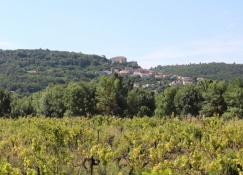
Die Wegweisung führt uns rechts auf die Nebenstraße und damit den Hang hinauf. Über uns ragt das ehemalige Schloss von Pontevès in den Himmel. Nach 35 Höhenmetern geht der gleichmäßige Anstieg in ein Auf und Ab über. Wir radeln abwechselnd durch Wald und Felder. Dann kommen wir wieder auf die D560. Dieser folgen wir für 7½ Kilometer.
Informationen zu Urheber-Rechten | |
|---|---|
Rechte-Ausprägung / Lizenz | by-sa: CREATIVE COMMONS Namensnennung, Weitergabe unter gleichen Bedingungen |
Link zur Rechtebeschreibung | |
übernommen / bearbeitet am | 24.09.2018
|
übernommen / bearbeitet durch |
|
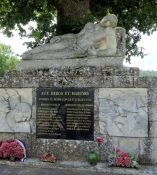
Informationen zu Urheber-Rechten | |
|---|---|
Rechte-Inhaber | |
Rechte-Ausprägung / Lizenz | © Alle Rechte vorbehalten. |
Bild hochgeladen | durch ThimbleU am 24.09.2018
|
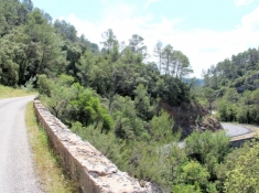
Informationen zu Urheber-Rechten | |
|---|---|
Rechte-Inhaber | |
Rechte-Ausprägung / Lizenz | © Alle Rechte vorbehalten. |
Bild hochgeladen | durch ThimbleU am 24.09.2018
|
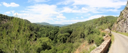
Vor Sillans-la-Cascade verlassen wir die Straße und folgen dem jetzt ausgebauten Bahnradweg für sieben Kilometer. An dessen Ende vor Salernes folgen wir nicht der Wegweisung, sondern rollen ein kurzes Stück auf der D560 hinunter zur D2560 und auf dieser weiter hinab nach Salernes hinein. Am Hauptplatz des Ortes verweilen viele Menschen unter Plantanen in den Cafés und Restaurants.
Informationen zu Urheber-Rechten | |
|---|---|
Rechte-Ausprägung / Lizenz | by-sa: CREATIVE COMMONS Namensnennung, Weitergabe unter gleichen Bedingungen |
Link zur Rechtebeschreibung | |
übernommen / bearbeitet am | 24.09.2018
|
übernommen / bearbeitet durch |
|
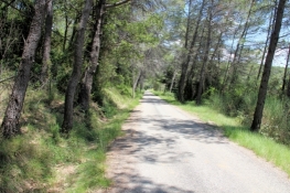
Hinter Salernes setzt sich für 22 Kilometer der ausgebaute Bahnradweg fort. Die Oberfläche ist durchgängig asphaltiert. Wir radeln überwiegend durch einen lichten Nadelholzwald, gelegentlich durch Felder und Siedlungen.
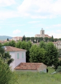
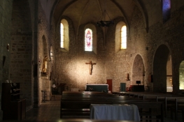
Unterhalb von Flayosc biegen wir auf einen Weg hinauf in den Ort ab. Der schlechte Asphalt und die Steigung erzwingen ein Schieben der Räder. Oben angekommen liegt der Ortskern von Flayosc mit der Kirche Saint-Laurent fotogen vor uns.
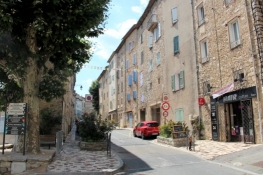
Die Suche nach einer Unterkunft wird wieder einmal etwas aufwändiger. Eine Vermieterin will nicht unter zwei Nächten vermieten, eine andere erklärt Vollbelegung, obwohl im Internet freie Kapazität angezeigt wird. Wo das Office du Tourisme ist, weiß im Ort so recht keiner. Wir finden es schließlich in der Mediathek. Dort spricht man nur französisch. Es gelingt uns trotzdem eine Unterkunft zu finden. Zwar teuer, aber sehr schön.
Das Abendessen kaufen wir uns im Ort ein und verzehren es auf der Terrasse unseres Zimmers.
Informationen zu Urheber-Rechten | |
|---|---|
Rechte-Ausprägung / Lizenz | by-sa: CREATIVE COMMONS Namensnennung, Weitergabe unter gleichen Bedingungen |
Link zur Rechtebeschreibung | |
übernommen / bearbeitet am | 24.09.2018
|
übernommen / bearbeitet durch |
|