
Cycle Tour Canal des 2 mers - Mediterranean route - Cycle route Switzerland-Mediterranean
19. Etappe: Vercelli - Alzo
![]()
Please wait - map data are loading
Added on 13 Jun 2018
last edited by ThimbleU on 22 Oct 2018
Cycle route metrics
ridden
Total distance in km
86
Cumulative elevation gain in m
465
Avg. slope uphill in %
0,54
Cumulative elevation loss in m
215
Total cycling hours
5,0
Avg. pace in km/h
17,2
Min. height
119
Max. height
383
Information about rights to the gps-track data | |
|---|---|
Rights owner | |
Rights characteristic / license | cc0: Public Domain no Rights reserved |
Link to the description of the license | |
GPX file uploaded | by ThimbleU on 06 Jul 2018
|
Track points in total
1.251
Track points per km (avg)
15
Start/endpoint
Start location
Vercelli, Piemont, IT (129 m NHN)
End location
Pella, Piemont, IT (379 m NHN)
ridden on
06 Jul 2018
Weather
At first sunny, later bright.
Accommodation
La Séca - Antico Albergo Alzese
Via Pietro Durio 106
IT-28010 Alzo
Signposting
No signposting. |
Properties
asphalt | 82,2 km | 95,9 % |
fine gravel bad to cycle | 2,3 km | 2,7 % |
forest path bad to cycle | 1,2 km | 1,4 % |
forest path very bad to cycle | 0 km | 0 % |
The information relates to the track as traveled!
Slope Gradient Distribution
Travel report
The breakfast was very good today, only with the bread there was no diversity. Toast only. During breakfast, our landlady has clarified the accommodation for tonight, which turned out to be very valuable because the landlady at the destination does not speak English.
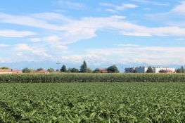
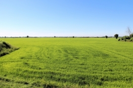
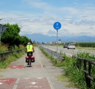
We left Vercelli on a direct way without detour. After three kilometers we had the busy roads behind us and could continue cycling on side roads. The next 25 kilometers we were underway in the flat plain of the Po valley. On both sides of the small streets dominated the rice fields. Villages are rare.
Information about copyright | |
|---|---|
Rights characteristic / license | by-sa: CREATIVE COMMONS Attribution-ShareAlike |
Link to the description of the license | |
taken over / edited on | 21 Oct 2018 - 22 Oct 2018
|
taken over / edited by |
|
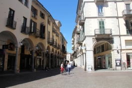
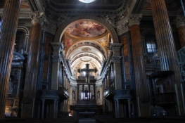
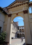
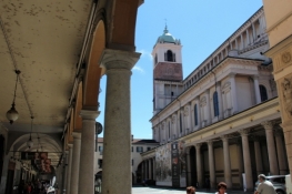
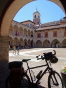
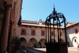
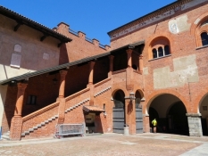
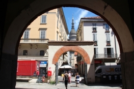
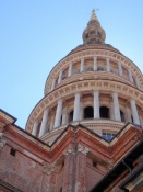
Exactly from the south we cycled to Novara. The tower of the basilica could be seen from afar. About 2 ½ kilometers we cycled from the first houses of the city until we were in the old town. We visited the Cathedral, the Broletto and the Basilica. The cathedral is scaffolded inside. The aisles and the altar and choir room are not affected and showed the splendor of the works of art. The current appearance of the cathedral in Neo-Classicist style was first created in the 1860s. The Basilica of San Gaudenzio impresses with the 121-meter-high tower, which we had already seen from afar in the south and which we later noticed from far north. The Broletto is the former administrative and judicial place of the free city of Novara.
Information about copyright | |
|---|---|
Rights characteristic / license | by-sa: CREATIVE COMMONS Attribution-ShareAlike |
Link to the description of the license | |
taken over / edited on | 22 Oct 2018
|
taken over / edited by |
|
Information about copyright | |
|---|---|
Rights owner | |
Rights characteristic / license | © all rights reserved. |
Image has been uploaded | by ThimbleU on 22 Oct 2018
|
Information about copyright | |
|---|---|
Rights owner | |
Rights characteristic / license | © all rights reserved. |
Image has been uploaded | by ThimbleU on 22 Oct 2018
|
Information about copyright | |
|---|---|
Rights owner | |
Rights characteristic / license | © all rights reserved. |
Image has been uploaded | by ThimbleU on 22 Oct 2018
|
Information about copyright | |
|---|---|
Rights owner | |
Rights characteristic / license | © all rights reserved. |
Image has been uploaded | by ThimbleU on 22 Oct 2018
|
The exit from the city to the north extends over nine kilometers, until we came back to low-traffic roads. A long piece of it was on road SP229.
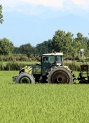
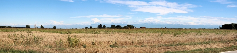
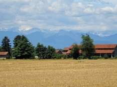
Then we cycled on side roads with significantly less traffic. The rice fields lost their dominance, maize and other cereals took their place. The area remained flat and sparsely populated.
In Barengo we made a detour to the castle, but had to turn back in front of closed gates.
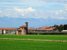
In Borgomanero we came again into a considerable downtown with nice cobbled but smooth streets. The city center was busy. The church and some houses stood out architecturally.
We continued to Briga Novarese and Gozzano, both with pretty village centers. Between the two villages, the track led us to a dead end in front of the railway embankment. 300 meters back we already came to an alternative route, which brought us back to the planned track.
Information about copyright | |
|---|---|
Rights characteristic / license | by-sa: CREATIVE COMMONS Attribution-ShareAlike |
Link to the description of the license | |
taken over / edited on | 22 Oct 2018
|
taken over / edited by |
|
Information about copyright | |
|---|---|
Rights owner | |
Rights characteristic / license | © all rights reserved. |
Image has been uploaded | by ThimbleU on 22 Oct 2018
|
Information about copyright | |
|---|---|
Rights owner | |
Rights characteristic / license | © all rights reserved. |
Image has been uploaded | by ThimbleU on 22 Oct 2018
|
Information about copyright | |
|---|---|
Rights owner | |
Rights characteristic / license | © all rights reserved. |
Image has been uploaded | by ThimbleU on 22 Oct 2018
|
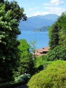
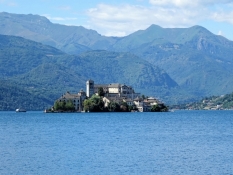
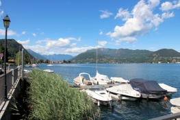
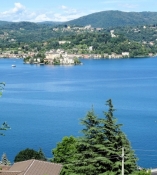
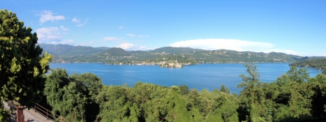
Beyond Gozzano, the terrain falls down 60 meters to the Lake Orta. There are first wonderful views of the lake and the island of San Giulio.
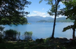
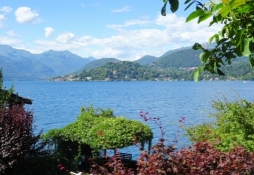
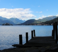
Just above the lakeshore led the track as a narrow path along the lake. The surface is not very good, sometimes bad, but sometimes also good to cycle. But because of the really beautiful impressions of the lake in this good weather with clear, dry air, this route is recommended. In San Maurizio there is a short steeper climb to tackle.
NOTE: From the church in San Filiberto Pella or directly from Pella, you can take the line ferry to Orta and continue on the eastern side of Lake Orta. This saves the many meters of altitude on the western side of the lake. |
Information about copyright | |
|---|---|
Rights characteristic / license | by-sa: CREATIVE COMMONS Attribution-ShareAlike |
Link to the description of the license | |
taken over / edited on | 22 Oct 2018
|
taken over / edited by |
|
Information about copyright | |
|---|---|
Rights owner | |
Rights characteristic / license | © all rights reserved. |
Image has been uploaded | by ThimbleU on 22 Oct 2018
|
Information about copyright | |
|---|---|
Rights owner | |
Rights characteristic / license | © all rights reserved. |
Image has been uploaded | by ThimbleU on 22 Oct 2018
|
Information about copyright | |
|---|---|
Rights owner | |
Rights characteristic / license | © all rights reserved. |
Image has been uploaded | by ThimbleU on 22 Oct 2018
|
Information about copyright | |
|---|---|
Rights owner | |
Rights characteristic / license | © all rights reserved. |
Image has been uploaded | by ThimbleU on 22 Oct 2018
|
Information about copyright | |
|---|---|
Rights owner | |
Rights characteristic / license | © all rights reserved. |
Image has been uploaded | by ThimbleU on 22 Oct 2018
|
Just two kilometers further we had to cycle uphill to Alzo; it was about 80 vertical meters. And then we already were at our accommodation. Our landlady speaks only a few words of English; just as we can speak very little Italian. But talking with our hands we could clarify everything necessary.
In the small restaurant in the place, which was well attended with about 20 guests, we were served a delicious and filling dinner.
Information about copyright | |
|---|---|
Rights characteristic / license | by-sa: CREATIVE COMMONS Attribution-ShareAlike |
Link to the description of the license | |
taken over / edited on | 22 Oct 2018
|
taken over / edited by |
|