
Cycle Tour Danube - Vltava - Elbe
1. Etappe: Passau - Aigen
![]()
Please wait - map data are loading
Added on 01 Jul 2015
last edited by ThimbleU on 17 Jul 2015
Cycle route metrics
ridden
Total distance in km
76
Cumulative elevation gain in m
814
Avg. slope uphill in %
1,07
Cumulative elevation loss in m
554
Total cycling hours
5,0
Avg. pace in km/h
15,2
Min. height
264
Max. height
675
Information about rights to the gps-track data | |
|---|---|
Rights owner | |
Rights characteristic / license | by-sa: CREATIVE COMMONS Attribution-ShareAlike |
Link to the description of the license | |
GPX file uploaded | by ThimbleU on 16 Jul 2015
|
Track points in total
1.127
Track points per km (avg)
15
Start/endpoint
Start location
Passau, Bayern, DE (300 m NHN)
End location
Aigen-Schlägl, Oberösterreich, AT (575 m NHN)
ridden on
05 Jul 2015
Weather
Bis 33°, heiter bis wolkenlos.
Accommodation
Pension Gierlinger
Paul Jaukerstraße 7
AT-4160 Aigen im Mühlkreis
Signposting
Donauradweg, R1, R26.
Properties
Durchgehend Asphalt.
Slope Gradient Distribution
Remarks
Die gefahrene Strecke teilt sich wie folgt auf:
- 46,1 km an der Donau (19,9 km/Std.)
- 3,8 km Bootsfahrt (9,3 km/Std.)
- 27,8 km bergauf nach Aigen durch das Tal der Kleinen Mühl (12,2 km/Std.)
Travel report
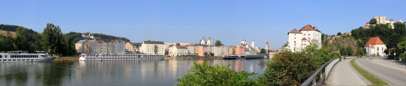
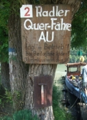
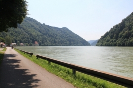
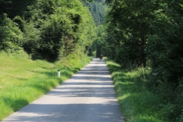
Von Passau zunächst entlang der Straße in Sichtweite zur Donau. In Österreich wird die Straße schmaler, schließlich einspurig bis zur Donauschleife. Das Tal ist auch bei der für mich zweiten Tour wieder sehr beeindruckend. Im Gegensatz zur Route am rechten Ufer aber keine Steigungen.
Information about copyright | |
|---|---|
Rights characteristic / license | by-sa: CREATIVE COMMONS Attribution-ShareAlike |
Link to the description of the license | |
taken over / edited on | 16 Jul 2015 - 17 Jul 2015
|
taken over / edited by |
|

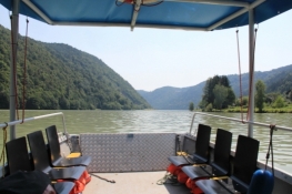
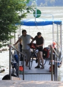
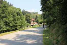
Ab Donauschleife für 3,8 km mit der Längsfähre auf einem kleinen Boot, wir alleine mit einem Bootsführer, der ein kleiner Weltenbummler war und jetzt wieder zurück auf Start gegangen ist. Vor 31 Jahren hat er die Fährlinie gegründet, jetzt sitzt er wieder am Ruder.
Information about copyright | |
|---|---|
Rights characteristic / license | by-sa: CREATIVE COMMONS Attribution-ShareAlike |
Link to the description of the license | |
taken over / edited on | 16 Jul 2015 - 17 Jul 2015
|
taken over / edited by |
|
Information about copyright | |
|---|---|
Rights owner | |
Rights characteristic / license | © all rights reserved. |
Image has been uploaded | by ThimbleU on 16 Jul 2015
|
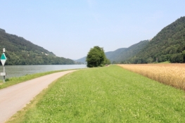
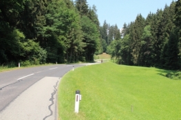
Von Obermühl fahren wir an der Kleinen Mühl entlang das Tal hinauf mit gleichmäßiger Steigung im Kleinbahnniveau. Die Straße ist wenig befahren. Am Weg etliche Sägewerke und andere Holzverarbeitungsbetriebe. Waldstücke wechseln sich mit Wiesen ab.
Information about copyright | |
|---|---|
Rights characteristic / license | by-sa: CREATIVE COMMONS Attribution-ShareAlike |
Link to the description of the license | |
taken over / edited on | 16 Jul 2015
|
taken over / edited by |
|
Information about copyright | |
|---|---|
Rights owner | |
Rights characteristic / license | © all rights reserved. |
Image has been uploaded | by ThimbleU on 16 Jul 2015
|
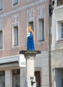
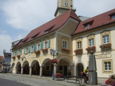
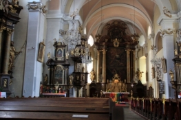
In Rohrbach auf dem Stadtplatz machen wir in einem Café Rast. Der frische Topfenstrudel schmeckt echt lecker und das Kaltgetränk füllt die leergeschwitzten Zellen wieder ein wenig auf. Die Kirche ist nicht so eindrucksvoll, aber voll mit barockem Schmuck und Altären.
Information about copyright | |
|---|---|
Rights characteristic / license | by-sa: CREATIVE COMMONS Attribution-ShareAlike |
Link to the description of the license | |
taken over / edited on | 16 Jul 2015
|
taken over / edited by |
|
Information about copyright | |
|---|---|
Rights owner | |
Rights characteristic / license | © all rights reserved. |
Image has been uploaded | by ThimbleU on 16 Jul 2015
|
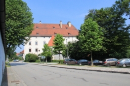
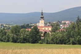
Nach Rohrbach gibt es die erste heftige Steigung, jetzt voll der Sonne ausgesetzt. Wir klettern bis auf 700 Meter. Dann rollen wir hinunter Richtung Aigen. Vorbei am Stift Schlägl und danach noch einmal kräftig den Berg hinauf nach Aigen.
Information about copyright | |
|---|---|
Rights characteristic / license | by-sa: CREATIVE COMMONS Attribution-ShareAlike |
Link to the description of the license | |
taken over / edited on | 16 Jul 2015
|
taken over / edited by |
|
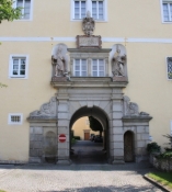
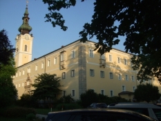
Information about copyright | |
|---|---|
Rights owner | |
Rights characteristic / license | © all rights reserved. |
Image has been uploaded | by ThimbleU on 16 Jul 2015
|
Die angedachte Pension gab es nicht mehr, aber direkt gegenüber finden wir ein Zimmer in einer kleinen Pension für 62 €.
Das Kaltduschen tat so gut wie selten!
Information about copyright | |
|---|---|
Rights characteristic / license | by-sa: CREATIVE COMMONS Attribution-ShareAlike |
Link to the description of the license | |
taken over / edited on | 16 Jul 2015 - 17 Jul 2015
|
taken over / edited by |
|