
Cycle Tour Fulda nach Lourdes
Tag 7: Freiburg - Cernay
![]()
Please wait - map data are loading
Added on 22 Dec 2013
last edited by Tandemteam-Traudel_und_Dieter on 06 Jan 2015
Cycle route metrics
ridden
Total distance in km
97
Cumulative elevation gain in m
735
Avg. slope uphill in %
0,76
Cumulative elevation loss in m
748
Total cycling hours
5,7
Avg. pace in km/h
17,0
Min. height
181
Max. height
325
Information about rights to the gps-track data | |
|---|---|
Rights owner | |
Rights characteristic / license | by-sa: CREATIVE COMMONS Attribution-ShareAlike |
Link to the description of the license | |
GPX file uploaded | by Tandemteam-Traudel_und_Dieter on 28 Dec 2013
|
Track points in total
594
Track points per km (avg)
6
Start/endpoint
Start location
Freiburg im Breisgau, Baden-Württemberg, DE (305 m NHN)
End location
Uffholtz, Grand Est, FR (292 m NHN)
ridden on
07 Jun 2007
Weather
Sonne (heiß)
Properties
Nebenstraßen und Radwege
Travel report
Information about copyright | |
|---|---|
Rights owner | |
Rights characteristic / license | © all rights reserved. |
Image has been uploaded | by Tandemteam-Traudel_und_Dieter on 06 Jan 2015
|
Information about copyright | |
|---|---|
Rights owner | |
Rights characteristic / license | © all rights reserved. |
Image has been uploaded | by Tandemteam-Traudel_und_Dieter on 06 Jan 2015
|
Information about copyright | |
|---|---|
Rights owner | |
Rights characteristic / license | © all rights reserved. |
Image has been uploaded | by Tandemteam-Traudel_und_Dieter on 31 Dec 2014
|
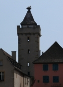
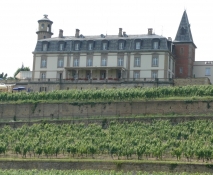
Heute heiß, heiß, heiß aber immer weiter über die Grenze nach Frankreich. Kaffeepause auf französisch in Guebwiller. Übernachtung in einer Ferienwohnung.
Information about copyright | |
|---|---|
Rights characteristic / license | by-sa: CREATIVE COMMONS Attribution-ShareAlike |
Link to the description of the license | |
taken over / edited on | 01 Dec 2014
|
taken over / edited by |
|
Information about copyright | |
|---|---|
Rights owner | |
Rights characteristic / license | © all rights reserved. |
Image has been uploaded | by Tandemteam-Traudel_und_Dieter on 06 Jan 2015
|
Information about copyright | |
|---|---|
Rights owner | |
Rights characteristic / license | © all rights reserved. |
Image has been uploaded | by Tandemteam-Traudel_und_Dieter on 31 Dec 2014
|
Information about copyright | |
|---|---|
Rights owner | |
Rights characteristic / license | © all rights reserved. |
Image has been uploaded | by Tandemteam-Traudel_und_Dieter on 06 Jan 2015
|