
Radtour Fulda nach Lourdes
Tag 13: Cluny - Saint-Germain-Lespinasse
![]()
Bitte warten - Kartendaten werden geladen
Erstellt am 22.12.2013
zuletzt geändert von Tandemteam-Traudel_und_Dieter am 06.01.2015
Strecken-Merkmale
gefahren
Gesamtlänge in km
83
Gesamthöhenmeter Aufstieg
1.289
Durchschn. Steigung Aufstieg %
1,55
Gesamthöhenmeter Abstieg
1.192
Gesamtsattelstunden
5,0
Durchschnittsgeschwindigkeit in km/Std.
16,6
min. Höhe
234
max. Höhe
559
Informationen zu Rechten an den GPS-Track-Daten | |
|---|---|
Rechte-Inhaber | |
Rechte-Ausprägung / Lizenz | by-sa: CREATIVE COMMONS Namensnennung, Weitergabe unter gleichen Bedingungen |
Link zur Rechtebeschreibung | |
gpx-Datei hochgeladen | durch Tandemteam-Traudel_und_Dieter am 29.12.2013
|
Gesamtzahl Trackpoints
499
Trackpoint-Dichte per km
6
Endorte
Start
Cluny, Bourgogne-Franche-Comté, FR (239 m NHN)
Ziel
Saint-Germain-Lespinasse, Auvergne-Rhône-Alpes, FR (336 m NHN)
gefahren am
13.06.2007
Wetter
Bedeckt, Abends Gewitter
Unterkunft
Beschaffenheit
Nebenstraßen
Reisebericht
Informationen zu Urheber-Rechten | |
|---|---|
Rechte-Inhaber | |
Rechte-Ausprägung / Lizenz | © Alle Rechte vorbehalten. |
Bild hochgeladen | durch Tandemteam-Traudel_und_Dieter am 01.01.2015
|
Informationen zu Urheber-Rechten | |
|---|---|
Rechte-Inhaber | |
Rechte-Ausprägung / Lizenz | © Alle Rechte vorbehalten. |
Bild hochgeladen | durch Tandemteam-Traudel_und_Dieter am 01.01.2015
|
Informationen zu Urheber-Rechten | |
|---|---|
Rechte-Inhaber | |
Rechte-Ausprägung / Lizenz | © Alle Rechte vorbehalten. |
Bild hochgeladen | durch Tandemteam-Traudel_und_Dieter am 01.01.2015
|
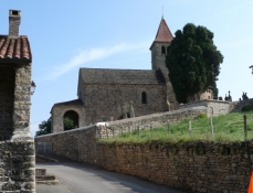
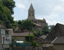
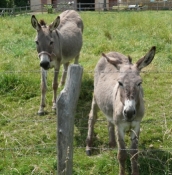
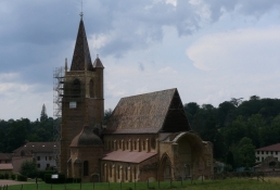
Der erste Teil der Strecke war hart, dann wurde es leichter. Kaffeepause war heute in La Benisson-Dieu. Die heutige Übernachtung (Privat) war wie ein Museum, mit Kronleuchter, Sekretär und Möbel aus einer anderen Zeit.
Informationen zu Urheber-Rechten | |
|---|---|
Rechte-Ausprägung / Lizenz | by-sa: CREATIVE COMMONS Namensnennung, Weitergabe unter gleichen Bedingungen |
Link zur Rechtebeschreibung | |
übernommen / bearbeitet am | 01.12.2014
|
übernommen / bearbeitet durch |
|
Informationen zu Urheber-Rechten | |
|---|---|
Rechte-Inhaber | |
Rechte-Ausprägung / Lizenz | © Alle Rechte vorbehalten. |
Bild hochgeladen | durch Tandemteam-Traudel_und_Dieter am 01.01.2015
|
Informationen zu Urheber-Rechten | |
|---|---|
Rechte-Inhaber | |
Rechte-Ausprägung / Lizenz | © Alle Rechte vorbehalten. |
Bild hochgeladen | durch Tandemteam-Traudel_und_Dieter am 01.01.2015
|
Informationen zu Urheber-Rechten | |
|---|---|
Rechte-Inhaber | |
Rechte-Ausprägung / Lizenz | © Alle Rechte vorbehalten. |
Bild hochgeladen | durch Tandemteam-Traudel_und_Dieter am 06.01.2015
|