Cycle Tour Hospental nach Basel
Tag 8: Teufen nach Stein AG
![]()
Please wait - map data are loading
Added on 09 Mar 2017
on 15 Mar 2017
Cycle route metrics
ridden
Total distance in km
65
Cumulative elevation gain in m
1.150
Avg. slope uphill in %
1,77
Cumulative elevation loss in m
1.211
Total cycling hours
4,0
Avg. pace in km/h
16,3
Min. height
297
Max. height
416
Information about rights to the gps-track data | |
|---|---|
Rights owner | |
Rights characteristic / license | by-sa: CREATIVE COMMONS Attribution-ShareAlike |
Link to the description of the license | |
GPX file uploaded | by Tandemteam-Traudel_und_Dieter on 10 Mar 2017
|
Track points in total
954
Track points per km (avg)
15
Start/endpoint
Start location
Freienstein-Teufen, Zürich, CH (363 m NHN)
End location
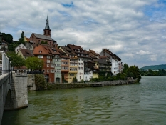
Stein, Aargau, CH (302 m NHN)
ridden on
30 Jul 2011
Weather
bedeckt
Properties
Teer und befestigter Weg.
Travel report
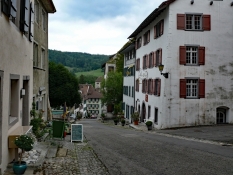
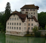
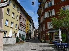
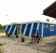
Heute über Kaiserstuhl, Bad Zurzach an der Deutsch/Schweizer Grenze nach Laufenburg. Nach einem Rundgang durch Laufenburg (CH) und Laufenburg (D) noch eine Kaffeepause. In Stein AG endet unsere heutige Etappe, im Sportcenter Bustelbach gab es eine Übernachtung. Nachmittags ging es noch nach Bad Säckingen zum Rundgang.
Information about copyright | |
|---|---|
Rights characteristic / license | by-sa: CREATIVE COMMONS Attribution-ShareAlike |
Link to the description of the license | |
taken over / edited on | 14 Mar 2017
|
taken over / edited by |
|