Cycle Tour Rheinzabern - German Wine Route for Cyclists - Mainz
Travel report
Actions
![]()
Please wait - map data are loading
Added on 15 Mar 2014,
on 17 Apr 2015
Actions
Cycle route metrics
planned
ridden
Total distance in km
208
191
Cumulative elevation gain in m
2.107
2.154
Avg. slope uphill in %
1,01
1,13
Cumulative elevation loss in m
2.127
2.074
Total cycling hours
-
13,1
Avg. pace in km/h
-
14,6
Information about rights to the gps-track data | |
|---|---|
Rights owner | ThimbleU & biroto-Contributors |
Rights characteristic / license | by-sa: CREATIVE COMMONS Attribution-ShareAlike |
Link to the description of the license | |
GPX file taken from | |
GPX file uploaded | by ThimbleU on 15 Mar 2014
|
Track points in total
2.918
3.548
Track points per km (avg)
14
19
Start/endpoint
Start location
Rheinzabern, Rheinland-Pfalz, DE (115 m NHN)
End location
Mainz, Rhineland-Palatinate, DE (95 m NHN)
Stages
Beds4Cyclists, worth visiting and infrastructure
Name and address
Latitude / Longitude
Phone
Fax
Mobile
Type of accommodation
Rating for cyclists
Route km
Dist. to route
Elevation
2 km
3,7 km
114 m
3 km
0,0 km
105 m
4 km
2,2 km
95 m
7 km
1,1 km
107 m

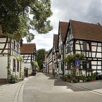
Das durch historische Fachwerkhäuser geprägte „Hinnerstädel“ beeindruckt durch sein idyllisches Flair und hat schon manchem Künstler eine dauerhafte Bleibe gegeben. Dieser Ortsteil (Ludwigstraße) ist der wohl älteste erhaltene Teil Jockgrims. Reste der alten Stadtmauer und das Zehnthaus sind hier zu besichtigen. In diesem Ortsteil wird zudem alle zwei Jahre das sogenannte „Hinnerstädelfeschd“ ausgetragen, zuletzt im Herbst 2008.
Eine weitere Sehenswürdigkeit ist das restaurierte Exemplar eines Kugelhauses , erfunden von der Familie Ludowici. Es steht in der Nähe des Bürgerhauses und enthält alles, was für einen Zwei-Personen-Haushalt erforderlich ist.
Information about copyright | |
|---|---|
Rights characteristic / license | by-sa: CREATIVE COMMONS Attribution-ShareAlike |
Link to the description of the license | |
Input taken over from: |
aus Wikipedia: Jockgrim Stand 14.07.2011 |
taken over / edited on | 14 Jul 2011 - 17 Dec 2011
|
taken over / edited by |
|
17 km
0,2 km
123 m
![]()


