
Cycle Tour Spittal - Szeged - Cracow
Travel report: Auf Drau- und Donau-Radweg und auf dem EuroVelo 11
Actions
![]()
Please wait - map data are loading
Added on 30 Nov 2015,
last edited by ThimbleU on 25 Jan 2018
Actions
Cycle route metrics
planned
ridden
Total distance in km
1.664
1.726
Cumulative elevation gain in m
11.912
9.827
Avg. slope uphill in %
0,72
0,57
Cumulative elevation loss in m
12.238
10.070
Total cycling hours
-
100,2
Avg. pace in km/h
-
17,2
Information about rights to the gps-track data | |
|---|---|
Rights owner | ThimbleU & biroto-Contributors |
Rights characteristic / license | cc0: Public Domain no Rights reserved |
Link to the description of the license | |
GPX file taken from | |
GPX file uploaded | by ThimbleU on 29 May 2017
|
Track points in total
16.345
20.578
Track points per km (avg)
10
12
Start/endpoint
Start location
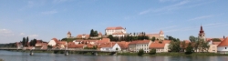
Spittal an der Drau, Kärnten, AT (543 m NHN)
End location
Krakow, Lesser Poland Voivodeship, PL (217 m NHN)
Signposting
Die Beschilderung ist außerhalb Österreichs überwiegend nicht ausreichend für die Navigation. Einzelheiten sind bei den Reiseberichten der Tagesetappen beschrieben.
Remarks
Die Tour ist zusammengestellt aus
- dem Drau-Radweg,
- dem Donauradweg (von der Quelle zur Mündung),
- dem Radweg EuroVelo 11: Osteuropa-Route und
selbst erstellten Ergänzungen.
Stages
11 km
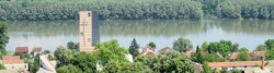
Spittal - Seeboden - Spittal
90 km
Spittal - Kirschentheuer
84 km
Kirschentheuer - Dravograd
70 km
Dravograd - Maribor
95 km
Maribor - Varaždin
97 km
Varaždin - Đurđevac
80 km
Đurđevac - Višnjica
105 km
Višnjica - Osijek
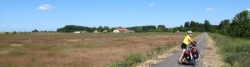
Information about copyright | |
|---|---|
Rights owner | |
Rights characteristic / license | © all rights reserved. |
Image has been uploaded | by ThimbleU on 20 Jun 2016
|
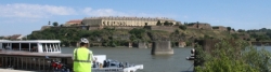
92 km
Osijek - Ilok
101 km
Ilok - Bečej
96 km
Bečej - Szeged
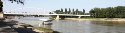
76 km
Szeged - Csongrád
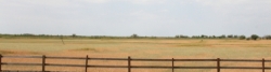
79 km
Csongrád – Szolnok
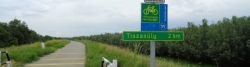
Information about copyright | |
|---|---|
Rights owner | |
Rights characteristic / license | © all rights reserved. |
Image has been uploaded | by ThimbleU on 20 Jun 2016
|
101 km
Szolnok - Tiszafüred
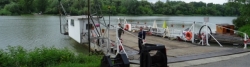
Information about copyright | |
|---|---|
Rights owner | |
Rights characteristic / license | © all rights reserved. |
Image has been uploaded | by ThimbleU on 20 Jun 2016
|
103 km
Tiszafüred - Tokaj
113 km
Tokaj - Košice
42 km
Košice - Prešov
55 km
Prešov - Bardejov
99 km
Bardejov - Nowy Sącz
78 km
Nowy Sącz - Bochnia
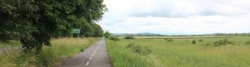
Information about copyright | |
|---|---|
Rights owner | |
Rights characteristic / license | © all rights reserved. |
Image has been uploaded | by ThimbleU on 20 Jun 2016
|
59 km
Bochnia - Krakau
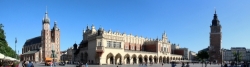
Krakau
Beds4Cyclists, worth visiting and infrastructure
Name and address
Latitude / Longitude
Phone
Fax
Mobile
Type of accommodation
Rating for cyclists
Route km
Dist. to route
Elevation
0 km
3,0 km
585 m
0 km
0,0 km
541 m
1 km
0,0 km
552 m
Frühstückspension & Appartements
AT-9800 Spittal an der Drau
Boardinghouse / guest house
1 km
3,1 km
606 m
Hours of opening
Mo - Do: 08:00 - 12:00 Uhr und 13:00 - 17:00 Uhr
Freitag: 08:00 - 12:00 Uhr und 15:00 - 19:00 Uhr
1 km
0,2 km
553 m
Information about copyright | |
|---|---|
Rights owner | |
Rights characteristic / license | by-sa: CREATIVE COMMONS Attribution-ShareAlike |
Link to the description of the license | |
Image taken over from | |
Image has been uploaded | by ThimbleU on 29 Sep 2013
|
Information about copyright | |
|---|---|
Rights owner | |
Rights characteristic / license | cc0: Public Domain no Rights reserved |
Link to the description of the license | |
Image taken over from | commons.wikimedia.org/wiki/File:Spittal_an_der_Drau_-_Villa_Kukutsch.jpg |
Image has been uploaded | by ThimbleU on 29 Sep 2013
|
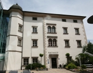
Information about copyright | |
|---|---|
Rights owner | |
Rights characteristic / license | by-sa: CREATIVE COMMONS Attribution-ShareAlike |
Link to the description of the license | |
Image taken over from | commons.wikimedia.org/wiki/File:Rathaus_in_Spittal_an_der_Drau.jpg |
Image has been uploaded | by ThimbleU on 29 Sep 2013
|
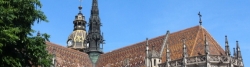
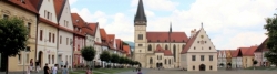
Spittal an der Drau ist eine Stadtgemeinde mit 15.543 Einwohnern (Stand 2013).
Sehenswürdigkeiten
Bauwerke
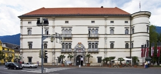
- ⊙Schloss Porcia
 , einer der bedeutendsten Renaissancebauten außerhalb Italiens.
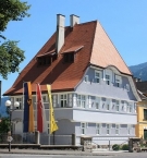
 - ⊙Khevenhüller Stadtpalais (heute Rathaus)
- ⊙Pfarrkirche Spittal an der Drau
- ⊙Spittl (historisches, namensgebendes Hospital, heute Standort der FH Technikum Kärnten)
Die Stadt Spittal ist Mitglied im Verband Kleine historische Städte.
Museen und Ausstellungen
- ⊙Museum für Volkskultur : Bezirksheimatmuseum im Dachgeschoss von Schloss Porcia, 1958 von Prof. Helmut Prasch gegründet. Mit ca. 20.000 Exponaten aus dem Oberkärntner Raum eine der vier größten volkskundlichen Sammlungen Österreichs.
Information about copyright | |
|---|---|
Rights characteristic / license | by-sa: CREATIVE COMMONS Attribution-ShareAlike |
Link to the description of the license | |
Input taken over from: |
Seite „Spittal an der Drau“. In: Wikipedia, Die freie Enzyklopädie. Bearbeitungsstand: 20. September 2013, 21:52 UTC. URL: http://de.wikipedia.org/w/index.php?title=Spittal_an_der_Drau&oldid=122726168 |
taken over / edited on | 29 Sep 2013 - 03 May 2022
|
taken over / edited by |
|
![]()