
Cycle Tour Tauern-Adria-Dolomiten-Runde
Tag 4: Heiligenblut nach Spittal
![]()
Please wait - map data are loading
Added on 12 Aug 2016
last edited by Tandemteam-Traudel_und_Dieter on 19 Dec 2016
Cycle route metrics
ridden
Total distance in km
95
Cumulative elevation gain in m
633
Avg. slope uphill in %
0,67
Cumulative elevation loss in m
1.320
Total cycling hours
5,8
Avg. pace in km/h
16,4
Min. height
564
Max. height
1.271
Information about rights to the gps-track data | |
|---|---|
Rights owner | |
Rights characteristic / license | by-sa: CREATIVE COMMONS Attribution-ShareAlike |
Link to the description of the license | |
GPX file uploaded | by Tandemteam-Traudel_und_Dieter on 29 Aug 2016
|
Track points in total
2.226
Track points per km (avg)
23
Start/endpoint
Start location
Heiligenblut am Großglockner, Kärnten, AT (1251 m NHN)
End location
Spittal an der Drau, Kärnten, AT (565 m NHN)
ridden on
27 Jun 2016
Weather
bedeckt, etwas Sonne, Mittags etwas Regen
Properties
Teilweise Radweg, befestigt und Teer.
Travel report
Information about copyright | |
|---|---|
Rights owner | |
Rights characteristic / license | © all rights reserved. |
Image has been uploaded | by Tandemteam-Traudel_und_Dieter on 14 Dec 2016
|
Information about copyright | |
|---|---|
Rights owner | |
Rights characteristic / license | © all rights reserved. |
Image has been uploaded | by Tandemteam-Traudel_und_Dieter on 14 Dec 2016
|
Information about copyright | |
|---|---|
Rights owner | |
Rights characteristic / license | © all rights reserved. |
Image has been uploaded | by Tandemteam-Traudel_und_Dieter on 14 Dec 2016
|
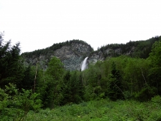
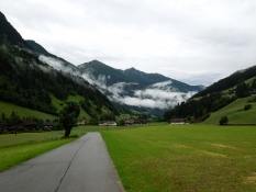
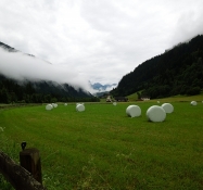
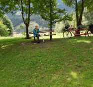
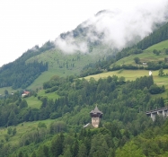
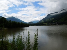
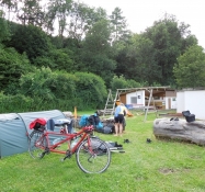
Bei bedecktem Himmel ging es auf den Möllradweg R8, teilweise befestigter Weg. Es war ein angenehmes Radeln. Bei einer Pause kam ein leichter Regenschauer, was uns nicht störte, wir waren bei einer überdachten Bank am Radweg. Bei der Groppensteinschlucht machten wir Mittagspause.
Information about copyright | |
|---|---|
Rights characteristic / license | by-sa: CREATIVE COMMONS Attribution-ShareAlike |
Link to the description of the license | |
taken over / edited on | 14 Dec 2016 - 19 Dec 2016
|
taken over / edited by |
|
Information about copyright | |
|---|---|
Rights owner | |
Rights characteristic / license | © all rights reserved. |
Image has been uploaded | by Tandemteam-Traudel_und_Dieter on 14 Dec 2016
|
Information about copyright | |
|---|---|
Rights owner | |
Rights characteristic / license | © all rights reserved. |
Image has been uploaded | by Tandemteam-Traudel_und_Dieter on 14 Dec 2016
|
Information about copyright | |
|---|---|
Rights owner | |
Rights characteristic / license | © all rights reserved. |
Image has been uploaded | by Tandemteam-Traudel_und_Dieter on 14 Dec 2016
|
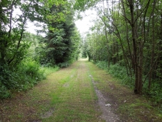
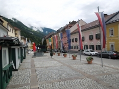
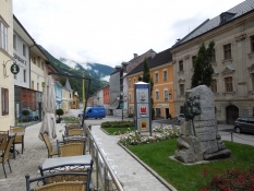
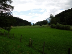
Ab Obervellach kam der Alpe Adria Radweg zum R8 dazu, weiter an der Möll bis Möllbrücke. In Möllbrücke radelten wir weiter auf dem Drauradweg bis nach Spittal.
Information about copyright | |
|---|---|
Rights characteristic / license | by-sa: CREATIVE COMMONS Attribution-ShareAlike |
Link to the description of the license | |
taken over / edited on | 14 Dec 2016
|
taken over / edited by |
|
Information about copyright | |
|---|---|
Rights owner | |
Rights characteristic / license | © all rights reserved. |
Image has been uploaded | by Tandemteam-Traudel_und_Dieter on 14 Dec 2016
|
Information about copyright | |
|---|---|
Rights owner | |
Rights characteristic / license | © all rights reserved. |
Image has been uploaded | by Tandemteam-Traudel_und_Dieter on 14 Dec 2016
|
Information about copyright | |
|---|---|
Rights owner | |
Rights characteristic / license | © all rights reserved. |
Image has been uploaded | by Tandemteam-Traudel_und_Dieter on 14 Dec 2016
|
Information about copyright | |
|---|---|
Rights owner | |
Rights characteristic / license | © all rights reserved. |
Image has been uploaded | by Tandemteam-Traudel_und_Dieter on 14 Dec 2016
|
Information about copyright | |
|---|---|
Rights owner | |
Rights characteristic / license | © all rights reserved. |
Image has been uploaded | by Tandemteam-Traudel_und_Dieter on 14 Dec 2016
|
Information about copyright | |
|---|---|
Rights owner | |
Rights characteristic / license | © all rights reserved. |
Image has been uploaded | by Tandemteam-Traudel_und_Dieter on 14 Dec 2016
|