
Cycle Tour The Channel Tour
Dag 3: Brugge-Dover
![]()
Please wait - map data are loading
Added on 23 Jun 2015
last edited by Ottocolor on 04 Jul 2015
Cycle route metrics
ridden
Total distance in km
112
Cumulative elevation gain in m
384
Avg. slope uphill in %
0,34
Cumulative elevation loss in m
328
Information about rights to the gps-track data | |
|---|---|
Rights owner | |
Rights characteristic / license | by-sa: CREATIVE COMMONS Attribution-ShareAlike |
Link to the description of the license | |
GPX file uploaded | by Ottocolor on 25 Jun 2015
|
Track points in total
574
Track points per km (avg)
5
Start/endpoint
Start location
Bruges, Flanders, BE (18 m NHN)
End location
Dover, England, GB (75 m NHN)
ridden on
11 Jun 2015
Weather
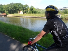
Perfect! Quite hot, around 28° centrigrade, but not at all muggy thanks to a fresh easterly breeze that gave us a nice tailwind all day.
Properties
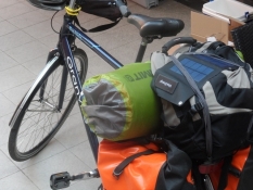
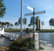
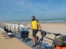
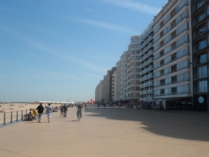
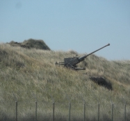
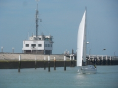
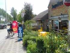
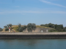
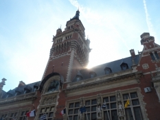
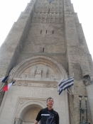
Between Bruges and Oostende on a perfect, broad newly tarmaced bike path in it's own run. From Oostende to Nieuwpoort on the wide beach promenade. Some caution for pedestrians and fine sand, which forms small dunes on the promenade. Very easy to follow the bike route. That's much more difficult in France. A huge detour due to a closed bridge on the port of Dunkerque. Later another bridge was only negotiable via long stairs up and down, where we lost a lot of time, so we arrived very late to the ferry to Dover/England. There we had problems being let out through a gate in the fence around Dover port.
Slope Gradient Distribution
Remarks
The longest stage of the trip with the described difficulties. It was long dark, when we arrived at Dover, so all accomodating businesses were all shut, so we had to sleep on the beach.
Travel report
Information about copyright | |
|---|---|
Rights owner | |
Rights characteristic / license | by-sa: CREATIVE COMMONS Attribution-ShareAlike |
Link to the description of the license | |
Image has been uploaded | by Ottocolor on 04 Jul 2015
|
Information about copyright | |
|---|---|
Rights owner | |
Rights characteristic / license | by-sa: CREATIVE COMMONS Attribution-ShareAlike |
Link to the description of the license | |
Image has been uploaded | by Ottocolor on 04 Jul 2015
|
Information about copyright | |
|---|---|
Rights owner | |
Rights characteristic / license | by-sa: CREATIVE COMMONS Attribution-ShareAlike |
Link to the description of the license | |
Image has been uploaded | by Ottocolor on 04 Jul 2015
|
Information about copyright | |
|---|---|
Rights owner | |
Rights characteristic / license | by-sa: CREATIVE COMMONS Attribution-ShareAlike |
Link to the description of the license | |
Image has been uploaded | by Ottocolor on 04 Jul 2015
|
Information about copyright | |
|---|---|
Rights owner | |
Rights characteristic / license | by-sa: CREATIVE COMMONS Attribution-ShareAlike |
Link to the description of the license | |
Image has been uploaded | by Ottocolor on 04 Jul 2015
|
Information about copyright | |
|---|---|
Rights owner | |
Rights characteristic / license | by-sa: CREATIVE COMMONS Attribution-ShareAlike |
Link to the description of the license | |
Image has been uploaded | by Ottocolor on 04 Jul 2015
|
Information about copyright | |
|---|---|
Rights owner | |
Rights characteristic / license | by-sa: CREATIVE COMMONS Attribution-ShareAlike |
Link to the description of the license | |
Image has been uploaded | by Ottocolor on 04 Jul 2015
|
Information about copyright | |
|---|---|
Rights owner | |
Rights characteristic / license | by-sa: CREATIVE COMMONS Attribution-ShareAlike |
Link to the description of the license | |
Image has been uploaded | by Ottocolor on 04 Jul 2015
|
Information about copyright | |
|---|---|
Rights owner | |
Rights characteristic / license | by-sa: CREATIVE COMMONS Attribution-ShareAlike |
Link to the description of the license | |
Image has been uploaded | by Ottocolor on 04 Jul 2015
|
Information about copyright | |
|---|---|
Rights owner | |
Rights characteristic / license | by-sa: CREATIVE COMMONS Attribution-ShareAlike |
Link to the description of the license | |
Image has been uploaded | by Ottocolor on 04 Jul 2015
|
Information about copyright | |
|---|---|
Rights owner | |
Rights characteristic / license | by-sa: CREATIVE COMMONS Attribution-ShareAlike |
Link to the description of the license | |
Image has been uploaded | by Ottocolor on 04 Jul 2015
|
Information about copyright | |
|---|---|
Rights owner | |
Rights characteristic / license | by-sa: CREATIVE COMMONS Attribution-ShareAlike |
Link to the description of the license | |
Image has been uploaded | by Ottocolor on 04 Jul 2015
|
Information about copyright | |
|---|---|
Rights owner | |
Rights characteristic / license | by-sa: CREATIVE COMMONS Attribution-ShareAlike |
Link to the description of the license | |
Image has been uploaded | by Ottocolor on 04 Jul 2015
|
Information about copyright | |
|---|---|
Rights owner | |
Rights characteristic / license | by-sa: CREATIVE COMMONS Attribution-ShareAlike |
Link to the description of the license | |
Image has been uploaded | by Ottocolor on 04 Jul 2015
|
Information about copyright | |
|---|---|
Rights owner | |
Rights characteristic / license | by-sa: CREATIVE COMMONS Attribution-ShareAlike |
Link to the description of the license | |
Image has been uploaded | by Ottocolor on 04 Jul 2015
|