Cycle Tour Vom Bodensee über Genfersee nach Basel
Tag 6: Giswil nach Bumbach
![]()
Please wait - map data are loading
Added on 06 Apr 2017
on 14 Apr 2017
Cycle route metrics
ridden
Total distance in km
41
Cumulative elevation gain in m
2.039
Avg. slope uphill in %
4,97
Cumulative elevation loss in m
1.584
Total cycling hours
3,9
Avg. pace in km/h
10,5
Min. height
471
Max. height
1.616
Information about rights to the gps-track data | |
|---|---|
Rights owner | |
Rights characteristic / license | by-sa: CREATIVE COMMONS Attribution-ShareAlike |
Link to the description of the license | |
GPX file uploaded | by Tandemteam-Traudel_und_Dieter on 06 Apr 2017
|
Track points in total
963
Track points per km (avg)
23
Start/endpoint
Start location
Giswil, Obwalden, CH (471 m NHN)
End location
Schangnau, Bern, CH (926 m NHN)
ridden on
01 Aug 2012
Weather
Sonne
Properties
Teer und befestigter Weg
Travel report
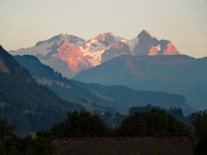
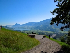
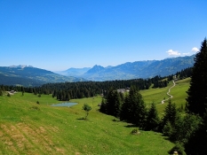
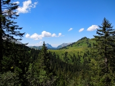
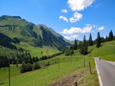
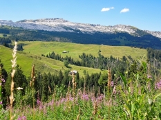
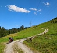
Vom Campingplatz nach Giswil und auf die Panoramastraße hinauf zum Glaubenbielenpass mit schönen Ausblicken und vielen Pausen.
Information about copyright | |
|---|---|
Rights characteristic / license | by-sa: CREATIVE COMMONS Attribution-ShareAlike |
Link to the description of the license | |
taken over / edited on | 06 Apr 2017
|
taken over / edited by |
|
Information about copyright | |
|---|---|
Rights characteristic / license | by-sa: CREATIVE COMMONS Attribution-ShareAlike |
Link to the description of the license | |
taken over / edited on | 06 Apr 2017
|
taken over / edited by |
|
Information about copyright | |
|---|---|
Rights characteristic / license | by-sa: CREATIVE COMMONS Attribution-ShareAlike |
Link to the description of the license | |
taken over / edited on | 06 Apr 2017
|
taken over / edited by |
|