
Cycle Tour Vom Bodensee über Genfersee nach Basel
Tag 7: Bumbach nach Längenbühl
![]()
Please wait - map data are loading
Added on 06 Apr 2017
last edited by Tandemteam-Traudel_und_Dieter on 14 Apr 2017
Cycle route metrics
ridden
Total distance in km
43
Cumulative elevation gain in m
992
Avg. slope uphill in %
2,31
Cumulative elevation loss in m
1.257
Total cycling hours
3,2
Avg. pace in km/h
13,4
Min. height
557
Max. height
1.171
Information about rights to the gps-track data | |
|---|---|
Rights owner | |
Rights characteristic / license | by-sa: CREATIVE COMMONS Attribution-ShareAlike |
Link to the description of the license | |
GPX file uploaded | by Tandemteam-Traudel_und_Dieter on 06 Apr 2017
|
Track points in total
877
Track points per km (avg)
20
Start/endpoint
Start location
Schangnau, Bern, CH (916 m NHN)
End location
Forst-Längenbühl, Bern, CH (651 m NHN)
ridden on
02 Aug 2012
Weather
Sonne
Properties
Teer
Travel report
Information about copyright | |
|---|---|
Rights owner | |
Rights characteristic / license | © all rights reserved. |
Image has been uploaded | by Tandemteam-Traudel_und_Dieter on 06 Apr 2017
|
Information about copyright | |
|---|---|
Rights owner | |
Rights characteristic / license | © all rights reserved. |
Image has been uploaded | by Tandemteam-Traudel_und_Dieter on 06 Apr 2017
|
Information about copyright | |
|---|---|
Rights owner | |
Rights characteristic / license | © all rights reserved. |
Image has been uploaded | by Tandemteam-Traudel_und_Dieter on 06 Apr 2017
|
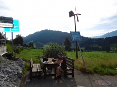
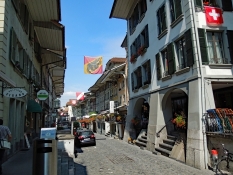
Wieder ohne Frühstück losgeradelt, bis wir in Schangnau in einer Bäckerei frühstücken konnten. Gestärkt ging es über die Emme und weiter hinauf zum Schallenberg-Pass.
Information about copyright | |
|---|---|
Rights characteristic / license | by-sa: CREATIVE COMMONS Attribution-ShareAlike |
Link to the description of the license | |
taken over / edited on | 06 Apr 2017
|
taken over / edited by |
|
Information about copyright | |
|---|---|
Rights owner | |
Rights characteristic / license | © all rights reserved. |
Image has been uploaded | by Tandemteam-Traudel_und_Dieter on 06 Apr 2017
|
Information about copyright | |
|---|---|
Rights owner | |
Rights characteristic / license | © all rights reserved. |
Image has been uploaded | by Tandemteam-Traudel_und_Dieter on 06 Apr 2017
|
Information about copyright | |
|---|---|
Rights owner | |
Rights characteristic / license | © all rights reserved. |
Image has been uploaded | by Tandemteam-Traudel_und_Dieter on 06 Apr 2017
|
Information about copyright | |
|---|---|
Rights characteristic / license | by-sa: CREATIVE COMMONS Attribution-ShareAlike |
Link to the description of the license | |
taken over / edited on | 06 Apr 2017
|
taken over / edited by |
|
Information about copyright | |
|---|---|
Rights owner | |
Rights characteristic / license | © all rights reserved. |
Image has been uploaded | by Tandemteam-Traudel_und_Dieter on 07 Apr 2017
|
Information about copyright | |
|---|---|
Rights owner | |
Rights characteristic / license | © all rights reserved. |
Image has been uploaded | by Tandemteam-Traudel_und_Dieter on 07 Apr 2017
|
Information about copyright | |
|---|---|
Rights owner | |
Rights characteristic / license | © all rights reserved. |
Image has been uploaded | by Tandemteam-Traudel_und_Dieter on 07 Apr 2017
|
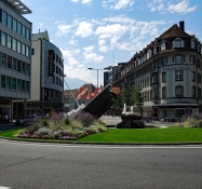
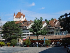
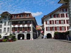
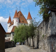
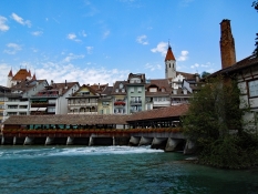
Nach Stadtrundgang und Kaffeepause suchten wir nochmal einen Optiker. Mein Brillengestell musste gerichtet werden, hatte im Zelt darauf gelegen. Das letzte Stück dieser Etappe führt uns nach Längenbühl zum Bauernhof Schlupf. „Schlafen im Stroh“
Information about copyright | |
|---|---|
Rights characteristic / license | by-sa: CREATIVE COMMONS Attribution-ShareAlike |
Link to the description of the license | |
taken over / edited on | 07 Apr 2017
|
taken over / edited by |
|
Information about copyright | |
|---|---|
Rights owner | |
Rights characteristic / license | © all rights reserved. |
Image has been uploaded | by Tandemteam-Traudel_und_Dieter on 07 Apr 2017
|
Information about copyright | |
|---|---|
Rights owner | |
Rights characteristic / license | © all rights reserved. |
Image has been uploaded | by Tandemteam-Traudel_und_Dieter on 07 Apr 2017
|

Information about copyright | |
|---|---|
Rights owner | |
Rights characteristic / license | © all rights reserved. |
Image has been uploaded | by Tandemteam-Traudel_und_Dieter on 07 Apr 2017
|