Radtour Vom Bodensee über Genfersee nach Basel
Tag 10: Aigle bis Excenevex
![]()
Bitte warten - Kartendaten werden geladen
Erstellt am 06.04.2017
zuletzt geändert von Tandemteam-Traudel_und_Dieter am 14.04.2017
Strecken-Merkmale
gefahren
Gesamtlänge in km
65
Gesamthöhenmeter Aufstieg
548
Durchschn. Steigung Aufstieg %
0,84
Gesamthöhenmeter Abstieg
578
Gesamtsattelstunden
4,0
Durchschnittsgeschwindigkeit in km/Std.
16,3
min. Höhe
371
max. Höhe
437
Informationen zu Rechten an den GPS-Track-Daten | |
|---|---|
Rechte-Inhaber | |
Rechte-Ausprägung / Lizenz | by-sa: CREATIVE COMMONS Namensnennung, Weitergabe unter gleichen Bedingungen |
Link zur Rechtebeschreibung | |
gpx-Datei hochgeladen | durch Tandemteam-Traudel_und_Dieter am 07.04.2017
|
Gesamtzahl Trackpoints
375
Trackpoint-Dichte per km
6
Endorte
Start
Aigle, Waadt, CH (404 m NHN)
Ziel
Excenevex, Auvergne-Rhône-Alpes, FR (374 m NHN)
gefahren am
05.08.2012
Wetter
Bewölkt
Beschaffenheit
Teer
Reisebericht
Informationen zu Urheber-Rechten | |
|---|---|
Rechte-Inhaber | |
Rechte-Ausprägung / Lizenz | © Alle Rechte vorbehalten. |
Bild hochgeladen | durch Tandemteam-Traudel_und_Dieter am 07.04.2017
|
Informationen zu Urheber-Rechten | |
|---|---|
Rechte-Inhaber | |
Rechte-Ausprägung / Lizenz | © Alle Rechte vorbehalten. |
Bild hochgeladen | durch Tandemteam-Traudel_und_Dieter am 07.04.2017
|
Informationen zu Urheber-Rechten | |
|---|---|
Rechte-Inhaber | |
Rechte-Ausprägung / Lizenz | © Alle Rechte vorbehalten. |
Bild hochgeladen | durch Tandemteam-Traudel_und_Dieter am 07.04.2017
|
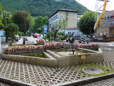
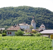
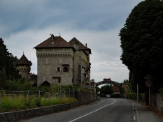
Nach dem Frühstück noch eine Runde durch Aigle geradelt, bevor wir auf dem Rhone Radweg nach Vouvry radelten.
Informationen zu Urheber-Rechten | |
|---|---|
Rechte-Ausprägung / Lizenz | by-sa: CREATIVE COMMONS Namensnennung, Weitergabe unter gleichen Bedingungen |
Link zur Rechtebeschreibung | |
übernommen / bearbeitet am | 07.04.2017
|
übernommen / bearbeitet durch |
|
Informationen zu Urheber-Rechten | |
|---|---|
Rechte-Inhaber | |
Rechte-Ausprägung / Lizenz | © Alle Rechte vorbehalten. |
Bild hochgeladen | durch Tandemteam-Traudel_und_Dieter am 07.04.2017
|
Informationen zu Urheber-Rechten | |
|---|---|
Rechte-Inhaber | |
Rechte-Ausprägung / Lizenz | © Alle Rechte vorbehalten. |
Bild hochgeladen | durch Tandemteam-Traudel_und_Dieter am 07.04.2017
|
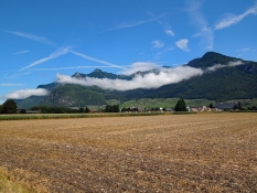
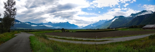
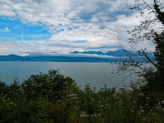
Ein kleiner Rundgang, einen Kaffee und weiter auf dem Rhone Radweg zum Genfer See. Diesmal radelten wir auf der französischen Seite den Genfer See entlang.
Informationen zu Urheber-Rechten | |
|---|---|
Rechte-Ausprägung / Lizenz | by-sa: CREATIVE COMMONS Namensnennung, Weitergabe unter gleichen Bedingungen |
Link zur Rechtebeschreibung | |
übernommen / bearbeitet am | 07.04.2017
|
übernommen / bearbeitet durch |
|
Informationen zu Urheber-Rechten | |
|---|---|
Rechte-Inhaber | |
Rechte-Ausprägung / Lizenz | © Alle Rechte vorbehalten. |
Bild hochgeladen | durch Tandemteam-Traudel_und_Dieter am 07.04.2017
|
Informationen zu Urheber-Rechten | |
|---|---|
Rechte-Inhaber | |
Rechte-Ausprägung / Lizenz | © Alle Rechte vorbehalten. |
Bild hochgeladen | durch Tandemteam-Traudel_und_Dieter am 07.04.2017
|
Informationen zu Urheber-Rechten | |
|---|---|
Rechte-Inhaber | |
Rechte-Ausprägung / Lizenz | © Alle Rechte vorbehalten. |
Bild hochgeladen | durch Tandemteam-Traudel_und_Dieter am 07.04.2017
|
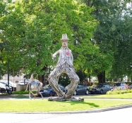
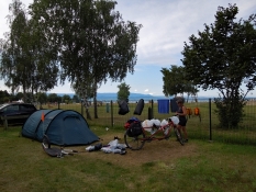
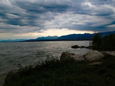
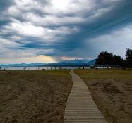
In Evian-les-Bains machten wir noch eine Kaffeepause und einen Rundgang, bevor wir zum Campingplatz bei Excenevex (mit Sandstrand am Genfer See) weiter radelten.
Informationen zu Urheber-Rechten | |
|---|---|
Rechte-Ausprägung / Lizenz | by-sa: CREATIVE COMMONS Namensnennung, Weitergabe unter gleichen Bedingungen |
Link zur Rechtebeschreibung | |
übernommen / bearbeitet am | 07.04.2017
|
übernommen / bearbeitet durch |
|
Informationen zu Urheber-Rechten | |
|---|---|
Rechte-Inhaber | |
Rechte-Ausprägung / Lizenz | © Alle Rechte vorbehalten. |
Bild hochgeladen | durch Tandemteam-Traudel_und_Dieter am 07.04.2017
|
Informationen zu Urheber-Rechten | |
|---|---|
Rechte-Inhaber | |
Rechte-Ausprägung / Lizenz | © Alle Rechte vorbehalten. |
Bild hochgeladen | durch Tandemteam-Traudel_und_Dieter am 07.04.2017
|
Informationen zu Urheber-Rechten | |
|---|---|
Rechte-Inhaber | |
Rechte-Ausprägung / Lizenz | © Alle Rechte vorbehalten. |
Bild hochgeladen | durch Tandemteam-Traudel_und_Dieter am 07.04.2017
|

