
Cycle Tour Vom Bodensee über Genfersee nach Basel
Tag 14: Le Sentier nach Fleurier
![]()
Please wait - map data are loading
Added on 06 Apr 2017
last edited by Tandemteam-Traudel_und_Dieter on 14 Apr 2017
Cycle route metrics
ridden
Total distance in km
67
Cumulative elevation gain in m
1.996
Avg. slope uphill in %
2,98
Cumulative elevation loss in m
2.273
Total cycling hours
4,8
Avg. pace in km/h
14,0
Min. height
643
Max. height
1.308
Information about rights to the gps-track data | |
|---|---|
Rights owner | |
Rights characteristic / license | by-sa: CREATIVE COMMONS Attribution-ShareAlike |
Link to the description of the license | |
GPX file uploaded | by Tandemteam-Traudel_und_Dieter on 08 Apr 2017
|
Track points in total
1.384
Track points per km (avg)
21
Start/endpoint
Start location
Le Lieu, Waadt, CH (1032 m NHN)
End location
Val-de-Travers, Neuenburg, CH (755 m NHN)
ridden on
09 Aug 2012
Weather
Sonne
Properties
Teer und befestigter Weg
Travel report
Information about copyright | |
|---|---|
Rights owner | |
Rights characteristic / license | © all rights reserved. |
Image has been uploaded | by Tandemteam-Traudel_und_Dieter on 08 Apr 2017
|
Information about copyright | |
|---|---|
Rights owner | |
Rights characteristic / license | © all rights reserved. |
Image has been uploaded | by Tandemteam-Traudel_und_Dieter on 08 Apr 2017
|
Information about copyright | |
|---|---|
Rights owner | |
Rights characteristic / license | © all rights reserved. |
Image has been uploaded | by Tandemteam-Traudel_und_Dieter on 08 Apr 2017
|
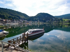
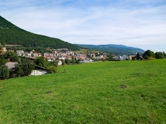
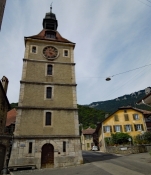
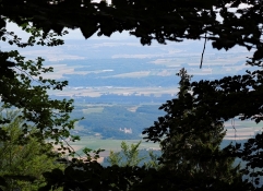
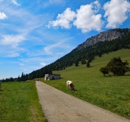
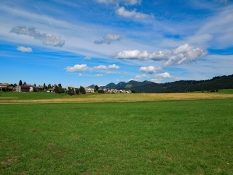
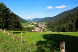
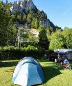
Vom Campingplatz geht es am See entlang bis Le Pont. Auf und ab geht es auf Nebenstraßen weiter über Vallorbe, Lignerolle nach Baulmes.
Information about copyright | |
|---|---|
Rights characteristic / license | by-sa: CREATIVE COMMONS Attribution-ShareAlike |
Link to the description of the license | |
taken over / edited on | 08 Apr 2017
|
taken over / edited by |
|
Information about copyright | |
|---|---|
Rights owner | |
Rights characteristic / license | © all rights reserved. |
Image has been uploaded | by Tandemteam-Traudel_und_Dieter on 08 Apr 2017
|
Information about copyright | |
|---|---|
Rights owner | |
Rights characteristic / license | © all rights reserved. |
Image has been uploaded | by Tandemteam-Traudel_und_Dieter on 08 Apr 2017
|
Information about copyright | |
|---|---|
Rights owner | |
Rights characteristic / license | © all rights reserved. |
Image has been uploaded | by Tandemteam-Traudel_und_Dieter on 08 Apr 2017
|
Information about copyright | |
|---|---|
Rights characteristic / license | by-sa: CREATIVE COMMONS Attribution-ShareAlike |
Link to the description of the license | |
taken over / edited on | 08 Apr 2017
|
taken over / edited by |
|
Information about copyright | |
|---|---|
Rights owner | |
Rights characteristic / license | © all rights reserved. |
Image has been uploaded | by Tandemteam-Traudel_und_Dieter on 08 Apr 2017
|
Information about copyright | |
|---|---|
Rights owner | |
Rights characteristic / license | © all rights reserved. |
Image has been uploaded | by Tandemteam-Traudel_und_Dieter on 08 Apr 2017
|
Information about copyright | |
|---|---|
Rights owner | |
Rights characteristic / license | © all rights reserved. |
Image has been uploaded | by Tandemteam-Traudel_und_Dieter on 08 Apr 2017
|
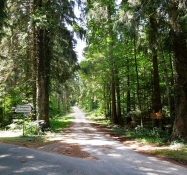
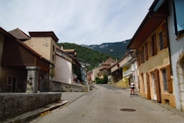
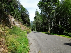
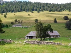
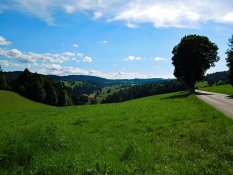
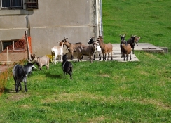
An Weiden vorbei auf einsamer Straße weiter abwärts durch La Côte-aux-Fées und Buttes nach Fleurier.
Information about copyright | |
|---|---|
Rights characteristic / license | by-sa: CREATIVE COMMONS Attribution-ShareAlike |
Link to the description of the license | |
taken over / edited on | 08 Apr 2017
|
taken over / edited by |
|