
Cycle Tour Radwandern in den Cevennen 2018
Radrundfahrt: Saint-Jean-du-Gard nach Anduze
![]()
Please wait - map data are loading
Added on 15 Nov 2018
last edited by Tandemteam-Traudel_und_Dieter on 27 Nov 2018
Cycle route metrics
ridden
Total distance in km
52
Cumulative elevation gain in m
783
Avg. slope uphill in %
1,51
Cumulative elevation loss in m
768
Total cycling hours
3,1
Avg. pace in km/h
16,8
Min. height
140
Max. height
549
Information about rights to the gps-track data | |
|---|---|
Rights owner | |
Rights characteristic / license | by-sa: CREATIVE COMMONS Attribution-ShareAlike |
Link to the description of the license | |
GPX file uploaded | by Tandemteam-Traudel_und_Dieter on 15 Nov 2018
|
Track points in total
1.424
Track points per km (avg)
27
Start/endpoint
Start location
Saint-Jean-du-Gard, Occitania, FR (230 m NHN)
End location
Saint-Jean-du-Gard, Occitania, FR (246 m NHN)
ridden on
07 Jun 2018
Weather
Bedeckt
Properties
Teerstraßen
Travel report
Information about copyright | |
|---|---|
Rights owner | |
Rights characteristic / license | © all rights reserved. |
Image has been uploaded | by Tandemteam-Traudel_und_Dieter on 15 Nov 2018
|
Information about copyright | |
|---|---|
Rights owner | |
Rights characteristic / license | © all rights reserved. |
Image has been uploaded | by Tandemteam-Traudel_und_Dieter on 15 Nov 2018
|
Information about copyright | |
|---|---|
Rights owner | |
Rights characteristic / license | © all rights reserved. |
Image has been uploaded | by Tandemteam-Traudel_und_Dieter on 15 Nov 2018
|
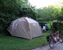
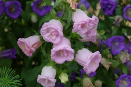
Wir waren mehrere Tage auf dem Campingplatz in Saint-Jean-du-Gard um einige Radtouren und Wanderungen zu unternehmen.
Information about copyright | |
|---|---|
Rights characteristic / license | by-sa: CREATIVE COMMONS Attribution-ShareAlike |
Link to the description of the license | |
taken over / edited on | 15 Nov 2018
|
taken over / edited by |
|
Information about copyright | |
|---|---|
Rights owner | |
Rights characteristic / license | © all rights reserved. |
Image has been uploaded | by Tandemteam-Traudel_und_Dieter on 15 Nov 2018
|
Information about copyright | |
|---|---|
Rights owner | |
Rights characteristic / license | © all rights reserved. |
Image has been uploaded | by Tandemteam-Traudel_und_Dieter on 15 Nov 2018
|
Information about copyright | |
|---|---|
Rights owner | |
Rights characteristic / license | © all rights reserved. |
Image has been uploaded | by Tandemteam-Traudel_und_Dieter on 15 Nov 2018
|
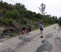
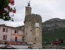
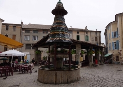
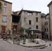
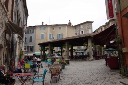
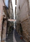
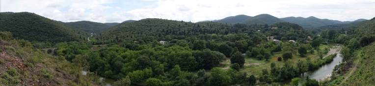
Die erste Radtour führte uns über Départementstraßen in den Südcevennen nach Anduze. Die schöne Altstadt und die Straßencafés ist eine Radtour wert.
Information about copyright | |
|---|---|
Rights characteristic / license | by-sa: CREATIVE COMMONS Attribution-ShareAlike |
Link to the description of the license | |
taken over / edited on | 15 Nov 2018
|
taken over / edited by |
|
Information about copyright | |
|---|---|
Rights owner | |
Rights characteristic / license | © all rights reserved. |
Image has been uploaded | by Tandemteam-Traudel_und_Dieter on 15 Nov 2018
|
Information about copyright | |
|---|---|
Rights owner | |
Rights characteristic / license | © all rights reserved. |
Image has been uploaded | by Tandemteam-Traudel_und_Dieter on 15 Nov 2018
|
Information about copyright | |
|---|---|
Rights owner | |
Rights characteristic / license | © all rights reserved. |
Image has been uploaded | by Tandemteam-Traudel_und_Dieter on 15 Nov 2018
|
Information about copyright | |
|---|---|
Rights owner | |
Rights characteristic / license | © all rights reserved. |
Image has been uploaded | by Tandemteam-Traudel_und_Dieter on 15 Nov 2018
|