Radtour Route des Crête
Reisebericht: Nordseite der Verdon-Schlucht
Aktionen
![]()
Bitte warten - Kartendaten werden geladen
Erstellt am 07.10.2017,
zuletzt geändert von Tandemteam-Traudel_und_Dieter am 09.10.2017
Aktionen
Strecken-Merkmale
geplant
gefahren
Gesamtlänge in km
101
85
Gesamthöhenmeter Aufstieg
4.956
3.181
Durchschn. Steigung Aufstieg %
4,91
3,74
Gesamthöhenmeter Abstieg
4.965
3.189
Gesamtsattelstunden
-
6,8
Durchschnittsgeschwindigkeit in km/Std.
-
12,5
Informationen zu Rechten an den GPS-Track-Daten | |
|---|---|
Rechte-Inhaber | |
Rechte-Ausprägung / Lizenz | by-sa: CREATIVE COMMONS Namensnennung, Weitergabe unter gleichen Bedingungen |
Link zur Rechtebeschreibung | |
gpx-Datei hochgeladen | durch Tandemteam-Traudel_und_Dieter am 07.10.2017
|
Gesamtzahl Trackpoints
2.855
988
Trackpoint-Dichte per km
28
12
Endorte
Start
Les Salles-sur-Verdon, Provence-Alpes-Côte d'Azur, FR (511 m NHN)
Ziel
Les Salles-sur-Verdon, Provence-Alpes-Côte d'Azur, FR (502 m NHN)
Charakter
Informationen zu Urheber-Rechten | |
|---|---|
Rechte-Ausprägung / Lizenz | by-sa: CREATIVE COMMONS Namensnennung, Weitergabe unter gleichen Bedingungen |
Link zur Rechtebeschreibung | |
übernommen / bearbeitet am | 07.10.2017 - 09.10.2017
|
übernommen / bearbeitet durch |
|
Landschaft
Informationen zu Urheber-Rechten | |
|---|---|
Rechte-Ausprägung / Lizenz | by-sa: CREATIVE COMMONS Namensnennung, Weitergabe unter gleichen Bedingungen |
Link zur Rechtebeschreibung | |
übernommen / bearbeitet am | 07.10.2017 - 09.10.2017
|
übernommen / bearbeitet durch |
|
An- und Abreise
Mit Auto zum Campingplatz in Aiguines.
In Frankreich ist es nicht erlaubt, ein Tandem im Zug mitzunehmen!
Etappen
Informationen zu Urheber-Rechten | |
|---|---|
Rechte-Inhaber | |
Rechte-Ausprägung / Lizenz | © Alle Rechte vorbehalten. |
Bild hochgeladen | durch Tandemteam-Traudel_und_Dieter am 07.10.2017
|
85 km
Aiguines
Fahrradfreundliche Unterkünfte, Sehenswertes und Infrastruktur
Name u. Anschrift
Breite / Länge
Tel.
Fax.
Mobile
Art d. Unterkunft
Radler-freund-lichkeit
Strecken-km
km zur Strecke
Höhe
6 km
4,9 km
550 m
6 km
4,2 km
547 m
72 km
0,0 km
772 m
Informationen zu Urheber-Rechten | |
|---|---|
Rechte-Inhaber | |
Rechte-Ausprägung / Lizenz | by: CREATIVE COMMONS Namensnennung |
Link zur Rechtebeschreibung | |
Bild übernommen aus | |
Bild hochgeladen | durch biroto-Redaktion am 28.02.2015
|
Informationen zu Urheber-Rechten | |
|---|---|
Rechte-Inhaber | |
Rechte-Ausprägung / Lizenz | by-sa: CREATIVE COMMONS Namensnennung, Weitergabe unter gleichen Bedingungen |
Link zur Rechtebeschreibung | |
Bild übernommen aus | commons.wikimedia.org/wiki/File:Gorges_du_Verdon_River_from_Bottom_0364.jpg |
Bild hochgeladen | durch biroto-Redaktion am 28.02.2015
|
Informationen zu Urheber-Rechten | |
|---|---|
Rechte-Inhaber | |
Rechte-Ausprägung / Lizenz | by-sa: CREATIVE COMMONS Namensnennung, Weitergabe unter gleichen Bedingungen |
Link zur Rechtebeschreibung | |
Bild übernommen aus | commons.wikimedia.org/wiki/File:Route_des_Crêtes-Gorges_du_Verdon_Ost.jpg |
Bild hochgeladen | durch biroto-Redaktion am 28.02.2015
|
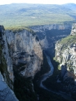
Die Verdonschlucht, französisch Gorges du Verdon, umgangssprachlich auch Grand Canyon du Verdon, ist eine Schlucht in der französischen Provence. Sie beginnt flussabwärts nach der Stadt Castellane und endet nahe Moustiers-Sainte-Marie
im Stausee Lac de Sainte-Croix
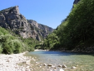
. Durch den etwa 21 km langen und bis zu 700 Meter tiefen Canyon fließt der türkisfarbene Fluss Verdon
. Die Gorges du Verdon sind einer der größten Canyons Europas und Hauptbestandteil des nach ihm benannten Regionalen Naturparks Verdon
.
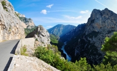
Auf der Ringstraße um den Verdon-Canyon sind immer wieder Aussichtspunkte zur Schlucht hin, aber auch auf die Lavendel-Felder, für die die Region berühmt ist, angelegt. Über der Schlucht kreisen häufig Paraglider, Drachen und Segelflieger, wenn das Wetter dies zulässt. Die Pont de l’Artuby wird sehr stark von Bungee-Jumpern frequentiert. Ebenso ist die Schlucht mit ihren Pässen Ziel vieler Motorradfahrer.
Informationen zu Urheber-Rechten | |
|---|---|
Rechte-Ausprägung / Lizenz | by-sa: CREATIVE COMMONS Namensnennung, Weitergabe unter gleichen Bedingungen |
Link zur Rechtebeschreibung | |
Text(e) übernommen von: |
Seite „Verdonschlucht“. In: Wikipedia, Die freie Enzyklopädie. Bearbeitungsstand: 15. Februar 2015, 20:02 UTC. URL: http://de.wikipedia.org/w/index.php?title=Verdonschlucht&oldid=138877643 (Abgerufen: 28. Februar 2015, 14:36 UTC) |
übernommen / bearbeitet am | 28.02.2015
|
übernommen / bearbeitet durch |
|


