
Cycle Tour Five-Rivers-Cycle-Route
Travel report
Actions
![]()
Please wait - map data are loading
Added on 17 Mar 2014,
last edited by ThimbleU on 03 Apr 2014
Actions
Cycle route metrics
planned
ridden
Total distance in km
310
308
Cumulative elevation gain in m
3.066
1.932
Avg. slope uphill in %
0,99
0,63
Cumulative elevation loss in m
3.066
1.941
Total cycling hours
-
18,3
Avg. pace in km/h
-
16,8
Information about rights to the gps-track data | |
|---|---|
Rights owner | ThimbleU & biroto-Contributors |
Rights characteristic / license | by-sa: CREATIVE COMMONS Attribution-ShareAlike |
Link to the description of the license | |
GPX file taken from | |
GPX file uploaded | by ThimbleU on 17 Mar 2014
|
Track points in total
4.659
4.640
Track points per km (avg)
15
15
Start/endpoint
Start location
Nürnberg, Bayern, DE (312 m NHN)
End location
Nürnberg, Bayern, DE (312 m NHN)
Travel to and from ...
Zug an/ab Nürnberg
Stages
50 km
Nürnberg - Neumarkt
99 km
Neumarkt - Bad Abbach
93 km
Bad Abbach - Sulzbach
66 km
Sulzbach - Nürnberg
Beds4Cyclists, worth visiting and infrastructure
Name and address
Latitude / Longitude
Phone
Fax
Mobile
Type of accommodation
Rating for cyclists
Route km
Dist. to route
Elevation
6 km
0,0 km
321 m
Information about copyright | |
|---|---|
Rights owner | |
Rights characteristic / license | by-sa: CREATIVE COMMONS Attribution-ShareAlike |
Link to the description of the license | |
Image taken over from | |
Image has been uploaded | by biroto-Redaktion on 17 Mar 2014
|
Information about copyright | |
|---|---|
Rights owner | |
Rights characteristic / license | by-sa: CREATIVE COMMONS Attribution-ShareAlike |
Link to the description of the license | |
Image taken over from | |
Image has been uploaded | by biroto-Redaktion on 17 Mar 2014
|
Information about copyright | |
|---|---|
Rights owner | |
Rights characteristic / license | cc0: Public Domain no Rights reserved |
Link to the description of the license | |
Image taken over from | commons.wikimedia.org/wiki/File:Nuernberg_100904_Ehrenhalle_Luitpoldhain.jpg |
Image has been uploaded | by biroto-Redaktion on 17 Mar 2014
|
Information about copyright | |
|---|---|
Rights owner | |
Rights characteristic / license | by-sa: CREATIVE COMMONS Attribution-ShareAlike |
Link to the description of the license | |
Image taken over from | commons.wikimedia.org/wiki/File:Nürnberg_-_Haupttribüne_des_Zeppelinfeldes2.jpg |
Image has been uploaded | by biroto-Redaktion on 17 Mar 2014
|
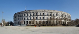
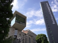
The Documentation Center Nazi Party Rallying Grounds (German: Dokumentationszentrum Reichsparteitagsgelände) is a museum in Nuremberg ![]() . It is in the north wing of the unfinished remains of the Congress Hall of the former Nazi party rallies
. It is in the north wing of the unfinished remains of the Congress Hall of the former Nazi party rallies ![]() . Attached to the museum is an education forum.
. Attached to the museum is an education forum.
The permanent exhibition "Fascination and Terror" (Faszination und Gewalt) studies the causes, coherence, and consequences of National Socialism. It describes the Nazi Party Rallies and explains the fascination they exercised upon participants and visitors. At the same time, the exhibition endeavors to explain what led to the National Socialists' criminal exercise of power and to reveal how the various causal factors were interrelated. A further goal is a frank presentation of the violent consequences that ensued for the population. The events that are inseparably linked with Nuremberg ("city of the party rally" — Stadt der Reichsparteitage) and the National Socialist period are also explained: the activities of Julius Streicher, editor of the anti-Semitic rabble-rousing weekly Der Stürmer (The Storm Trooper), the history of the Nuremberg Rally, the proclamation of the so-called Nuremberg Laws in 1935, the buildings of the Nazi party rally grounds and the trouble with Nazi architecture after 1945, and the criminal Nuremberg Trials against the chief executives of the National Socialist agenda in 1945-1946 and twelve succeeding trials. The exhibition concludes with an examination of the problem that has been with Germany since 1945: how Germans should deal with the legacy in stone left at the Party Rally Grounds by the National Socialists.
Information about copyright | |
|---|---|
Rights characteristic / license | by-sa: CREATIVE COMMONS Attribution-ShareAlike |
Link to the description of the license | |
Input taken over from: |
Wikipedia contributors, 'Documentation Center Nazi Party Rally Grounds', Wikipedia, The Free Encyclopedia, 22 February 2014, 13:21 UTC, <http://en.wikipedia.org/w/index.php?title=Documentation_Center_Nazi_Party_Rally_Grounds&oldid=596629696> [accessed 17 March 2014] |
taken over / edited on | 17 Mar 2014
|
taken over / edited by |
|
Hours of opening
Mon – Fri: 9 a.m. - 6 p.m
Sat & Sun:10 a.m. - 6 p.m.
8 km
0,2 km
318 m
15 km
0,0 km
332 m
19 km
0,3 km
329 m
Information about copyright | |
|---|---|
Rights owner | |
Rights characteristic / license | by-sa: CREATIVE COMMONS Attribution-ShareAlike |
Link to the description of the license | |
Image taken over from | commons.wikimedia.org/wiki/File:Altes_Rathaus_und_Wendenbrunnen_Wendelstein.JPG |
Image has been uploaded | by biroto-Redaktion on 17 Mar 2014
|
Information about copyright | |
|---|---|
Rights owner | |
Rights characteristic / license | by: CREATIVE COMMONS Attribution |
Link to the description of the license | |
Image taken over from | commons.wikimedia.org/wiki/File:Gasthaus_in_Wendelstein_(D-5-76-151-18)_01.jpg |
Image has been uploaded | by biroto-Redaktion on 17 Mar 2014
|
Information about copyright | |
|---|---|
Rights owner | |
Rights characteristic / license | by-sa: CREATIVE COMMONS Attribution-ShareAlike |
Link to the description of the license | |
Image taken over from | commons.wikimedia.org/wiki/File:Kleine_Wohnhausgruppe_in_Wendelstein_(D-5-76-151-35)_01.jpg |
Image has been uploaded | by biroto-Redaktion on 17 Mar 2014
|
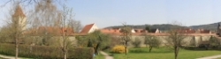
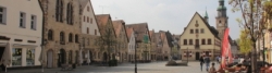
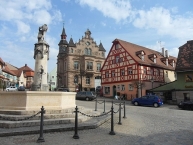
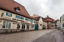
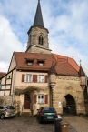
Wendelstein ist ein Markt im mittelfränkischen Landkreis Roth.
Kultur und Sehenswürdigkeiten
Bauwerke
- Allerheiligenkirche in Kleinschwarzenlohe mit Altar von Tilman Riemenschneider
- Evangelische Kirche St. Georg in Wendelstein. Der Altar von Hans Süß von Kulmbach aus dem Jahre 1510 befindet sich nach jahrelanger Auslagerung und Restaurierung seit 17. April 2001 wieder in der Achahildis-Kapelle, einer Seitenkapelle der Kirche.
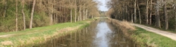
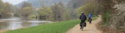
- Der historische Ludwig-Donau-Main-Kanal
 verläuft durch das Gemeindegebiet; dort befinden sich die Lände Wendelstein und der Gauchsbach-Brückkanal.
Information about copyright | |
|---|---|
Rights characteristic / license | by-sa: CREATIVE COMMONS Attribution-ShareAlike |
Link to the description of the license | |
Input taken over from: |
Seite „Wendelstein (Mittelfranken)“. In: Wikipedia, Die freie Enzyklopädie. Bearbeitungsstand: 10. Dezember 2013, 11:06 UTC. URL: http://de.wikipedia.org/w/index.php?title=Wendelstein_(Mittelfranken)&oldid=125305305 (Abgerufen: 17. März 2014, 15:22 UTC) |
taken over / edited on | 17 Mar 2014 - 18 Mar 2014
|
taken over / edited by |
|
22 km
0,0 km
339 m
Information about copyright | |
|---|---|
Rights owner | |
Rights characteristic / license | by-sa: CREATIVE COMMONS Attribution-ShareAlike |
Link to the description of the license | |
Image taken over from | |
Image has been uploaded | by biroto-Redaktion on 17 Mar 2014
|
Information about copyright | |
|---|---|
Rights owner | |
Rights characteristic / license | by-sa: CREATIVE COMMONS Attribution-ShareAlike |
Link to the description of the license | |
Image taken over from | |
Image has been uploaded | by biroto-Redaktion on 17 Mar 2014
|
Information about copyright | |
|---|---|
Rights owner | |
Rights characteristic / license | by-sa: CREATIVE COMMONS Attribution-ShareAlike |
Link to the description of the license | |
Image taken over from | |
Image has been uploaded | by biroto-Redaktion on 17 Mar 2014
|
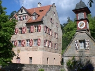
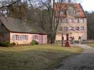
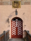
Schloss Kugelhammer ist das bedeutendste Bauwerk des Ortes Röthenbach, dessen Administrator (Verwalter) Christoph von Volckamer ist. Seinen Namen hat das Schloss von dem Hammerwerk, das schon im 14. Jahrhundert eiserne Kugeln herstellte. Der Bauernhof im Schlossbereich wurde 1310 urkundlich als Zeidelgut des Heinrich Creutzer erwähnt. Er dürfte auch den ersten festen Sitz, das Steinhewslein errichtet haben. Später erschienen die Namen Schloss am Doos (Wasserfall) und Schlösschen zu Sankt Wolfgang (Wolfgangskapelle). Seit 1700 wird die Bezeichnung Schlüsselfeldscher Herrensitz verwendet. Von den späteren Besitzern des Schlosses nehmen die Meichsner in Röthenbachs Geschichte eine bedeutende Stellung ein.
Von 1678 bis 1709 war das Gut im Besitz von Johann Carl von Schlüsselfelder von und auf Kirchensittenbach und Röthenbach bei St. Wolfgang, der als Letzter seines Geschlechtes eine nach ihm benannte Familienstiftung einrichtete. Er bestimmte das sogenannteNassauer Hausin Nürnberg gegenüber der Westfassade der Lorenzkirche zum Stiftungshaus der J. C. von Schlüsselfelder’schen Familienstiftung.
Das Stiftungstestament bestimmte seine beiden Schwager F. S. Kreß von Kressenstein und C. Welser von Neuhof zu Nutznießern. Die Verwaltung übertrug er dem jeweils Ältesten dieser Familien im Wechsel. Mit dem Tod seiner Gattin Maria Helena im Jahr 1713 trat die Stiftung in Kraft. Seit 1709 standen 23 Verwalter der Familien Kreß von Kressenstein, Welser und Volckamer von Kirchensittenbach (seit 1878) der Stiftung vor.
Information about copyright | |
|---|---|
Rights characteristic / license | by-sa: CREATIVE COMMONS Attribution-ShareAlike |
Link to the description of the license | |
Input taken over from: |
Seite „Röthenbach bei Sankt Wolfgang“. In: Wikipedia, Die freie Enzyklopädie. Bearbeitungsstand: 11. Mai 2013, 19:01 UTC. URL: http://de.wikipedia.org/w/index.php?title=R%C3%B6thenbach_bei_Sankt_Wolfgang&oldid=118411952 (Abgerufen: 17. März 2014, 15:38 UTC) |
taken over / edited on | 17 Mar 2014
|
taken over / edited by |
|
![]()