Cycle Tour Romantic Middle Franconia
Tag 9: Neustadt a.d. Aisch - Forchheim
![]()
Please wait - map data are loading
Added on 17 Aug 2021
last edited by ThimbleU on 11 Sep 2021
Cycle route metrics
ridden
Total distance in km
60
Cumulative elevation gain in m
202
Avg. slope uphill in %
0,34
Cumulative elevation loss in m
269
Total cycling hours
3,6
Avg. pace in km/h
16,7
Min. height
244
Max. height
328
Information about rights to the gps-track data | |
|---|---|
Rights owner | |
Rights characteristic / license | cc0: Public Domain no Rights reserved |
Link to the description of the license | |
GPX file uploaded | by ThimbleU on 25 Aug 2021
|
Track points in total
969
Track points per km (avg)
16
Start/endpoint
Start location
Neustadt an der Aisch, Bayern, DE (328 m NHN)
End location
Forchheim, Bayern, DE (261 m NHN)
ridden on
25 Aug 2021
Weather
Wolkenlos bis leicht bewölkt, trocken, Wind aus nördlichen Richtungen. 15 bis 24 °C.
Signposting
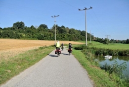
Von Neustadt bis Trailsdorf beschildert mit dem Logo des Aischtalradweges an Punkten, an denen mehrere Radwege zusammentreffen, deshalb nur selten. Im Wesentlichen allgemeines Radwegweisungsschild (grün). Für die Navigation ausreichend. |
|
| |
Von Trailsdorf bis zum Main-Donau-Kanal ohne zielführende Beschilderung. |
|
Am Main-Donau-Kanal (Neuses bis vor Forchheim) beschildert mit dem Logo des D11 an Punkten, an denen mehrere Radwege zusammentreffen, deshalb nur selten. Im Wesentlichen allgemeines Radwegweisungsschild (grün). Für die Navigation ausreichend. |
|
|
Properties
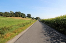
| Firm surface (asphalt, concrete, …) smooth | 57,5 km | 96,0 % |
| Firm surface (cobblestone, asphalt bad, …) bumpy | 0,7 km | 1,2 % |
| Granular surface (compacted with self-binding gravel, …) rough | 1,5 km | 2,5 % |
| Granular surface (compacted with self-binding gravel, …) bumpy | 0,2 km | 0,3 % |
The information relates to the track as traveled!
Slope Gradient Distribution
Travel report
Information about copyright | |
|---|---|
Rights characteristic / license | by-sa: CREATIVE COMMONS Attribution-ShareAlike |
Link to the description of the license | |
taken over / edited on | 10 Sep 2021
|
taken over / edited by |
|
Information about copyright | |
|---|---|
Rights characteristic / license | by-sa: CREATIVE COMMONS Attribution-ShareAlike |
Link to the description of the license | |
taken over / edited on | 10 Sep 2021
|
taken over / edited by |
|
Information about copyright | |
|---|---|
Rights characteristic / license | by-sa: CREATIVE COMMONS Attribution-ShareAlike |
Link to the description of the license | |
taken over / edited on | 10 Sep 2021
|
taken over / edited by |
|
Information about copyright | |
|---|---|
Rights characteristic / license | by-sa: CREATIVE COMMONS Attribution-ShareAlike |
Link to the description of the license | |
taken over / edited on | 10 Sep 2021
|
taken over / edited by |
|
Information about copyright | |
|---|---|
Rights characteristic / license | by-sa: CREATIVE COMMONS Attribution-ShareAlike |
Link to the description of the license | |
taken over / edited on | 10 Sep 2021
|
taken over / edited by |
|


