Print the page content is only available to registered and logged in users and only as a tourbook!

Cycle Tour Round trip Bergisches Land

Tag 3: Lohmar - Siegburg - Bensberg - Solingen

busy


Please wait - map data are loading

0100200
Elevation profile Cycle Tour Round trip Bergisches Land0100200020406080100120

Added on 17 Apr 2023

last edited by ThimbleU on 23 Apr 2023

Cycle route metrics

ridden

Total distance in km

82

Cumulative elevation gain in m

667

Avg. slope uphill in %

0,81

Cumulative elevation loss in m

533

Total cycling hours

5,4

Avg. pace in km/h

15,2

Min. height

41

Max. height

196

GPS track data

Information about rights to the gps-track data

Rights owner

ThimbleU

Rights characteristic / license

cc0: Public Domain no Rights reserved

Link to the description of the license

creativecommons.org/publicdomain/zero/1.0/

GPX file uploaded

by ThimbleU on 19 Apr 2023

Track points in total

1.589

Track points per km (avg)

19

Start/endpoint

Start location

Lohmar, NW, DE (62 m NHN)

End location

Solingen, NW, DE (196 m NHN)

ridden on

19 Apr 2023

Weather

Sonnig

Temperaturverlauf am 19.04.2023 10°15°20°10:0011:0012:0013:0014:0015:0016:0017:0012.7° - 19.6°

Slope Gradient Distribution

Travel report

Tube change

Information about copyright

Rights owner

ThimbleE

Rights characteristic / license

© all rights reserved.

Image has been uploaded

by ThimbleU on 23 Apr 2023

South of Lohmar

Information about copyright

Rights owner

ThimbleU

Rights characteristic / license

© all rights reserved.

Image has been uploaded

by ThimbleU on 23 Apr 2023

Rail Trail Aggertalbahn north of Dreesch

Information about copyright

Rights owner

ThimbleU

Rights characteristic / license

© all rights reserved.

Image has been uploaded

by ThimbleU on 23 Apr 2023

Nach dem Frühstück steht erst einmal Schlauchwechsel auf dem Programm. Danach radeln wir zur Tankstelle und bringen den korrekten Druck auf den Reifen.

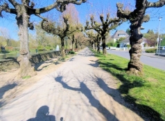
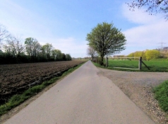
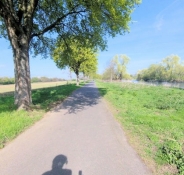
Um kurz vor 10 Uhr steigen wir auf den Sattel und radeln Richtung Siegburg. Nach einem Kilometer im Stadtgebiet kommen wir jenseits der Autobahn auf Wirtschaftswege und radeln durch die Felder. Ab Höhe der Autobahnabfahrt Lohmar sind wir wieder auf einem Bahntrassenweg, der durch ein Waldgebiet und weiter durch das Stadtgebiet Siegburgs bis an den Rand der Altstadt führt.

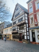
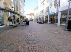
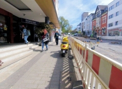
Wenige Meter weiter sind wir in der belebten Fußgängerzone Siegburgs. Auf der linken Seite fällt das Haus „Zum Tannenbaum“ mit seinem schön restaurierten Fachwerkgiebel auf.

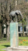
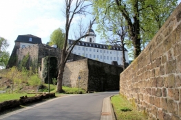
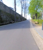
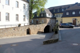
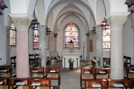
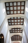
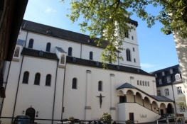
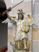
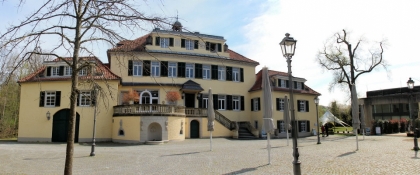
Am Marktplatz biegen wir in die Bergstraße ab und radeln die steile Straße hinauf zum Michaelsberg. Von der Autobahn A3 aus haben wir den Berg mit der Abtei auf seiner Spitze schon häufig gesehen, jetzt wollen wir die Abteigebäude genauer erkunden. Der Zugang zum Abteigelände erinnert immer noch an einen Burgzugang. Im Innenhof stehen wir vor der Abteikirche. Kirche und Krypta können wir besichtigen.

Information about copyright

Rights characteristic / license

by-sa: CREATIVE COMMONS Attribution-ShareAlike

Link to the description of the license

creativecommons.org/licenses/by-sa/3.0/

taken over / edited on

23 Apr 2023

taken over / edited by

ThimbleU

Rail Trail Aggertalbahn in Siegburg

Information about copyright

Rights owner

ThimbleU

Rights characteristic / license

© all rights reserved.

Image has been uploaded

by ThimbleU on 23 Apr 2023

Siegburg, house „Zum Tannenbaum“

Information about copyright

Rights owner

ThimbleU

Rights characteristic / license

© all rights reserved.

Image has been uploaded

by ThimbleU on 23 Apr 2023

Siegburg, old town center

Information about copyright

Rights owner

ThimbleU

Rights characteristic / license

© all rights reserved.

Image has been uploaded

by ThimbleU on 23 Apr 2023

Ascent to Michaelsberg Abbey

Information about copyright

Rights owner

ThimbleU

Rights characteristic / license

© all rights reserved.

Image has been uploaded

by ThimbleU on 23 Apr 2023

Ascent to Michaelsberg Abbey

Information about copyright

Rights owner

ThimbleU

Rights characteristic / license

© all rights reserved.

Image has been uploaded

by ThimbleU on 23 Apr 2023

Ascent to Michaelsberg Abbey

Information about copyright

Rights owner

ThimbleU

Rights characteristic / license

© all rights reserved.

Image has been uploaded

by ThimbleU on 23 Apr 2023

Abbey of St. Michael, inner courtyard

Information about copyright

Rights owner

ThimbleU

Rights characteristic / license

© all rights reserved.

Image has been uploaded

by ThimbleU on 23 Apr 2023

Abbey of St. Michael, crypt of the abbey church

Information about copyright

Rights owner

ThimbleU

Rights characteristic / license

© all rights reserved.

Image has been uploaded

by ThimbleU on 23 Apr 2023

Abbey of St. Michael, ceiling of the abbey church

Information about copyright

Rights owner

ThimbleU

Rights characteristic / license

© all rights reserved.

Image has been uploaded

by ThimbleU on 23 Apr 2023

Abbey of St. Michael, New Anno Shrine

Information about copyright

Rights owner

ThimbleU

Rights characteristic / license

© all rights reserved.

Image has been uploaded

by ThimbleU on 23 Apr 2023

Abbey of St. Michael

Information about copyright

Rights owner

ThimbleU

Rights characteristic / license

© all rights reserved.

Image has been uploaded

by ThimbleU on 23 Apr 2023

Abbey of St. Michael, Abbey Church

Information about copyright

Rights owner

ThimbleU

Rights characteristic / license

© all rights reserved.

Image has been uploaded

by ThimbleU on 23 Apr 2023

Abbey of St. Michael, abbey church, sculpture of St. Michael

Information about copyright

Rights owner

https://commons.wikimedia.org/wiki/User:Beckstet

Rights characteristic / license

by-sa: CREATIVE COMMONS Attribution-ShareAlike

Link to the description of the license

creativecommons.org/licenses/by-sa/3.0/

Image taken over from

https://commons.wikimedia.org/wiki/File:Siegburg_Abtei_Michael.JPG

Image has been uploaded

by ThimbleU on 23 Apr 2023

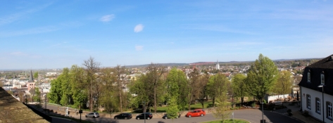
Von einigen Stellen des Geländes kann man weit über die Stadt und das umliegende Land gucken.

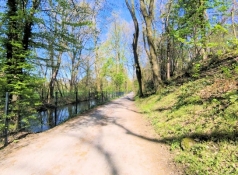
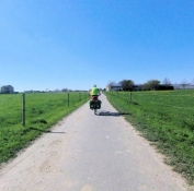
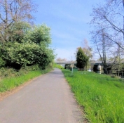
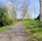
Zurück in der Altstadt radeln wir südwärts bis zur Siegbrücke und dann am Siegufer entlang bis zur Aggermündung. Auf dem Agger-Sülz-Radweg am Westrand des Talbodens das Tal wieder hinauf. Im Wald nördlich von Troisdorf wird die Wegoberfläche schlechter. Gut, dass es trocken ist. Bei Lohmar sind wir nur 150 Meter von unserer Route heute Morgen entfernt.

Wir radeln noch weitere zwei Kilometer auf schlechtem Weg an Agger und Sülz aufwärts.

Information about copyright

Rights characteristic / license

by-sa: CREATIVE COMMONS Attribution-ShareAlike

Link to the description of the license

creativecommons.org/licenses/by-sa/3.0/

taken over / edited on

23 Apr 2023

taken over / edited by

ThimbleU

Siegburg seen from the Michaelsberg

Information about copyright

Rights owner

ThimbleU

Rights characteristic / license

© all rights reserved.

Image has been uploaded

by ThimbleU on 23 Apr 2023

Siegburg, in the Siegwiesen

Information about copyright

Rights owner

ThimbleU

Rights characteristic / license

© all rights reserved.

Image has been uploaded

by ThimbleU on 23 Apr 2023

Agger-Sülz cycle path west of Siegburg

Information about copyright

Rights owner

ThimbleU

Rights characteristic / license

© all rights reserved.

Image has been uploaded

by ThimbleU on 23 Apr 2023

Agger-Sülz cycle path west of Siegburg

Information about copyright

Rights owner

ThimbleU

Rights characteristic / license

© all rights reserved.

Image has been uploaded

by ThimbleU on 23 Apr 2023

Agger-Sülz cycle path west of Lohmar

Information about copyright

Rights owner

ThimbleU

Rights characteristic / license

© all rights reserved.

Image has been uploaded

by ThimbleU on 23 Apr 2023

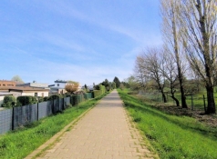
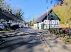
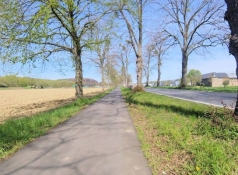
An der Sülztalstraße entlang verläuft der Radweg auf getrenntem und asphaltiertem Radstreifen. Wir passieren die Burg Sülz.

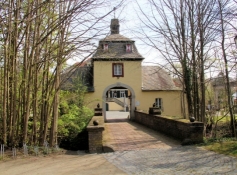
In Rösrath unterqueren wir die Sülztalstraße und schlängeln uns auf Wohnstraßen zum Schloss Eulenbroich. Durch das Torhaus gelangen wir auf in den Innenhof. Das Schloss wird derzeit als Veranstaltungsort und für standesamtliche Trauungen genutzt.

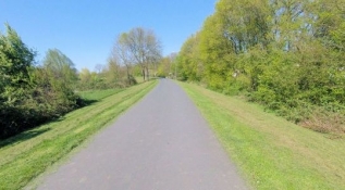
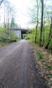
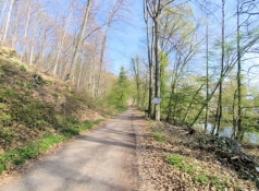
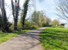
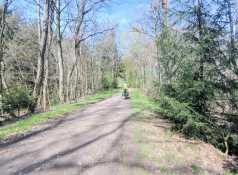
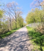
Vom Schloss aus radeln wir durch die Stadt einige Meter aufwärts, bis wir auf den Bahndamm der ehemaligen Sülztalbahn kommen. Diesem folgen wir aus dem Stadtgebiet hinaus und durch den Königsforst für rund sieben Kilometer.

Information about copyright

Rights characteristic / license

by-sa: CREATIVE COMMONS Attribution-ShareAlike

Link to the description of the license

creativecommons.org/licenses/by-sa/3.0/

taken over / edited on

23 Apr 2023

taken over / edited by

ThimbleU

Agger-Sülz cycle path near Meigermühle

Information about copyright

Rights owner

ThimbleU

Rights characteristic / license

© all rights reserved.

Image has been uploaded

by ThimbleU on 23 Apr 2023

Agger-Sülz cycle path near Sülz Castle

Information about copyright

Rights owner

ThimbleU

Rights characteristic / license

© all rights reserved.

Image has been uploaded

by ThimbleU on 23 Apr 2023

Agger-Sülz cycle path near Rambrücken

Information about copyright

Rights owner

ThimbleU

Rights characteristic / license

© all rights reserved.

Image has been uploaded

by ThimbleU on 23 Apr 2023

Eulenbroich Castle

Information about copyright

Rights owner

ThimbleU

Rights characteristic / license

© all rights reserved.

Image has been uploaded

by ThimbleU on 23 Apr 2023

Eulenbroich Castle

Information about copyright

Rights owner

ThimbleU

Rights characteristic / license

© all rights reserved.

Image has been uploaded

by ThimbleU on 23 Apr 2023

Agger-Sülz cycle path between Rösrath and Bensberg

Information about copyright

Rights owner

ThimbleU

Rights characteristic / license

© all rights reserved.

Image has been uploaded

by ThimbleU on 23 Apr 2023

Agger-Sülz cycle path between Rösrath and Bensberg

Information about copyright

Rights owner

ThimbleU

Rights characteristic / license

© all rights reserved.

Image has been uploaded

by ThimbleU on 23 Apr 2023

Agger-Sülz cycle path between Rösrath and Bensberg

Information about copyright

Rights owner

ThimbleU

Rights characteristic / license

© all rights reserved.

Image has been uploaded

by ThimbleU on 23 Apr 2023

Jenseits der Autobahn A4 radeln wir über Wohnstraßen nach Bensberg hinein. Spontan entschließen wir uns, im Zentrum nach einem Café zu suchen. Schließlich sind wir dafür die Kölner Straße 50 Höhenmeter hinaufgetreten. In der Fußgängerzone, derzeit Großbaustelle, finden wir das Café und gönnen uns Cappuccino und Kuchen. Was wir nicht realisiert haben ist, dass wir nur 200 Meter vom Schloss Bensberg entfernt sind. Folglich rollen wir den Berg wieder hinunter, ohne es gesehen zu haben.

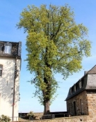
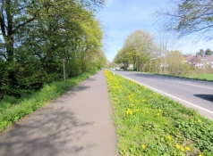
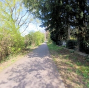
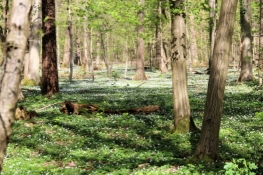
Auf dem Radwegnetz NRW radeln wir nordwestlich weiter vorbei an Bergisch Gladbach und weiter in ein großes Waldgebiet. Entlang des Dünnwalder Mühlenweges ist ein Waldstück voller Buschwindröschen. Herrlich!

Information about copyright

Rights characteristic / license

by-sa: CREATIVE COMMONS Attribution-ShareAlike

Link to the description of the license

creativecommons.org/licenses/by-sa/3.0/

taken over / edited on

23 Apr 2023

taken over / edited by

ThimbleU

Bensberg, Schloßstraße

Information about copyright

Rights owner

ThimbleU

Rights characteristic / license

© all rights reserved.

Image has been uploaded

by ThimbleU on 23 Apr 2023

Forest full of wood anemones

Information about copyright

Rights owner

ThimbleU

Rights characteristic / license

© all rights reserved.

Image has been uploaded

by ThimbleU on 23 Apr 2023

At Von Diergardt Lake

Information about copyright

Rights owner

ThimbleU

Rights characteristic / license

© all rights reserved.

Image has been uploaded

by ThimbleU on 23 Apr 2023

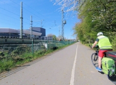
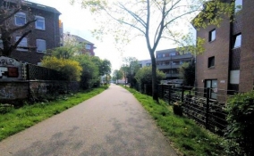
Durch Dünnwald geht es weiter auf Leverkusen zu. Ab dem Willy-Brandt-Ring ärgern wir uns über eine Reihe von Sperrungen des Radwegenetzes ohne Umleitungshinweis bzw. unsinnigen Umleitungen (einmal werden wir per Umleitung direkt in Baustelle geleitet, kein Durchkommen).

Erst stadtauswärts auf dem Dhünn-Deich kommen wir wieder unkompliziert voran. Ab dem Reuschenberger Mühlengraben sind wir auf uns bekanntem Terrain. Durch Opladen, Reusrath und an Leichlingen vorbei sind wir bald zuhause.

Information about copyright

Rights characteristic / license

by-sa: CREATIVE COMMONS Attribution-ShareAlike

Link to the description of the license

creativecommons.org/licenses/by-sa/3.0/

taken over / edited on

23 Apr 2023

taken over / edited by

ThimbleU

Leverkusen, elephant fountain

Information about copyright

Rights owner

ThimbleE

Rights characteristic / license

© all rights reserved.

Image has been uploaded

by ThimbleU on 23 Apr 2023

Leverkusen

Information about copyright

Rights owner

ThimbleU

Rights characteristic / license

© all rights reserved.

Image has been uploaded

by ThimbleU on 23 Apr 2023

Leverkusen, on the Dhünn dike

Information about copyright

Rights owner

ThimbleU

Rights characteristic / license

© all rights reserved.

Image has been uploaded

by ThimbleU on 23 Apr 2023

At the Reuschenberger Mühlengraben

Information about copyright

Rights owner

ThimbleU

Rights characteristic / license

© all rights reserved.

Image has been uploaded

by ThimbleU on 23 Apr 2023

Opladen, Ludwig-Rehbock-Anlage

Information about copyright

Rights owner

ThimbleU

Rights characteristic / license

© all rights reserved.

Image has been uploaded

by ThimbleU on 23 Apr 2023

Before Reusrath

Information about copyright

Rights owner

ThimbleU

Rights characteristic / license

© all rights reserved.

Image has been uploaded

by ThimbleU on 23 Apr 2023

Solingen, Haasenmühle

Information about copyright

Rights owner

ThimbleU

Rights characteristic / license

© all rights reserved.

Image has been uploaded

by ThimbleU on 23 Apr 2023