Cycle Tour Ebro GR99
Travel report
Actions

Please wait - map data are loading
Added on 22 Sep 2014,
last edited by Fredbiker on 15 Jul 2019
Actions
Cycle route metrics
planned
ridden
Total distance in km
830
0
Cumulative elevation gain in m
5.984
0
Avg. slope uphill in %
0,72
-
Cumulative elevation loss in m
6.875
0
Information about rights to the gps-track data | |
|---|---|
Rights owner | |
Rights characteristic / license | by-sa: CREATIVE COMMONS Attribution-ShareAlike |
Link to the description of the license | |
GPX file uploaded | by TheDoc on 22 Sep 2014
|
Track points in total
2.964
0
Track points per km (avg)
4
0
Start/endpoint
Start location
Nestares, Cantabria, ES (893 m NHN)
End location
Deltebre, Katalonien, ES (2 m NHN)
Character
GR99 is a hiking route so in large parts the route is off-road. We didn't follow the GR99 after Caspe but instead crossed over to the Via Verde de la Terra Alta.
Information about copyright | |
|---|---|
Rights characteristic / license | by-sa: CREATIVE COMMONS Attribution-ShareAlike |
Link to the description of the license | |
taken over / edited on | 22 Sep 2014 - 29 Sep 2014
|
taken over / edited by |
|
Landscape
Information about copyright | |
|---|---|
Rights characteristic / license | by-sa: CREATIVE COMMONS Attribution-ShareAlike |
Link to the description of the license | |
taken over / edited on | 22 Sep 2014
|
taken over / edited by |
|
Travel to and from ...
To: From Munich to Bilbao by plane, with the bus to Fontibre
From: Train from Carmales to Barcelona, to Munich by plane
Sources of information
- http://www.pilgerweg.de/camino-del-ebro.html
- http://www.caminosnaturales.com/ebro/
- http://www.tebarray.com/jobajada_del_ebro.htm
- http://www.rodadas.net/2010/05/27/ruta-jacobea/
- http://www.amigosdelciclismo.com/descensodelebro/
- http://zgzbtt.blogspot.de/2010/08/descenso-del-ebro-gr-99.html
- http://desnivel.com/cultura/se-presenta-el-libro-gr-99-el-ebro-de-las-montanas
- http://www.magrama.gob.es/es/desarrollo-rural/temas/caminos-naturales/caminos-naturales/sector-noreste/ebro/
- http://cidaddeebro.es/turismo-en-la-zona/gr993.html<
Remarks
Was a bit overgrown in some areas but always with good signpost
Beds4Cyclists, worth visiting and infrastructure
Name and address
Latitude / Longitude
Phone
Fax
Mobile
Type of accommodation
Rating for cyclists
Route km
Dist. to route
Elevation
144 km
3,7 km
602 m
Hours of opening
16 March till 31 October | 1 November till 15 March |
|---|---|
10:00-14:00 | 10:00-14:00 |
239 km
0,3 km
494 m
ES-01330 San Vicente de la Sonsierra
Tourist information
271 km
4,4 km
517 m
Information about copyright | |
|---|---|
Rights owner | |
Rights characteristic / license | by-sa: CREATIVE COMMONS Attribution-ShareAlike |
Link to the description of the license | |
Image taken over from | commons.wikimedia.org/wiki/File:Iglesia_de_la_Asunción_(Navarrete).jpg |
Image has been uploaded | by biroto-Redaktion on 14 Mar 2015
|
Information about copyright | |
|---|---|
Rights owner | |
Rights characteristic / license | by-sa: CREATIVE COMMONS Attribution-ShareAlike |
Link to the description of the license | |
Image taken over from | commons.wikimedia.org/wiki/File:Iglesia_de_la_Asuncion-Navarrete-DSC07854.jpg |
Image has been uploaded | by biroto-Redaktion on 14 Mar 2015
|
Information about copyright | |
|---|---|
Rights owner | |
Rights characteristic / license | by-sa: CREATIVE COMMONS Attribution-ShareAlike |
Link to the description of the license | |
Image taken over from | commons.wikimedia.org/wiki/File:Navarrete_-_Pórticos_1879723.jpg |
Image has been uploaded | by biroto-Redaktion on 14 Mar 2015
|
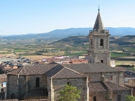
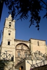
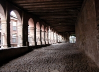
Navarrete is a municipality of the autonomous community of La Rioja, with a population of 2,996 (2021). Named a conjunto histórico of Spain, Navarrete is located between Logroño  and Nájera on the Way of St. James, a medieval pilgrim route.
Alfonso VIII of Castile proposed to the inhabitants of the old villages of the zone that they relocate in a defensive place. These villages were known by the name of Corcuetos and their names were: San Llorente, San Antolín, San Pedro and Nuestra Señora del Prado. Their population settled around a castle raised on Tedeón hill, thus founding the new villa of Navarrete. The castle was fortified and protected with a small wall, that enclosed the settlement and it defended it from the possible attacks that threatened from the north.
In 1192 important fueros were granted to the inhabitants of the new settlement. These fueros, or charter, gave rise to the use in common of river waters and the collective exploitation of grass lands and woods to the east of the town. The charter also allowed for the establishment of local markets and fairs. Thanks to these privileges, the villa reached a great importance.
In 1367 a battle took place in the locality which is sometimes called the Battle of Navarrete, but is better known as the Battle of Nájera.
Places of interest
The historic centre is protected as a Conjunto histórico.
Buildings and monuments
- Parish church of the Assumption (Asunción de María). Construction began in 1553 and finished in the 17th century. It consists of three naves and a baroque altarpiece.
- Hermitage of Santa Maria del Buen Suceso. Located to the south of the municipality, in the direction of Entrena . The facade reliefs make references to the travellers of the Way of St. James.
- The Castle. This is the name given to the highest peak of the Cerro Tedeón on account of there once being a castle there. No trace of the castle now exists. There is a viewing point from which can be seen several towns and mountains.
Information about copyright | |
|---|---|
Rights characteristic / license | by-sa: CREATIVE COMMONS Attribution-ShareAlike |
Link to the description of the license | |
Input taken over from: |
Wikipedia contributors, 'Navarrete, La Rioja', Wikipedia, The Free Encyclopedia, 31 December 2014, 15:32 UTC, http://en.wikipedia.org/w/index.php?title=Navarrete,_La_Rioja&oldid=640392325 |
taken over / edited on | 14 Mar 2015 - 08 Dec 2022
|
taken over / edited by |
|

284 km
0,0 km
401 m
Hours of opening
Winter (01 October-31 May)
Monday to Friday from 9 a.m. to 2 p.m. and 4 to 7 p.m.
Saturdays from 10 a.m. to 2 p.m. and 5 to 7 p.m.
Sundays from 10 a.m. to 2 p.m.
01 June to 30 June:
Monday to Friday from 9 a.m. to 2 p.m. and 4 to 7 p.m.
Saturdays and Sundays: 10 a.m. to 2 p.m. and 5 to 7 p.m.
Summer (01 July to 30 September)
Monday to Friday from 9 a.m. to 2 p.m. and 5 to 8 p.m.
Saturdays: 10 a.m. to 2 p.m. and 5 to 8 p.m.
Sundays: 10 a.m. to 2 p.m. and 5 to 7 p.m.
286 km
0,0 km
404 m
Information about copyright | |
|---|---|
Rights owner | |
Rights characteristic / license | by-sa: CREATIVE COMMONS Attribution-ShareAlike |
Link to the description of the license | |
Image taken over from | https://commons.wikimedia.org/wiki/File:Logroño20130714223240SAM_2650Claridad2.jpg |
Image has been uploaded | by biroto-Redaktion on 01 Jan 2019
|
Information about copyright | |
|---|---|
Rights owner | |
Rights characteristic / license | by-sa: CREATIVE COMMONS Attribution-ShareAlike |
Link to the description of the license | |
Image taken over from | https://commons.wikimedia.org/wiki/File:Logroño_-_Iglesia_de_San_Bartolome_01.jpg |
Image has been uploaded | by biroto-Redaktion on 01 Jan 2019
|
Information about copyright | |
|---|---|
Rights owner | |
Rights characteristic / license | by-sa: CREATIVE COMMONS Attribution-ShareAlike |
Link to the description of the license | |
Image taken over from | https://commons.wikimedia.org/wiki/File:Plaza_del_Mercado_en_Logroño.jpg |
Image has been uploaded | by biroto-Redaktion on 01 Jan 2019
|
Information about copyright | |
|---|---|
Rights owner | |
Rights characteristic / license | by-sa: CREATIVE COMMONS Attribution-ShareAlike |
Link to the description of the license | |
Image taken over from | |
Image has been uploaded | by biroto-Redaktion on 01 Jan 2019
|
Logroño is a city in northern Spain. It's the capital of the autonomous community of La Rioja, well known for its wine. Its population in 2021 was 150,808 inhabitants. The Way of St. James runs through the city as does the River Ebro.
Understand
The origin of Logroño is associated to the Roman Vareia, currently a neighbourhood of the city, and the Iron Age site on top of Monte Cantabria. Being an important crossroad on the Way of St. James and strategic point between the kingdoms of Aragon, Castile and Navarra helped to develop the city during the Middle Ages.
In 1095, the king Alfonso VI of León and Castile awarded the inhabitants of Logroño with the Code of Laws named Fuero. The king John II of Castile granted the status of 'city' in 1431 and the titles of 'very noble' and 'very loyal' in 1444.
In 1521, the population heroically resisted the siege of 30,000 troops sent by the king Francis I of France for 17 days. To remember the victory, Charles I ordered three fleurs-de-lis to be added to the city's emblem. A tribunal of the Spanish Inquisition was set in Logroño in 1570, being of historical importance in 1610 during the Basque witch trials.
The 1833 territorial division of Spain established Logroño as the capital of the new Province of Logroño, renamed in 1980 to Province of La Rioja and constituted as autonomous community since 1982.
Logroño is nowadays a city of 153 066 inhabitants and considered to have one of the greatest quality of life in Spain.
See
Churches
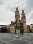
- ⊙Co-cathedral of Santa María de la Redonda (Concatedral de Santa María de la Redonda), C/Portales, 14, ☎ +34 941 257611. The cathedral was built during the 15th century and expanded in the 16th and 17th centuries. Behind the main altar there is a painting attributed to Michelangelo. Free entry.
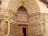
- ⊙Church of San Bartolomé (Iglesia de San Bartolomé), Plaza de San Bartolomé, 2. It's the oldest church in Logroñed dated back to the 12th century. It has a magnificent arched cover which contains some Romanesque sculptures. Free entry.
- ⊙Church of Santa María de Palacio (Iglesia de Santa María de Palacio), C/Marqués de San Nicolás, 36. The church was built between the 12th and 13th centuries and has the Gothic octagonal spire as the most representative symbol. The second tower was built around 1560. Free entry.
- ⊙Church of Santiago el Real (Iglesia de Santiago el Real), C/Barriocepo, 6. M-Su 08:15–13:15 18:30–19:00. This is the site of the oldest church in the city, although the current building was constructed during the 16th century. Free entry.
Landmarks
- ⊙El Cubo del Revellín, C/Once de Junio, 6. W 10:00–13:00 Th F 10:00–13:00 17:00–20:00 Sa 11:00–14:00 17:00–20:00 Su 11:00–14:00. It's the best conserved part of the city wall and hosts an exhibition inside. Free entry.
Museums
- ⊙House of Sciences (Casa de las Ciencias), C/Ebro, 1, ☎ +34 941 245943. Tu–Su 11:00–14:00 17:00–20:30. It's located on the other side of the river Ebro in the former slaughterhouse. It hosts different scientific exhibitions over the year. In the garden, there are some tools you can use to do your own experiments. Free entry.
- ⊙Museum of La Rioja (Museo de La Rioja), C/San Agustín, 23. Tu–Sa 10:00–14:00 16:00–21:00 Su 10:00–14:00. The museum is housed in a Baroque palace of the 18th century and hosts different collections featuring paintings, sculptures and furniture. Free entry.
Wineries
In the old city you can visit some of the vaulted underground cellars known as calados. For a bigger understanding of the winemaking you can get a tour in one of the currently active wineries that surround the city:
- ⊙Bodegas Franco-Españolas, C/Cabo Noval, 2, ☎ +34 941 251290. M–F 11:30 16:30 Sa 11:00 13:00 18:00 Su 12:00. €9.
- ⊙Bodegas Viña Ijalba, Ctra. Pamplona, km. 1, ☎ +34 941 261100. M–Sa 11:00 12:00 17:00 18:00. €10.
Eat
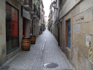
You can't leave Logroño without visiting the famous ⊙Calle Laurel. that together with Travesía del Laurel, Calle San Agustin and Calle Albornoz concentrate more than 50 bars serving tapas, known in the north of Spain as pintxos.
Each bar cooks its own speciality, although new openings are specialized in more than one dish, always accompanied by a glass of Rioja wine. You can hop freely from one bar to the next one along the one hundred meters of the street that has an unbeatable atmosphere of good vibes. The circuit is popularly known as Trail of the Elephants, because people would walk on four legs if they visited all the bars.
In the neighbouring ⊙Calle San Juan. which is 300 meters far away, you can find another 30 bars that are usually less crowded and have different specialities.
Budget
- Prices of pintxos are around €2 so it can become expensive if you feel really hungry or can't stop trying all those delicacies. An option to keep the budget low would be ordering bigger portions of them that are called raciones and are usually served in clay pots. Some of these bars serve as well bigger sandwiches known as bocadillos or bocatas.
- In autumn and winter you can find churrería stalls selling a fried-dough pastry named churro. During the cold months is common to find as well smaller kiosks selling roasted chestnuts.
Mid-range
During working days most of the restaurants offer a daily menu for lunch which includes three courses, bread, wine and water ranging from €10 to €15.
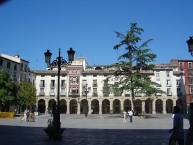
- ⊙Boragos, Plaza del Mercado, 2, ☎ +34 941 250353. Tu–Su 13:30–16:00 21:00–23:00. Modern cuisine with cod as speciality. Daily menu €20.
- ⊙LaMaite, C/Sagasta, 6, ☎ +34 941 254747. Traditional food with a special touch. Daily menu €14.90.
Splurge
- ⊙Tondeluna, C/Muro de la Mata, 9, ☎ +34 941 236425. M–Sa 12:00–16:00 20:30–23:15 Su 11:30–16:30. The 2-Michelin starred chef Francis Paniego opened this restaurant in 2011. It has affordable prices for cuisine of high quality elaborated with local products. Daily menu for €19 and 6-courses tasting menu at €40.
Information about copyright | |
|---|---|
Rights characteristic / license | by-sa: CREATIVE COMMONS Attribution-ShareAlike |
Link to the description of the license | |
Input taken over from: |
Wikivoyage contributors, 'Logroño', Wikivoyage, The FREE worldwide travel guide that anyone can edit, 3 July 2018, 23:16 UTC, https://en.wikivoyage.org/w/index.php?title=Logro%C3%B1o&oldid=3546284 |
taken over / edited on | 01 Jan 2019 - 08 Dec 2022
|
taken over / edited by |
|
