Radtour Aachen - Dresden auf der Mittellandroute
2. Etappe: Hasenfeld - Bad Godesberg
![]()
Bitte warten - Kartendaten werden geladen
Erstellt am 10.08.2014
zuletzt geändert von Rolando am 21.09.2014
Strecken-Merkmale
gefahren
Gesamtlänge in km
73
Gesamthöhenmeter Aufstieg
645
Durchschn. Steigung Aufstieg %
0,88
Gesamthöhenmeter Abstieg
841
min. Höhe
62
max. Höhe
424
Informationen zu Rechten an den GPS-Track-Daten | |
|---|---|
Rechte-Inhaber | |
Rechte-Ausprägung / Lizenz | by-sa: CREATIVE COMMONS Namensnennung, Weitergabe unter gleichen Bedingungen |
Link zur Rechtebeschreibung | |
gpx-Datei hochgeladen | durch Rolando am 21.09.2014
|
Gesamtzahl Trackpoints
1.734
Trackpoint-Dichte per km
24
Endorte
Start
Heimbach, Nordrhein-Westfalen, DE (272 m NHN)
Ziel
Bad Godesberg, Nordrhein-Westfalen, DE (75 m NHN)
gefahren am
17.07.2014
Wetter
Weiterhin schön und heiss, späterer Nachmittag sehr schwül.
Unterkunft
Hotel zum Adler
Koblenzer Straße 60
DE-53173 Bonn-Bad Godesberg
Steigungs-Verteilung
Informations-Quellen
GPS-Track, Schilder, alte Strassenkarte
Reisebericht
Informationen zu Urheber-Rechten | |
|---|---|
Rechte-Inhaber | |
Rechte-Ausprägung / Lizenz | by-sa: CREATIVE COMMONS Namensnennung, Weitergabe unter gleichen Bedingungen |
Link zur Rechtebeschreibung | |
Bild hochgeladen | durch Rolando am 21.09.2014
|
Informationen zu Urheber-Rechten | |
|---|---|
Rechte-Inhaber | |
Rechte-Ausprägung / Lizenz | by-sa: CREATIVE COMMONS Namensnennung, Weitergabe unter gleichen Bedingungen |
Link zur Rechtebeschreibung | |
Bild hochgeladen | durch Rolando am 21.09.2014
|
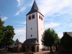
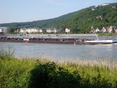
Nach Heimbach langsamer und stetig steilerer Anstieg durch den Wald. Wegen Gepäck kurze Schiebestrecken, landschaftlich sehr schön. Etliche Hügel, Landwirtschaftsgebiet, ruhige Nebenstrassen. Schwülwarmer Aufstieg und anschliessend kühle Abfahrt hinunter zum Rhein. Am Rhein entlang nach Bad Godesberg.


