Radtour Eiserner Vorhang Tour, Teil 3 Gdingen-Asch
Dag/day 2: Białogóra-Główczyce
![]()
Bitte warten - Kartendaten werden geladen
Erstellt am 14.06.2023
zuletzt geändert von Ottocolor am 02.07.2023
Strecken-Merkmale
gefahren
Gesamtlänge in km
61
Gesamthöhenmeter Aufstieg
393
Durchschn. Steigung Aufstieg %
0,64
Gesamthöhenmeter Abstieg
376
Informationen zu Rechten an den GPS-Track-Daten | |
|---|---|
Rechte-Inhaber | |
Rechte-Ausprägung / Lizenz | cc0: Public Domain keine Rechte vorbehalten |
Link zur Rechtebeschreibung | |
gpx-Datei hochgeladen | durch Ottocolor am 02.07.2023
|
Gesamtzahl Trackpoints
895
Trackpoint-Dichte per km
15
Endorte
Start
Krokowa, PL (9 m NHN)
Ziel
Główczyce, PL (26 m NHN)
gefahren am
10.05.2023
Wetter
More clouds, but also a lot of sun. Moderate breeze from southeast, som mostly tailwind, but also crosswinds and a little headwind. In the morning quite cold!
Bemerkungen
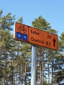
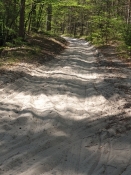
Because of the sandy trails on the superbly signposted cycle route EV13, I didn't manage to reach my goal of Ustka. Instead i diverted from the planned route southwards to road 213, and made it only to Główczyce, where I found a small hotel.
Reisebericht
Informationen zu Urheber-Rechten | |
|---|---|
Rechte-Inhaber | |
Rechte-Ausprägung / Lizenz | by-sa: CREATIVE COMMONS Namensnennung, Weitergabe unter gleichen Bedingungen |
Link zur Rechtebeschreibung | |
Bild hochgeladen | durch Ottocolor am 02.07.2023
|
Informationen zu Urheber-Rechten | |
|---|---|
Rechte-Inhaber | |
Rechte-Ausprägung / Lizenz | by-sa: CREATIVE COMMONS Namensnennung, Weitergabe unter gleichen Bedingungen |
Link zur Rechtebeschreibung | |
Bild hochgeladen | durch Ottocolor am 02.07.2023
|
Informationen zu Urheber-Rechten | |
|---|---|
Rechte-Inhaber | |
Rechte-Ausprägung / Lizenz | by-sa: CREATIVE COMMONS Namensnennung, Weitergabe unter gleichen Bedingungen |
Link zur Rechtebeschreibung | |
Bild hochgeladen | durch Ottocolor am 02.07.2023
|
Informationen zu Urheber-Rechten | |
|---|---|
Rechte-Inhaber | |
Rechte-Ausprägung / Lizenz | by-sa: CREATIVE COMMONS Namensnennung, Weitergabe unter gleichen Bedingungen |
Link zur Rechtebeschreibung | |
Bild hochgeladen | durch Ottocolor am 02.07.2023
|
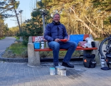
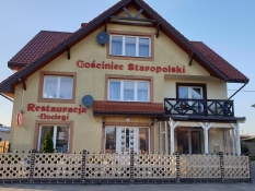
On this day the trails in the woods were very sandy. Even if the signposting was magnificent. After my lunch at a small bridge across a stream I decided to withdraw to a middle class road to the south. I was due to go down there in the town of Główczyce anyway and passed on to Ustka. Instead I checked into a small hotel in Główczyce (after a coffee break) and spent the planned rest day in Ustka by cycling the remaining distance there.
Informationen zu Urheber-Rechten | |
|---|---|
Rechte-Ausprägung / Lizenz | by-sa: CREATIVE COMMONS Namensnennung, Weitergabe unter gleichen Bedingungen |
Link zur Rechtebeschreibung | |
übernommen / bearbeitet am | 02.07.2023
|
übernommen / bearbeitet durch |
|
Informationen zu Urheber-Rechten | |
|---|---|
Rechte-Inhaber | |
Rechte-Ausprägung / Lizenz | by-sa: CREATIVE COMMONS Namensnennung, Weitergabe unter gleichen Bedingungen |
Link zur Rechtebeschreibung | |
Bild hochgeladen | durch Ottocolor am 02.07.2023
|
Informationen zu Urheber-Rechten | |
|---|---|
Rechte-Inhaber | |
Rechte-Ausprägung / Lizenz | by-sa: CREATIVE COMMONS Namensnennung, Weitergabe unter gleichen Bedingungen |
Link zur Rechtebeschreibung | |
Bild hochgeladen | durch Ottocolor am 02.07.2023
|
Informationen zu Urheber-Rechten | |
|---|---|
Rechte-Inhaber | |
Rechte-Ausprägung / Lizenz | by-sa: CREATIVE COMMONS Namensnennung, Weitergabe unter gleichen Bedingungen |
Link zur Rechtebeschreibung | |
Bild hochgeladen | durch Ottocolor am 02.07.2023
|
Informationen zu Urheber-Rechten | |
|---|---|
Rechte-Inhaber | |
Rechte-Ausprägung / Lizenz | by-sa: CREATIVE COMMONS Namensnennung, Weitergabe unter gleichen Bedingungen |
Link zur Rechtebeschreibung | |
Bild hochgeladen | durch Ottocolor am 02.07.2023
|
Informationen zu Urheber-Rechten | |
|---|---|
Rechte-Inhaber | |
Rechte-Ausprägung / Lizenz | by-sa: CREATIVE COMMONS Namensnennung, Weitergabe unter gleichen Bedingungen |
Link zur Rechtebeschreibung | |
Bild hochgeladen | durch Ottocolor am 02.07.2023
|

