Radtour Eiserner Vorhang Tour, Teil 3 Gdingen-Asch
Dag/day 22: Ilsenburg-Wernigerode-Walkenried
![]()
Bitte warten - Kartendaten werden geladen
Erstellt am 14.06.2023
zuletzt geändert von Ottocolor am 30.07.2023
Strecken-Merkmale
gefahren
Gesamtlänge in km
46
Gesamthöhenmeter Aufstieg
806
Durchschn. Steigung Aufstieg %
1,75
Gesamthöhenmeter Abstieg
849
min. Höhe
242
max. Höhe
621
Informationen zu Rechten an den GPS-Track-Daten | |
|---|---|
Rechte-Inhaber | |
Rechte-Ausprägung / Lizenz | cc0: Public Domain keine Rechte vorbehalten |
Link zur Rechtebeschreibung | |
gpx-Datei hochgeladen | durch Ottocolor am 14.06.2023
|
Gesamtzahl Trackpoints
757
Trackpoint-Dichte per km
16
Endorte
Start
Ilsenburg (Harz), ST, DE (321 m NHN)
Ziel
Walkenried, NI, DE (278 m NHN)
gefahren am
30.05.2023
Wetter
A warm, almost hot day with just a few clouds. Insignificant winds.
Steigungs-Verteilung
Bemerkungen
The stage quite different from the planned one. First I cycled to Wernigerode. From there a stretch in a steam train to Drei-Annen-Hohne station. From there on the planned route.
Reisebericht
Informationen zu Urheber-Rechten | |
|---|---|
Rechte-Inhaber | |
Rechte-Ausprägung / Lizenz | by-sa: CREATIVE COMMONS Namensnennung, Weitergabe unter gleichen Bedingungen |
Link zur Rechtebeschreibung | |
Bild hochgeladen | durch Ottocolor am 30.07.2023
|
Informationen zu Urheber-Rechten | |
|---|---|
Rechte-Inhaber | |
Rechte-Ausprägung / Lizenz | by-sa: CREATIVE COMMONS Namensnennung, Weitergabe unter gleichen Bedingungen |
Link zur Rechtebeschreibung | |
Bild hochgeladen | durch Ottocolor am 30.07.2023
|
Informationen zu Urheber-Rechten | |
|---|---|
Rechte-Inhaber | |
Rechte-Ausprägung / Lizenz | by-sa: CREATIVE COMMONS Namensnennung, Weitergabe unter gleichen Bedingungen |
Link zur Rechtebeschreibung | |
Bild hochgeladen | durch Ottocolor am 30.07.2023
|
Informationen zu Urheber-Rechten | |
|---|---|
Rechte-Inhaber | |
Rechte-Ausprägung / Lizenz | by-sa: CREATIVE COMMONS Namensnennung, Weitergabe unter gleichen Bedingungen |
Link zur Rechtebeschreibung | |
Bild hochgeladen | durch Ottocolor am 30.07.2023
|
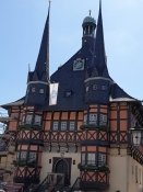
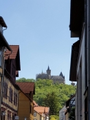
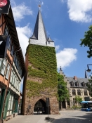
Ilsenburg was only capable of helping me with the cleaning fluid. With the other things it wasn't, so I decided to resort to the somewhat larger neighbouring town of Wernigerode instead. At first I wanted to take the bus there, but then I cycled anyway, and it turned out to be a good idea, because, in return for a pretty big stack of money, I got both a new luxury sleeping pad from an expensive outdoor store and a new rear wheel from a bicycle repair shop. They only needed an hour to install it, which I spent with sightseeing and eating my prepared lunch in the town centre. The town hall is one of the most polished and romantic things you can imagine.
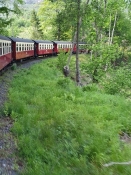
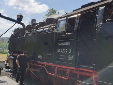
When the bike was ready, the steam train Harzquerbahn took me up into the Harz, so I didn't have to negotiate the altitude meters myself. The train was on its way up to the top of the mountain of Brocken, but I got off at Drei-Annen-Hohne, which was the highest point of my planned route.
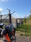
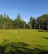
But there were still quite a few altitude meters up and down saved for me anyway. At one point I made a fool of myself with a completely hopeless shortcut, which cost a lot of time and effort. West of the village of Sorge, the border is displayed in all its horror, and an artist has created a natural work of art on the spot, which he calls "The ring of memory". Well, it didn't impress me. Thiese kind of things quickly gets overgrown with lush vegetation, so it becomes somewhat messy nature art. Again a steep, steep stretch of patrol road followed, but in Hohegeiß it was finally downhill to Walkenried and my goal for the day. And that on a major road, but without many cars.
I had hoped to find an open restaurant, but was disappointed. But I managed to cook something myself at the campsite after shopping for it. The Harz lay behind me. It turned out a little differently than planned, but I was very happy, especially with my new rear wheel. Because if one spoke breaks, more always follow, and then the wheel buckles, so it was an absolutely necessary repair.
Informationen zu Urheber-Rechten | |
|---|---|
Rechte-Ausprägung / Lizenz | by-sa: CREATIVE COMMONS Namensnennung, Weitergabe unter gleichen Bedingungen |
Link zur Rechtebeschreibung | |
übernommen / bearbeitet am | 30.07.2023
|
übernommen / bearbeitet durch |
|
Informationen zu Urheber-Rechten | |
|---|---|
Rechte-Inhaber | |
Rechte-Ausprägung / Lizenz | by-sa: CREATIVE COMMONS Namensnennung, Weitergabe unter gleichen Bedingungen |
Link zur Rechtebeschreibung | |
Bild hochgeladen | durch Ottocolor am 30.07.2023
|
Informationen zu Urheber-Rechten | |
|---|---|
Rechte-Inhaber | |
Rechte-Ausprägung / Lizenz | by-sa: CREATIVE COMMONS Namensnennung, Weitergabe unter gleichen Bedingungen |
Link zur Rechtebeschreibung | |
Bild hochgeladen | durch Ottocolor am 30.07.2023
|
Informationen zu Urheber-Rechten | |
|---|---|
Rechte-Inhaber | |
Rechte-Ausprägung / Lizenz | by-sa: CREATIVE COMMONS Namensnennung, Weitergabe unter gleichen Bedingungen |
Link zur Rechtebeschreibung | |
Bild hochgeladen | durch Ottocolor am 30.07.2023
|
Informationen zu Urheber-Rechten | |
|---|---|
Rechte-Inhaber | |
Rechte-Ausprägung / Lizenz | by-sa: CREATIVE COMMONS Namensnennung, Weitergabe unter gleichen Bedingungen |
Link zur Rechtebeschreibung | |
Bild hochgeladen | durch Ottocolor am 30.07.2023
|

