Radtour Rad-Urlaub in den Alpen 2014
Dag 2, etape/stage 1: St. Moritz-Maloja-St. Moritz
![]()
Bitte warten - Kartendaten werden geladen
Erstellt am 05.08.2014
zuletzt geändert von Ottocolor am 11.08.2014
Strecken-Merkmale
gefahren
Gesamtlänge in km
35
Gesamthöhenmeter Aufstieg
1.340
Durchschn. Steigung Aufstieg %
3,83
Gesamthöhenmeter Abstieg
1.342
min. Höhe
1.793
max. Höhe
2.650
Informationen zu Rechten an den GPS-Track-Daten | |
|---|---|
Rechte-Inhaber | |
Rechte-Ausprägung / Lizenz | by-sa: CREATIVE COMMONS Namensnennung, Weitergabe unter gleichen Bedingungen |
Link zur Rechtebeschreibung | |
gpx-Datei hochgeladen | durch Ottocolor am 09.08.2014
|
Gesamtzahl Trackpoints
771
Trackpoint-Dichte per km
22
Endorte
Start
Sankt Moritz, Graubünden, CH (1796 m NHN)
Ziel
Sankt Moritz, Graubünden, CH (1795 m NHN)
gefahren am
22.07.2014
Wetter
Overcast and very cool all day long. In the valley mostly dry. On the mountain walk to the Lunghin pass is was really cold (2-3°C) with light rain and foggy. On the bike trip 'home' to St. Moritz a light north easterly (head)wind.
Unterkunft
Campingplatz Olympiaschanze
Via San Gian
CH-7500 St. Moritz
Beschaffenheit
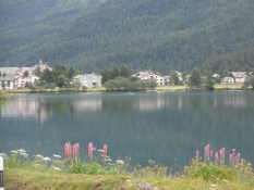
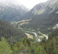
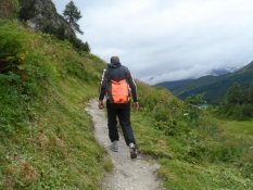
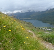
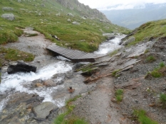
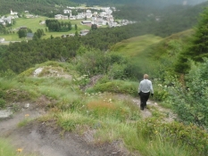
The outbound trip to Maloja we rode mainly on the main road in light, but fast going traffic. Short stretches on gravel paths. In the village og Maloja on the main road to the top point of the Maloja pass and then on a steeply ascending gravel path to Pila. From here we made a four-hour mountainwalk on a fairly taxing trail up to the Lunghin pass and back down again. From Pila cycled back to St. Moritz on the sighnposted cycle route (No. 6, 65 og Inn-Radweg), which followed the main road north of the Segl lake. Then through Segl Maria on a tarmac road. Then around the lakes of Silvaplauna and Champfér on a rather poor wet gravel path with wooden or metal rain drains across the trail.
Steigungs-Verteilung
Bemerkungen
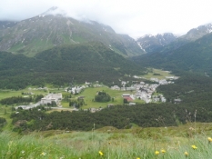
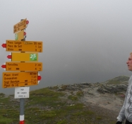
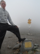
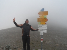
The first stage performed as a day trip from the the tent site a St. Moritz. Our goal was the top of the Maloja pass in 1,815 m. elevation and then a mountain walk to the well of the Inn at the Lunghin pass (2640 m) via the Lunghin lake. Outbound we rode on the main road, homebound on the official cycle route.
Reisebericht
Informationen zu Urheber-Rechten | |
|---|---|
Rechte-Inhaber | |
Rechte-Ausprägung / Lizenz | by-sa: CREATIVE COMMONS Namensnennung, Weitergabe unter gleichen Bedingungen |
Link zur Rechtebeschreibung | |
Bild hochgeladen | durch Ottocolor am 11.08.2014
|
Informationen zu Urheber-Rechten | |
|---|---|
Rechte-Inhaber | |
Rechte-Ausprägung / Lizenz | by-sa: CREATIVE COMMONS Namensnennung, Weitergabe unter gleichen Bedingungen |
Link zur Rechtebeschreibung | |
Bild hochgeladen | durch Ottocolor am 11.08.2014
|
Informationen zu Urheber-Rechten | |
|---|---|
Rechte-Inhaber | |
Rechte-Ausprägung / Lizenz | by-sa: CREATIVE COMMONS Namensnennung, Weitergabe unter gleichen Bedingungen |
Link zur Rechtebeschreibung | |
Bild hochgeladen | durch Ottocolor am 11.08.2014
|
Informationen zu Urheber-Rechten | |
|---|---|
Rechte-Inhaber | |
Rechte-Ausprägung / Lizenz | by-sa: CREATIVE COMMONS Namensnennung, Weitergabe unter gleichen Bedingungen |
Link zur Rechtebeschreibung | |
Bild hochgeladen | durch Ottocolor am 11.08.2014
|
Informationen zu Urheber-Rechten | |
|---|---|
Rechte-Inhaber | |
Rechte-Ausprägung / Lizenz | by-sa: CREATIVE COMMONS Namensnennung, Weitergabe unter gleichen Bedingungen |
Link zur Rechtebeschreibung | |
Bild hochgeladen | durch Ottocolor am 11.08.2014
|
Informationen zu Urheber-Rechten | |
|---|---|
Rechte-Inhaber | |
Rechte-Ausprägung / Lizenz | by-sa: CREATIVE COMMONS Namensnennung, Weitergabe unter gleichen Bedingungen |
Link zur Rechtebeschreibung | |
Bild hochgeladen | durch Ottocolor am 11.08.2014
|
Informationen zu Urheber-Rechten | |
|---|---|
Rechte-Inhaber | |
Rechte-Ausprägung / Lizenz | by-sa: CREATIVE COMMONS Namensnennung, Weitergabe unter gleichen Bedingungen |
Link zur Rechtebeschreibung | |
Bild hochgeladen | durch Ottocolor am 11.08.2014
|
Informationen zu Urheber-Rechten | |
|---|---|
Rechte-Inhaber | |
Rechte-Ausprägung / Lizenz | by-sa: CREATIVE COMMONS Namensnennung, Weitergabe unter gleichen Bedingungen |
Link zur Rechtebeschreibung | |
Bild hochgeladen | durch Ottocolor am 11.08.2014
|
Informationen zu Urheber-Rechten | |
|---|---|
Rechte-Inhaber | |
Rechte-Ausprägung / Lizenz | by-sa: CREATIVE COMMONS Namensnennung, Weitergabe unter gleichen Bedingungen |
Link zur Rechtebeschreibung | |
Bild hochgeladen | durch Ottocolor am 11.08.2014
|
Informationen zu Urheber-Rechten | |
|---|---|
Rechte-Inhaber | |
Rechte-Ausprägung / Lizenz | by-sa: CREATIVE COMMONS Namensnennung, Weitergabe unter gleichen Bedingungen |
Link zur Rechtebeschreibung | |
Bild hochgeladen | durch Ottocolor am 11.08.2014
|
Informationen zu Urheber-Rechten | |
|---|---|
Rechte-Inhaber | |
Rechte-Ausprägung / Lizenz | by-sa: CREATIVE COMMONS Namensnennung, Weitergabe unter gleichen Bedingungen |
Link zur Rechtebeschreibung | |
Bild hochgeladen | durch Ottocolor am 11.08.2014
|
Informationen zu Urheber-Rechten | |
|---|---|
Rechte-Inhaber | |
Rechte-Ausprägung / Lizenz | by-sa: CREATIVE COMMONS Namensnennung, Weitergabe unter gleichen Bedingungen |
Link zur Rechtebeschreibung | |
Bild hochgeladen | durch Ottocolor am 11.08.2014
|
Informationen zu Urheber-Rechten | |
|---|---|
Rechte-Inhaber | |
Rechte-Ausprägung / Lizenz | by-sa: CREATIVE COMMONS Namensnennung, Weitergabe unter gleichen Bedingungen |
Link zur Rechtebeschreibung | |
Bild hochgeladen | durch Ottocolor am 11.08.2014
|
Informationen zu Urheber-Rechten | |
|---|---|
Rechte-Inhaber | |
Rechte-Ausprägung / Lizenz | by-sa: CREATIVE COMMONS Namensnennung, Weitergabe unter gleichen Bedingungen |
Link zur Rechtebeschreibung | |
Bild hochgeladen | durch Ottocolor am 11.08.2014
|
Informationen zu Urheber-Rechten | |
|---|---|
Rechte-Inhaber | |
Rechte-Ausprägung / Lizenz | by-sa: CREATIVE COMMONS Namensnennung, Weitergabe unter gleichen Bedingungen |
Link zur Rechtebeschreibung | |
Bild hochgeladen | durch Ottocolor am 11.08.2014
|

