Radtour Lolland und Femö
Dag/day 1: Rudkøbing-Langø
![]()
Bitte warten - Kartendaten werden geladen
Erstellt am 29.04.2023
zuletzt geändert von Ottocolor am 21.07.2023
Strecken-Merkmale
gefahren
Gesamtlänge in km
49
Gesamthöhenmeter Aufstieg
231
Durchschn. Steigung Aufstieg %
0,47
Gesamthöhenmeter Abstieg
231
Informationen zu Rechten an den GPS-Track-Daten | |
|---|---|
Rechte-Inhaber | |
Rechte-Ausprägung / Lizenz | cc0: Public Domain keine Rechte vorbehalten |
Link zur Rechtebeschreibung | |
gpx-Datei hochgeladen | durch Ottocolor am 30.04.2023
|
Gesamtzahl Trackpoints
511
Trackpoint-Dichte per km
10
Endorte
Start
Rudkøbing, 83, DK (6 m NHN)
Ziel
Nakskov, 85, DK (6 m NHN)
gefahren am
20.04.2023
Wetter
Sunny all day, chilly temperatures around 10°C. Light to moderate breeze from the east, which increased to a stiff breeze. Mostly headwind.
Steigungs-Verteilung
Bemerkungen
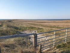
The bike trip out on the spit of Albuen had to be cancelled due to deep sand.
Reisebericht
Informationen zu Urheber-Rechten | |
|---|---|
Rechte-Inhaber | |
Rechte-Ausprägung / Lizenz | by-sa: CREATIVE COMMONS Namensnennung, Weitergabe unter gleichen Bedingungen |
Link zur Rechtebeschreibung | |
Bild hochgeladen | durch Ottocolor am 21.07.2023
|
Informationen zu Urheber-Rechten | |
|---|---|
Rechte-Inhaber | |
Rechte-Ausprägung / Lizenz | by-sa: CREATIVE COMMONS Namensnennung, Weitergabe unter gleichen Bedingungen |
Link zur Rechtebeschreibung | |
Bild hochgeladen | durch Ottocolor am 21.07.2023
|
Informationen zu Urheber-Rechten | |
|---|---|
Rechte-Inhaber | |
Rechte-Ausprägung / Lizenz | by-sa: CREATIVE COMMONS Namensnennung, Weitergabe unter gleichen Bedingungen |
Link zur Rechtebeschreibung | |
Bild hochgeladen | durch Ottocolor am 21.07.2023
|
Informationen zu Urheber-Rechten | |
|---|---|
Rechte-Inhaber | |
Rechte-Ausprägung / Lizenz | by-sa: CREATIVE COMMONS Namensnennung, Weitergabe unter gleichen Bedingungen |
Link zur Rechtebeschreibung | |
Bild hochgeladen | durch Ottocolor am 21.07.2023
|
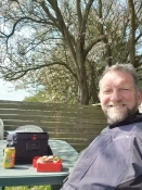
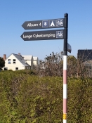
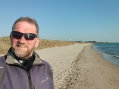
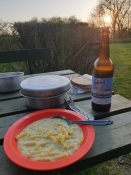
Four days with my own company on my bicycle with my tent and front panniers. After transport by train and bus to Svendborg and Rudkoebing respectively, followed a prologue on the island of Langeland. From the ferry harbour at Taars I tried to follow the coastline of Nakskov inlet through the town of Nakskov, where I shopped, to Langoe Bicycle Camping. South of Nakskov there was a detour because of som construction going on in the port. A fresh breeze from the East and lots of sunshine. In the evening I made a trip to the spit of Albuen, which I had to give up because of deep sand on the trail. I had a swim from the beach and returned to Langoe, where I cooked a dinner on the gas stove and enjoyed life at the bonfire. Unfortunately, the internet was weak, so the music did not flow proper into my ears.
Informationen zu Urheber-Rechten | |
|---|---|
Rechte-Ausprägung / Lizenz | by-sa: CREATIVE COMMONS Namensnennung, Weitergabe unter gleichen Bedingungen |
Link zur Rechtebeschreibung | |
übernommen / bearbeitet am | 21.07.2023
|
übernommen / bearbeitet durch |
|
Informationen zu Urheber-Rechten | |
|---|---|
Rechte-Inhaber | |
Rechte-Ausprägung / Lizenz | by-sa: CREATIVE COMMONS Namensnennung, Weitergabe unter gleichen Bedingungen |
Link zur Rechtebeschreibung | |
Bild hochgeladen | durch Ottocolor am 21.07.2023
|
Informationen zu Urheber-Rechten | |
|---|---|
Rechte-Inhaber | |
Rechte-Ausprägung / Lizenz | by-sa: CREATIVE COMMONS Namensnennung, Weitergabe unter gleichen Bedingungen |
Link zur Rechtebeschreibung | |
Bild hochgeladen | durch Ottocolor am 21.07.2023
|
Informationen zu Urheber-Rechten | |
|---|---|
Rechte-Inhaber | |
Rechte-Ausprägung / Lizenz | by-sa: CREATIVE COMMONS Namensnennung, Weitergabe unter gleichen Bedingungen |
Link zur Rechtebeschreibung | |
Bild hochgeladen | durch Ottocolor am 21.07.2023
|
Informationen zu Urheber-Rechten | |
|---|---|
Rechte-Inhaber | |
Rechte-Ausprägung / Lizenz | by-sa: CREATIVE COMMONS Namensnennung, Weitergabe unter gleichen Bedingungen |
Link zur Rechtebeschreibung | |
Bild hochgeladen | durch Ottocolor am 21.07.2023
|

