
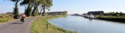
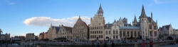
Flanders Cycle Route
former cycle route!
Actions
![]()
Please wait - map data are loading
Added on 05 Oct 2016,
last edited by biroto-Redaktion on 11 Mar 2024
Actions
Cycle route metrics
Total distance in km
832
Information about rights to the gps-track data | |
|---|---|
Rights owner | biroto-Redaktion & biroto-Contributors |
Rights characteristic / license | Contains information from OpenStreetMap, which is made available here under the Open Database License(ODbL) |
Link to the description of the license | |
GPX file taken from | |
GPX file uploaded | by biroto-Redaktion on 11 Mar 2024
|
Track points in total
12.992
Track points per km (avg)
16
Start/endpoint
Start location
Riemst, Limburg, BE (61 m NHN)
End location
Riemst, Limburg, BE (61 m NHN)
Sources of information
Bücher und Karten:
- Esterbauer bikeline: Flandern - Route: Rundtour durch den Norden Belgiens. Radtourenbuch und Karte, 152 Seiten, 1:75.000, 826 km, wetterfest/reißfest
Remarks
Seit 2021 wird die Flandern Runde eingestellt und durch die 952 km lange, in beide Richtungen ausgeschilderte Symbolroute LF Vlaanderenroute ersetzt.
Travel reports about cycle tours
22 Sep 2019
61 km
A stage of the tour »Paris - Ghent« of user ThimbleU
23 Sep 2019
51 km
A stage of the tour »Paris - Ghent« of user ThimbleU
Beds4Cyclists, worth visiting and infrastructure
Name and address
Latitude / Longitude
Phone
Fax
Mobile
Type of accommodation
Rating for cyclists
Route km
Dist. to route
Elevation
0 km
4,1 km
70 m
0 km
4,8 km
35 m
9 km
2,6 km
95 m
16 km
0,1 km
77 m
20 km
0,7 km
103 m
![]()