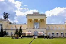
Cycle Route Lednice-Lovčice
No. of cycle route 412
Actions
![]()
Please wait - map data are loading
Added on 16 Dec 2012,
last edited by biroto-Redaktion on 30 Oct 2023
Actions
Cycle route metrics
Total distance in km
77
Information about rights to the gps-track data | |
|---|---|
Rights owner | OpenStreetMap and Contributors + biroto-Redaktion (biroto.eu) |
Rights characteristic / license | Contains information from OpenStreetMap, which is made available here under the Open Database License(ODbL) |
Link to the description of the license | |
GPX file taken from | |
GPX file uploaded | by biroto-Redaktion on 30 Oct 2023
|
Track points in total
1.040
Track points per km (avg)
14
Start/endpoint
Start location
Lednice, JM, CZ (169 m NHN)
End location
Ždánice, JM, CZ (438 m NHN)
Signposting
|
|
Beds4Cyclists, worth visiting and infrastructure
Name and address
Latitude / Longitude
Phone
Fax
Mobile
Type of accommodation
Rating for cyclists
Route km
Dist. to route
Elevation
0 km
0,9 km
151 m
0 km
4,3 km
158 m
0 km
0,7 km
164 m
0 km
4,3 km
158 m
Information about copyright | |
|---|---|
Rights owner | |
Rights characteristic / license | by: CREATIVE COMMONS Attribution |
Link to the description of the license | |
Image taken over from | |
Image has been uploaded | by biroto-Redaktion on 22 Dec 2012
|
Hlohovec (deutsch Bischofswarth) ist eine Gemeinde in der Region Südmähren in Tschechien.
Das Grenzschlösschen entstand in den Jahren zwischen 1816 und 1827 an der Grenze zwischen Niederösterreich und Mähren, wie die Aufschrift Zwischen Österreich und Mähren auf der Fassade zeigt. Der Erbauer des Schlösschen war Josef Poppelack , ein Architekt und Baumeister aus Schlesien. Erst im Jahr 1920 wurde die Staatsgrenze weiter nach Süden außerhalb von Hlohovec verschoben.
Information about copyright | |
|---|---|
Rights characteristic / license | by-sa: CREATIVE COMMONS Attribution-ShareAlike |
Link to the description of the license | |
Input taken over from: |
Seite „Hlohovec (Tschechien)“. In: Wikipedia, Die freie Enzyklopädie. Bearbeitungsstand: 16. Dezember 2012, 11:39 UTC. URL: http://de.wikipedia.org/w/index.php?title=Hlohovec_(Tschechien)&oldid=111727226 (Abgerufen: 22. Dezember 2012, 17:27 UTC) |
taken over / edited on | 22 Dec 2012
|
taken over / edited by |
|
0 km
1,0 km
152 m
![]()


