
Cycle Route Vejle - Horsens
No. of cycle route 53
Actions
![]()
Please wait - map data are loading
Added on 04 May 2013,
last edited by Ottocolor on 04 May 2013
Actions
Cycle route metrics
Total distance in km
40
Information about rights to the gps-track data | |
|---|---|
Rights owner | OpenStreetMap and Contributors + biroto-Redaktion (biroto.eu) |
Rights characteristic / license | Contains information from OpenStreetMap, which is made available here under the Open Database License(ODbL) |
Link to the description of the license | |
GPX file taken from | |
GPX file uploaded | by biroto-Redaktion on 24 Oct 2023
|
Track points in total
652
Track points per km (avg)
16
Start/endpoint
Start location
Vejle, 83, DK (3 m NHN)
End location
Horsens, 82, DK (2 m NHN)
Character
Regional Danish cycle route no. 53 (Southern/Eastern Jutland), connecting the two substantial towns of Vejle and Horsens and running 40 km in an north easterly direction, first following the Vejle fiord, then back roads through Bjerre Herred, just touching the quite steep hill of Purhøj/Bjerrelide before descending towards Horsens fiord, along which southern coast the route leads into Horsens and ends at the station. Signposted throughout its distance, however in the town centre of Vejle only as national route no. 5 (northbound).
Information about copyright | |
|---|---|
Rights characteristic / license | by-sa: CREATIVE COMMONS Attribution-ShareAlike |
Link to the description of the license | |
taken over / edited on | 04 May 2013
|
taken over / edited by |
|
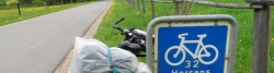
Signposting
|
|

Travel reports about cycle tours
Information about copyright | |
|---|---|
Rights owner | |
Rights characteristic / license | by-sa: CREATIVE COMMONS Attribution-ShareAlike |
Link to the description of the license | |
Image has been uploaded | by Ottocolor on 22 Nov 2013
|
21 May 2013
118 km
A stage of the tour »Spring tour to Western Jutland« of user Ottocolor
Beds4Cyclists, worth visiting and infrastructure
Name and address
Latitude / Longitude
Phone
Fax
Mobile
Type of accommodation
Rating for cyclists
Route km
Dist. to route
Elevation
0 km
0,3 km
9 m