
Cycle Route The coast and islands
No. of cycle route EE1
Actions
![]()
Please wait - map data are loading
Added on 05 Jun 2011,
last edited by biroto-Redaktion on 02 Dec 2020
Actions
Cycle route metrics
Total distance in km
980
Information about rights to the gps-track data | |
|---|---|
Rights owner | OpenStreetMap and Contributors + biroto-Redaktion (biroto.eu) |
Rights characteristic / license | Contains information from OpenStreetMap, which is made available here under the Open Database License(ODbL) |
Link to the description of the license | |
GPX file taken from | |
GPX file uploaded | by biroto-Redaktion on 02 Dec 2020
|
Track points in total
8.702
Track points per km (avg)
8
Start/endpoint
Start location
Ikla, EE (6 m NHN)
End location
Narva, EE (15 m NHN)
Character
Bike Route No. 1 in Estonia follows the Estonian coastline. It forms a part of the EuroVelo Cycling Route No. 10, which runs along the Baltic Sea.
Cyclists arriving from Latvia find a cosy coastal road to lead them from Ikla to Häädemeeste; on approach to Pärnu, however, they must also turn onto a highway. In Pärnu, titled as the summer capital of Estonia, bikers can enjoy an easy atmosphere and various cultural events. The leg from Pärnu to Virtsu runs along roads with little traffic in a pleasurable natural environment. We strongly recommend an at least one-day detour to Kihnu Island.
While the approach to Virtsu has to be made on some twenty kilometres of gravelled roads you will be rewarded by several nature reserves and bird paradises in the background.
The best part of this route are islands, such as Muhu, Saaremaa and Hiiumaa, which draw bikers in droves. Their offer scenic sites with a great natural diversity, a string of thrilling tourist attractions and memorable moments of meeting people. The road conditions of the route are good except for some sections of gravel roads in the north of Saaremaa, which are dusty.
Apart from the main route, we definitely recommend detours to the outmost corners of the plentiful peninsulas, in particular to routes No. 301 and 302 in Hiiumaa.
After returning to the mainland, it is worthwhile to look around in Haapsalu before the trip takes you to areas once populated with Swedes – Noarootsi Peninsula and the forests of Nõva. Unfortunately, the coastal roads there are fairly bumpy, yet the discomfort is offset by the natural environment, which is relatively pristine.
Paldiski is a living memorial of the Soviet rule. Once closed for outsiders, the town and its numerous vestiges of military facilities, while having a depressing effect, are interesting to look at.
The lap from Paldiski to Tallinn runs on asphalt roads lined with fabulous views of the sea, the steep limestone bluff and the forest. Closer to Tallinn the traffic turns disturbingly dense yet you have to put up with it until a special bicycle road is completed.
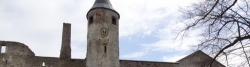
Those interested in cities may have a longer stop in Tallinn for sightseeing. Tallinn’s Old Town is one of the pearls of Europe.
As the journey continues from Tallinn to Narva, the first twenty or so kilometres along the main road have little to offer for the eye. Closer to the tourist magnet of North Estonia – Lahemaa National Park – we again enter a landscape that is very attractive to tourists. While the bike route leading to the remotest corners of the peninsulas comprises some 20 km of gravel roads it passes through fascinating places.
Past Lahemaa towards Narva the route proceeds parallel to the coast, occasionally opening up matchless vistas. In the Purtse area the route takes to narrow gravel and dirt roads, the only alternative to the heavy traffic of the highway. Outside Sillamäe you still have to pedal a short stretch or two on the highway. The places of interest are the Stalinist-style industrial city of Sillamäe, the formerly famous holiday resort Narva-Jõesuu and the border city of Narva.
Narva is the end point of the Estonian section of the EuroVelo route. Before you continue into Russia, take heed of the fact that the infrastructure for cycling has yet to be developed there.
Information about copyright | |
|---|---|
Rights characteristic / license | © all rights reserved. |
Input taken over from: |
Copied from Esto Velo, permission received from Rein Lepik on 13 Oct. 2013. |
taken over / edited on | 13 Oct 2013 - 02 Dec 2020
|
taken over / edited by |
|
Signposting
|

Sources of information
Travel reports about cycle tours
Information about copyright | |
|---|---|
Rights owner | |
Rights characteristic / license | by-sa: CREATIVE COMMONS Attribution-ShareAlike |
Link to the description of the license | |
Image has been uploaded | by Ottocolor on 07 Jul 2017
|
20 May 2017
96 km
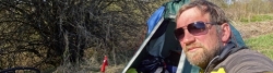
A stage of the tour »Iron Curtain Tour, part 1: Klaipeda-Grense Jakobselv« of user Ottocolor
Information about copyright | |
|---|---|
Rights owner | |
Rights characteristic / license | by-sa: CREATIVE COMMONS Attribution-ShareAlike |
Link to the description of the license | |
Image has been uploaded | by Ottocolor on 07 Jul 2017
|
19 May 2017
87 km
A stage of the tour »Iron Curtain Tour, part 1: Klaipeda-Grense Jakobselv« of user Ottocolor
Information about copyright | |
|---|---|
Rights owner | |
Rights characteristic / license | by-sa: CREATIVE COMMONS Attribution-ShareAlike |
Link to the description of the license | |
Image has been uploaded | by Ottocolor on 07 Jul 2017
|
18 May 2017
107 km
A stage of the tour »Iron Curtain Tour, part 1: Klaipeda-Grense Jakobselv« of user Ottocolor
Information about copyright | |
|---|---|
Rights owner | |
Rights characteristic / license | by-sa: CREATIVE COMMONS Attribution-ShareAlike |
Link to the description of the license | |
Image has been uploaded | by Ottocolor on 04 Jul 2017
|
16 May 2017
99 km
A stage of the tour »Iron Curtain Tour, part 1: Klaipeda-Grense Jakobselv« of user Ottocolor
Information about copyright | |
|---|---|
Rights owner | |
Rights characteristic / license | by-sa: CREATIVE COMMONS Attribution-ShareAlike |
Link to the description of the license | |
Image has been uploaded | by Ottocolor on 04 Jul 2017
|
15 May 2017
67 km
A stage of the tour »Iron Curtain Tour, part 1: Klaipeda-Grense Jakobselv« of user Ottocolor
Information about copyright | |
|---|---|
Rights owner | |
Rights characteristic / license | by-sa: CREATIVE COMMONS Attribution-ShareAlike |
Link to the description of the license | |
Image has been uploaded | by Ottocolor on 04 Jul 2017
|
13 May 2017
102 km
A stage of the tour »Iron Curtain Tour, part 1: Klaipeda-Grense Jakobselv« of user Ottocolor
Information about copyright | |
|---|---|
Rights owner | |
Rights characteristic / license | by-sa: CREATIVE COMMONS Attribution-ShareAlike |
Link to the description of the license | |
Image has been uploaded | by Ottocolor on 04 Jul 2017
|
12 May 2017
111 km
A stage of the tour »Iron Curtain Tour, part 1: Klaipeda-Grense Jakobselv« of user Ottocolor
Beds4Cyclists, worth visiting and infrastructure
Name and address
Latitude / Longitude
Phone
Fax
Mobile
Type of accommodation
Rating for cyclists
Route km
Dist. to route
Elevation
0 km
1,3 km
6 m
0 km
1,3 km
9 m
Languages spoken:
latviešu valoda
11 km
0,3 km
0 m
14 km
0,2 km
11 m
14 km
0,6 km
5 m
![]()