Carpathian Cycle Route
Actions
![]()
Please wait - map data are loading
Added on 01 Jul 2016,
last edited by biroto-Redaktion on 11 Jan 2021
Actions
Cycle route metrics
Total distance in km
609
Information about rights to the gps-track data | |
|---|---|
Rights owner | OpenStreetMap and Contributors + biroto-Redaktion (biroto.eu) |
Rights characteristic / license | Contains information from OpenStreetMap, which is made available here under the Open Database License(ODbL) |
Link to the description of the license | |
GPX file taken from | |
GPX file uploaded | by biroto-Redaktion on 11 Jan 2021
|
Track points in total
10.391
Track points per km (avg)
17
Start/endpoint
Start location
Cieszyn, Silesian Voivodeship, PL (273 m NHN)
End location
Krościenko, Subcarpathian Voivodeship, PL (397 m NHN)
Beds4Cyclists, worth visiting and infrastructure
Name and address
Latitude / Longitude
Phone
Fax
Mobile
Type of accommodation
Rating for cyclists
Route km
Dist. to route
Elevation
0 km
0,3 km
304 m
Information about copyright | |
|---|---|
Rights owner | |
Rights characteristic / license | by-sa: CREATIVE COMMONS Attribution-ShareAlike |
Link to the description of the license | |
Image taken over from | |
Image has been uploaded | by biroto-Redaktion on 11 Oct 2019
|
Information about copyright | |
|---|---|
Rights owner | https://commons.wikimedia.org/w/index.php?title=User:DanielG44K |
Rights characteristic / license | by-sa: CREATIVE COMMONS Attribution-ShareAlike |
Link to the description of the license | |
Image taken over from | https://commons.wikimedia.org/wiki/File:Saint_Mary_Magdalene_church_in_Cieszyn.jpg |
Image has been uploaded | by biroto-Redaktion on 11 Oct 2019
|
Information about copyright | |
|---|---|
Rights owner | |
Rights characteristic / license | by-sa: CREATIVE COMMONS Attribution-ShareAlike |
Link to the description of the license | |
Image taken over from | https://commons.wikimedia.org/wiki/File:Rotunda_w_Cieszynie_1.JPG |
Image has been uploaded | by biroto-Redaktion on 11 Oct 2019
|
Information about copyright | |
|---|---|
Rights owner | |
Rights characteristic / license | by-sa: CREATIVE COMMONS Attribution-ShareAlike |
Link to the description of the license | |
Image taken over from | https://commons.wikimedia.org/wiki/File:Pałac_Myśliwski_Habsburgów_w_Cieszynie_1.JPG |
Image has been uploaded | by biroto-Redaktion on 11 Oct 2019
|
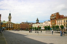
Cieszyn is a medieval town in Silesian Voivodeship, Poland. It is one of the principal border crossing points between Poland and Czech Republic. The town on the other side of the river Olza (which forms the border between the two countries) is called Český Těšín. Both towns were Cieszyn until they were divided by a Versailles Treaty change in borders in 1920.
See
- ⊙Old Town Square (Rynek) with bourgeoisie houses and Town Hall (Ratusz)
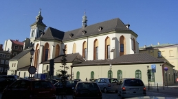
- ⊙Cieszyn Castle, Zamkowa 3. Su-F: 9:00—17:00. Closed on Sa. Remnants: Piast Castle Tower, Gothic St. Mary Magdalene Church, Romanesque St. Nicholas' Chapel (11th century rotunda)
- Jewish cemeteries
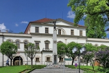
- ⊙Museum of Cieszyn Silesia, ul. Tadeusza Regera 6. In the former Larisch palace (Pałac Laryszów, Muzeum Śląska Cieszyńskiego). The oldest continuously working museum in Poland, opened in 1802. 16 PLN. (updated Mar 2017)
- ⊙Museum of Typography (Muzeum Drukarstwa), ul. Głęboka 50, ☎ +48 33 851 1630. Tue-Fri 10-17, from may-september also on Sat-Sun 14-18. 10 PLN incl. tour. (updated Mar 2017)
- ⊙Rotunda of Saint Nicholas, Zamkowa. A Romanesque rotunda built in the 12th century. It used to be a castle chapel and a stronghold church. This rotunda is also the one that can be seen on the 20 zł banknotes.
Information about copyright | |
|---|---|
Rights characteristic / license | by-sa: CREATIVE COMMONS Attribution-ShareAlike |
Link to the description of the license | |
Input taken over from: |
Wikivoyage contributors, 'Cieszyn', Wikivoyage, The FREE worldwide travel guide that anyone can edit, 25 May 2019, 01:46 UTC, https://en.wikivoyage.org/w/index.php?title=Cieszyn&oldid=3785172 [accessed 11 October 2019] |
taken over / edited on | 11 Oct 2019
|
taken over / edited by |
|
0 km
0,3 km
305 m
Hours of opening
May - September:
Monday - Friday from 8:00 to 18:00
Saturday from 8:00 to 16:00 (every second Saturday: until 18:00)
Sunday from 10:00 to 16:00
October - April:
Monday - Friday from 8:00 to 16:00
Saturday from 8:00 to 16:00 (9:00 to 13:00)
246 km
3,3 km
324 m
Information about copyright | |
|---|---|
Rights owner | |
Rights characteristic / license | by-sa: CREATIVE COMMONS Attribution-ShareAlike |
Link to the description of the license | |
Image taken over from | |
Image has been uploaded | by biroto-Redaktion on 07 Jul 2016
|
Information about copyright | |
|---|---|
Rights owner | |
Rights characteristic / license | by-sa: CREATIVE COMMONS Attribution-ShareAlike |
Link to the description of the license | |
Image taken over from | https://commons.wikimedia.org/wiki/File:Zespół_kościoła_parafialnego.jpg |
Image has been uploaded | by biroto-Redaktion on 07 Jul 2016
|
Information about copyright | |
|---|---|
Rights owner | |
Rights characteristic / license | by-sa: CREATIVE COMMONS Attribution-ShareAlike |
Link to the description of the license | |
Image taken over from | https://commons.wikimedia.org/wiki/File:Zespół_koscioła_parafialnego,_spichlerz.jpg |
Image has been uploaded | by biroto-Redaktion on 07 Jul 2016
|
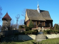
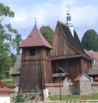
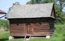
The Parish Church of the Nativity of the Blessed Virgin Mary in Rajbrot dates from the beginning of the C16th. The single-nave church constitutes a well preserved example of gothic wooden architecture.
Information about copyright | |
|---|---|
Rights characteristic / license | by-sa: CREATIVE COMMONS Attribution-ShareAlike |
Link to the description of the license | |
Input taken over from: |
Taken from the info-board in front of the church. |
taken over / edited on | 07 Jul 2016
|
taken over / edited by |
|
257 km
0,7 km
277 m
Information about copyright | |
|---|---|
Rights owner | |
Rights characteristic / license | by-sa: CREATIVE COMMONS Attribution-ShareAlike |
Link to the description of the license | |
Image taken over from | https://commons.wikimedia.org/wiki/File:Kościół_w_Iwkowej_prezbiterium.jpg |
Image has been uploaded | by biroto-Redaktion on 08 Jul 2016
|
Information about copyright | |
|---|---|
Rights owner | |
Rights characteristic / license | by-sa: CREATIVE COMMONS Attribution-ShareAlike |
Link to the description of the license | |
Image taken over from | https://commons.wikimedia.org/wiki/File:Kościół_w_Iwkowej-portal.jpg |
Image has been uploaded | by biroto-Redaktion on 08 Jul 2016
|
Information about copyright | |
|---|---|
Rights owner | |
Rights characteristic / license | by-sa: CREATIVE COMMONS Attribution-ShareAlike |
Link to the description of the license | |
Image taken over from | https://commons.wikimedia.org/wiki/File:Kościół_w_Iwkowej-wnetrze.jpg |
Image has been uploaded | by biroto-Redaktion on 08 Jul 2016
|
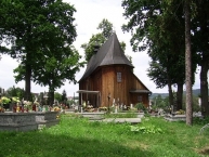
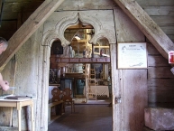
The Cemetery Church of the Annunciation of the Blessed Virgin Mary in Iwkowa dates from the second half of the C15th and is one of the oldest churches in Małopolska. The low post-construction spire was added in 1619. Fragments of late-renaissance figurative polychrome have survived to the present day.
Information about copyright | |
|---|---|
Rights characteristic / license | by-sa: CREATIVE COMMONS Attribution-ShareAlike |
Link to the description of the license | |
Input taken over from: |
Taken from the info-board in front of the church. |
taken over / edited on | 08 Jul 2016
|
taken over / edited by |
|
261 km
0,0 km
220 m
Information about copyright | |
|---|---|
Rights owner | https://commons.wikimedia.org/w/index.php?title=User:ZeroJeden |
Rights characteristic / license | by-sa: CREATIVE COMMONS Attribution-ShareAlike |
Link to the description of the license | |
Image taken over from | https://commons.wikimedia.org/wiki/File:Zamek_Tropsztyn_-_ZJ001.jpg |
Image has been uploaded | by biroto-Redaktion on 25 Jan 2016
|
Information about copyright | |
|---|---|
Rights owner | |
Rights characteristic / license | by-sa: CREATIVE COMMONS Attribution-ShareAlike |
Link to the description of the license | |
Image taken over from | https://commons.wikimedia.org/wiki/File:Zamek_Tropsztyn_20150704_8683.jpg |
Image has been uploaded | by biroto-Redaktion on 25 Jan 2016
|
Information about copyright | |
|---|---|
Rights owner | |
Rights characteristic / license | by: CREATIVE COMMONS Attribution |
Link to the description of the license | |
Image taken over from | |
Image has been uploaded | by biroto-Redaktion on 25 Jan 2016
|
![]()

