Cycle Route Via Julia
Actions
![]()
Please wait - map data are loading
Added on 30 Apr 2012,
last edited by biroto-Redaktion on 04 Apr 2024
Actions
Cycle route metrics
Total distance in km
316
Information about rights to the gps-track data | |
|---|---|
Rights owner | OpenStreetMap and Contributors + biroto-Redaktion (biroto.eu) |
Rights characteristic / license | Contains information from OpenStreetMap, which is made available here under the Open Database License(ODbL) |
Link to the description of the license | |
GPX file taken from | |
GPX file uploaded | by biroto-Redaktion on 04 Apr 2024
|
Track points in total
5.142
Track points per km (avg)
16
Start/endpoint
Start location
Günzburg, Bayern, DE (470 m NHN)
End location
Salzburg, Salzburg, AT (422 m NHN)
Signposting
|
|
Beds4Cyclists, worth visiting and infrastructure
Name and address
Latitude / Longitude
Phone
Fax
Mobile
Type of accommodation
Rating for cyclists
Route km
Dist. to route
Elevation
0 km
1,6 km
446 m
0 km
0,7 km
468 m
0 km
1,1 km
465 m
Information about copyright | |
|---|---|
Rights owner | |
Rights characteristic / license | cc0: Public Domain no Rights reserved |
Link to the description of the license | |
Image taken over from | |
Image has been uploaded | by biroto-Redaktion on 18 Feb 2013
|
Information about copyright | |
|---|---|
Rights owner | |
Rights characteristic / license | by: CREATIVE COMMONS Attribution |
Link to the description of the license | |
Image taken over from | commons.wikimedia.org/wiki/File:Günzburg,_Altstadt_von_Westen-002.jpg |
Image has been uploaded | by biroto-Redaktion on 18 Feb 2013
|
Information about copyright | |
|---|---|
Rights owner | |
Rights characteristic / license | by: CREATIVE COMMONS Attribution |
Link to the description of the license | |
Image taken over from | commons.wikimedia.org/wiki/File:Günzburg,_Marktplatz_8-002.jpg |
Image has been uploaded | by biroto-Redaktion on 18 Feb 2013
|
Information about copyright | |
|---|---|
Rights owner | |
Rights characteristic / license | cc0: Public Domain no Rights reserved |
Link to the description of the license | |
Image taken over from | |
Image has been uploaded | by biroto-Redaktion on 18 Feb 2013
|
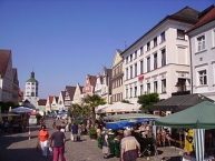
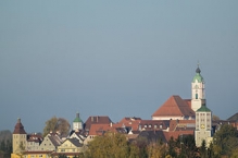
Günzburg ist eine Stadt an der Donau und ist Verwaltungssitz des gleichnamigen Landkreises. Sie liegt im Regierungsbezirk Schwaben im Schwäbischen Barockwinkel.
Die Stadt Günzburg liegt an der Mündung des Flusses Günz in die Donau. Der historische Stadtkern liegt am rechten Flußufer, das Stadtgebiet reicht auf die andere Seite des Flussesn in das Donauried.
Sehenswürdigkeiten
- Altstadt: die Altstadt ist umfassend saniert und fast vollständig erhalten.
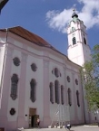
- ⊙Frauenkirche. Die Kirche wurde 1736–1741 von Dominikus Zimmermann im Stil des Rokoko erbaut und gilt als Vorgängerin der Wieskirche.
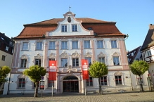
- ⊙Markgräfliches Schloss mit Hofkirche. Das Schloss wurde im späten 16. Jahrhundert von den Habsburgern erbaut. Das Schloss wurde im 19. Jahrhundert umgebaut. Nach den Beschädigungen im 2. Weltkrieg wurde es restauriert und dient heute als Sitz verschiedener Behörden.
- ⊙Unteres Tor, Stadtturm. Der Turm gilt als Wahrzeichen der Stadt.
- ⊙Kuhturm
- ⊙Heimatmuseum: mit großen frühgeschichtlichen Sammlungen.
Information about copyright | |
|---|---|
Rights characteristic / license | by-sa: CREATIVE COMMONS Attribution-ShareAlike |
Link to the description of the license | |
Input taken over from: |
|
taken over / edited on | 18 Feb 2013 - 22 Dec 2022
|
taken over / edited by |
|
0 km
1,1 km
472 m
0 km
0,1 km
469 m
![]()


