Cycle Route Saint-Brieuc - Lorient
No. of cycle route V8
Actions
![]()
Please wait - map data are loading
Added on 24 Jan 2015,
last edited by biroto-Redaktion on 06 Dec 2020
Actions
Cycle route metrics
Total distance in km
178
Information about rights to the gps-track data | |
|---|---|
Rights owner | OpenStreetMap and Contributors + biroto-Redaktion (biroto.eu) |
Rights characteristic / license | Contains information from OpenStreetMap, which is made available here under the Open Database License(ODbL) |
Link to the description of the license | |
GPX file taken from | |
GPX file uploaded | by biroto-Redaktion on 06 Dec 2020
|
Track points in total
3.365
Track points per km (avg)
19
Start/endpoint
Start location
Hillion, Brittany, FR (6 m NHN)
End location
Hennebont, Brittany, FR (6 m NHN)
Sources of information
WebSites:
- Route description on francevelotourisme.com
Beds4Cyclists, worth visiting and infrastructure
Name and address
Latitude / Longitude
Phone
Fax
Mobile
Type of accommodation
Rating for cyclists
Route km
Dist. to route
Elevation
117 km
1,2 km
79 m
118 km
0,1 km
74 m
119 km
0,1 km
56 m
Information about copyright | |
|---|---|
Rights owner | |
Rights characteristic / license | by-sa: CREATIVE COMMONS Attribution-ShareAlike |
Link to the description of the license | |
Image taken over from | |
Image has been uploaded | by biroto-Redaktion on 24 Apr 2015
|
Information about copyright | |
|---|---|
Rights owner | |
Rights characteristic / license | by-sa: CREATIVE COMMONS Attribution-ShareAlike |
Link to the description of the license | |
Image taken over from | |
Image has been uploaded | by biroto-Redaktion on 24 Apr 2015
|
Information about copyright | |
|---|---|
Rights owner | |
Rights characteristic / license | by-sa: CREATIVE COMMONS Attribution-ShareAlike |
Link to the description of the license | |
Image taken over from | |
Image has been uploaded | by biroto-Redaktion on 24 Apr 2015
|
Information about copyright | |
|---|---|
Rights owner | |
Rights characteristic / license | by-sa: CREATIVE COMMONS Attribution-ShareAlike |
Link to the description of the license | |
Image taken over from | |
Image has been uploaded | by biroto-Redaktion on 24 Apr 2015
|
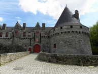
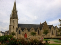
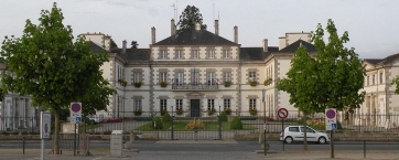
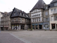
Pontivy (Pondi auf Bretonisch) ist eine französische Gemeinde mit 13.973 Einwohnern (Stand 1. Januar 2012) im Département Morbihan in der Region Bretagne.
Der Mönch Ivy gründete Pontivy im 7. Jahrhundert. Er ließ eine Brücke über den Blavet bauen, die der Stadt ihren Namen gab. Am 18. Brumaire des Jahres XII der Revolution (9. November 1804) wurde der Name der Stadt in Napoléonville geändert. Nach dem Sturz Napoleons I. hieß sie wieder Pontivy, dann Bourbonville, dann erneut einige Jahre (unter Napoléon III.) Napoléonville.
Sehenswürdigkeiten
- Burg der Familie Rohan (Ende 15. Jahrhundert)
- Basilika Notre-Dame-de-Joie
Information about copyright | |
|---|---|
Rights characteristic / license | by-sa: CREATIVE COMMONS Attribution-ShareAlike |
Link to the description of the license | |
Input taken over from: |
Seite „Pontivy“. In: Wikipedia, Die freie Enzyklopädie. Bearbeitungsstand: 20. Oktober 2014, 15:05 UTC. URL: http://de.wikipedia.org/w/index.php?title=Pontivy&oldid=135060363 (Abgerufen: 24. April 2015, 11:41 UTC) |
taken over / edited on | 24 Apr 2015
|
taken over / edited by |
|
119 km
0,2 km
58 m
128 km
0,3 km
78 m
![]()


