Cycle Tour Canal des 2 mers - Mediterranean route - Cycle route Switzerland-Mediterranean
14. Etappe: Peymeinade - Menton
![]()
Please wait - map data are loading
Added on 13 Jun 2018
last edited by ThimbleU on 25 Sep 2018
Cycle route metrics
ridden
Total distance in km
101
Cumulative elevation gain in m
762
Avg. slope uphill in %
0,75
Cumulative elevation loss in m
939
Total cycling hours
6,6
Avg. pace in km/h
15,3
Min. height
3
Max. height
230
Information about rights to the gps-track data | |
|---|---|
Rights owner | |
Rights characteristic / license | cc0: Public Domain no Rights reserved |
Link to the description of the license | |
GPX file uploaded | by ThimbleU on 02 Jul 2018
|
Track points in total
1.913
Track points per km (avg)
19
Start/endpoint
Start location
Peymeinade, Provence-Alpes-Côte d'Azur, FR (193 m NHN)
End location
Menton, Provence-Alpes-Côte d'Azur, FR (16 m NHN)
ridden on
01 Jul 2018
Weather
Sunny.
Accommodation
Hôtel Chambord
6 Avenue Boyer
FR-06500 Menton
Signposting
Signposting with the EV8 logo behind Pégomas for six kilometers, and occasionally from Cannes to Nice, but not enough for navigation. |
|

Properties
asphalt | 101 km | 100 % |
The information relates to the track as traveled!
Slope Gradient Distribution
Travel report
The breakfast was small: coffee short, two pieces of white bread, two croissants, and two small portion trays with jam.
From the hotel we cycled the few meters back to the bike path towards Grasse. Then we rolled down a side road to avoid road D2562. After that we had to climb uphill 55 meters of elevation again. Road D2562 would have been the better alternative.
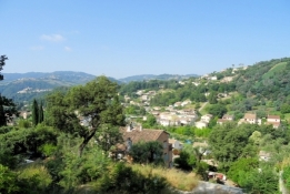
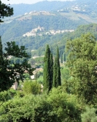
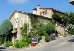
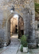
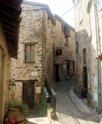
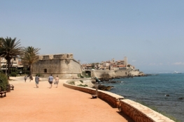
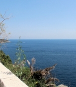
Then we turned south, this time the side street made sense. At almost the same elevation we cycled through residential areas and came to road D609. On this the descent to the sea began. We once more took a side street. Steep and with beautiful views of the opposite side of the valley we rolled down 160 meters of elevation. From the roundabout of road D9 we turned right to the old mountain village of Auribeau, which we already saw impressively hanging on the flank of the hill during the descent. This small village with its medieval buildings is very pittoresque.
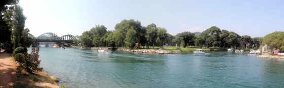
It went back to road D9 and on this through Pégomas. Shortly before the river Siagne the signage of the EV8 started. 5½ kilometers we cycled on a well-developed bike path towards the sea. Then suddenly the signage ended. Luckily we were close to the elaborated track and were able to navigate to the sea easily.
Information about copyright | |
|---|---|
Rights characteristic / license | by-sa: CREATIVE COMMONS Attribution-ShareAlike |
Link to the description of the license | |
taken over / edited on | 25 Sep 2018
|
taken over / edited by |
|
Information about copyright | |
|---|---|
Rights owner | |
Rights characteristic / license | © all rights reserved. |
Image has been uploaded | by ThimbleU on 25 Sep 2018
|
Information about copyright | |
|---|---|
Rights owner | |
Rights characteristic / license | © all rights reserved. |
Image has been uploaded | by ThimbleU on 25 Sep 2018
|
Information about copyright | |
|---|---|
Rights owner | |
Rights characteristic / license | © all rights reserved. |
Image has been uploaded | by ThimbleU on 25 Sep 2018
|

Information about copyright | |
|---|---|
Rights owner | |
Rights characteristic / license | © all rights reserved. |
Image has been uploaded | by ThimbleU on 25 Sep 2018
|
Information about copyright | |
|---|---|
Rights owner | |
Rights characteristic / license | © all rights reserved. |
Image has been uploaded | by ThimbleU on 25 Sep 2018
|
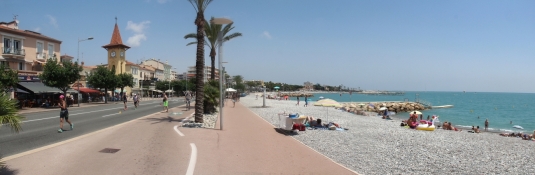
From now on the route went along the shore road for many kilometers.
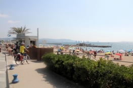
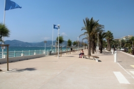
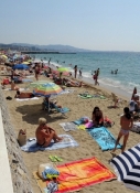
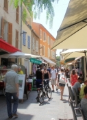
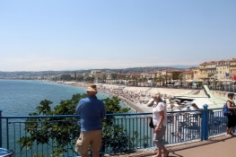
On the section to Cannes there was bustling activity. The cars drove walking pace and we had to adapt to that. A bicycle lane is rarely available and if so, was occupied by pedestrians. To the right of us on the only a few meters wide sandy beach it was swarming with sunbathers. Cars were parked densely at the roadside (and also on the few bike lanes).
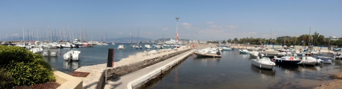
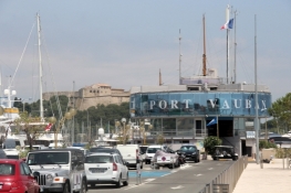
The situation got better when we arrived at Cannes harbour. The traffic density was much lower and we could cycle easily through the city. Changing on the wide sidewalks made no sense; there were too many pedestrians.
Information about copyright | |
|---|---|
Rights characteristic / license | by-sa: CREATIVE COMMONS Attribution-ShareAlike |
Link to the description of the license | |
taken over / edited on | 25 Sep 2018
|
taken over / edited by |
|
Information about copyright | |
|---|---|
Rights owner | |
Rights characteristic / license | © all rights reserved. |
Image has been uploaded | by ThimbleU on 25 Sep 2018
|
Information about copyright | |
|---|---|
Rights owner | |
Rights characteristic / license | © all rights reserved. |
Image has been uploaded | by ThimbleU on 25 Sep 2018
|
Information about copyright | |
|---|---|
Rights owner | |
Rights characteristic / license | © all rights reserved. |
Image has been uploaded | by ThimbleU on 25 Sep 2018
|
Information about copyright | |
|---|---|
Rights owner | |
Rights characteristic / license | © all rights reserved. |
Image has been uploaded | by ThimbleU on 25 Sep 2018
|
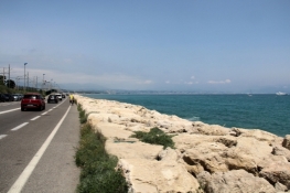
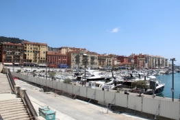
At the end of the peninsula of Cap de la Croissete a well-developed bike path began that brought us until shortly before Golfe-Juan. Then until Antibes it was again necessary to cycle on the road.
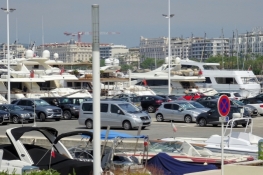
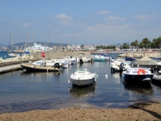
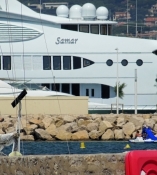
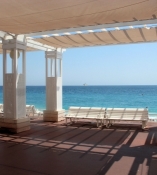
The images were repeated. Many beaches with many sunbathers, harbours full of boats, at the landward side accommodations, restaurants, cafes, shops.
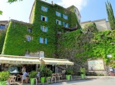
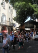
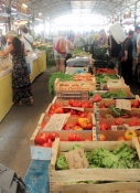
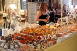
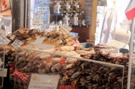
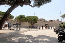
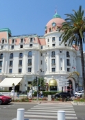
A nice highlight was the old town of Antibes. The town, which was converted from Vabaun to the fortress, has beautiful alleys, but was also overrun by tourists. A Provencal market took place on one of the small squares. Provided with fresh fruit from the market we took a break in the harbour area.
Information about copyright | |
|---|---|
Rights characteristic / license | by-sa: CREATIVE COMMONS Attribution-ShareAlike |
Link to the description of the license | |
taken over / edited on | 25 Sep 2018
|
taken over / edited by |
|
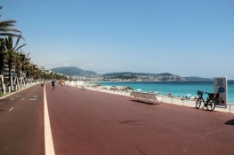
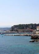
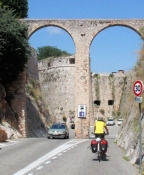
Behind Antibes begins an excellently developed bike path that goes until the eastern edge of Nice.
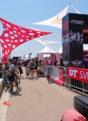
In Cagnes-sur-Mer a triathlon took place at 30° C. The road was closed, but we were able to pass on the bike path.
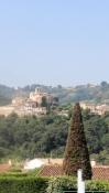
Behind the airport then a nice view over the bay of Nice.
Information about copyright | |
|---|---|
Rights characteristic / license | by-sa: CREATIVE COMMONS Attribution-ShareAlike |
Link to the description of the license | |
taken over / edited on | 25 Sep 2018
|
taken over / edited by |
|
Information about copyright | |
|---|---|
Rights owner | |
Rights characteristic / license | © all rights reserved. |
Image has been uploaded | by ThimbleU on 25 Sep 2018
|
Information about copyright | |
|---|---|
Rights owner | |
Rights characteristic / license | © all rights reserved. |
Image has been uploaded | by ThimbleU on 25 Sep 2018
|
Information about copyright | |
|---|---|
Rights owner | |
Rights characteristic / license | © all rights reserved. |
Image has been uploaded | by ThimbleU on 25 Sep 2018
|
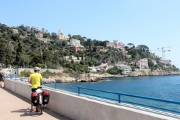
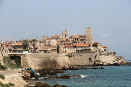
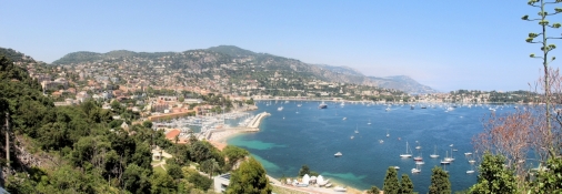
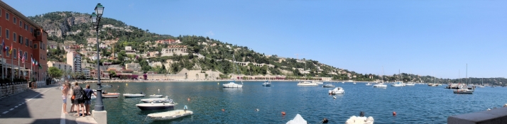
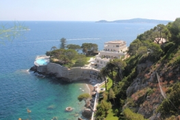
Behind Nice, the flat parts of the today's stage ended. At first the Château in Nice, then behind the harbour, the Mont Boron with the Cap de Nice was to circumnavigate. In Villefranche-sur-Mer we cycled from road M6098 down to the village. But the track around the old citadel required to cycle uphill again immediately. After a beautiful stretch around the bay, a planning error turned out. To get out of the bay at the eastern end, was only possible over two stairs. We carried the bikes up and then pushed them back through a private area to road M6098. We'd better have stayed from the outset up there on road M6098.
Information about copyright | |
|---|---|
Rights characteristic / license | by-sa: CREATIVE COMMONS Attribution-ShareAlike |
Link to the description of the license | |
taken over / edited on | 25 Sep 2018
|
taken over / edited by |
|
Information about copyright | |
|---|---|
Rights owner | |
Rights characteristic / license | © all rights reserved. |
Image has been uploaded | by ThimbleU on 25 Sep 2018
|
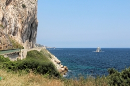
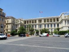
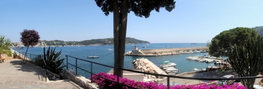
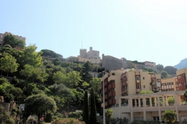
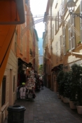
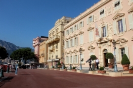
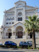
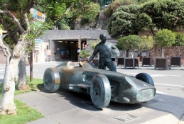
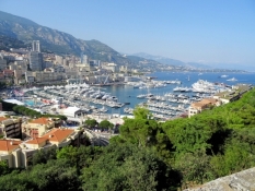
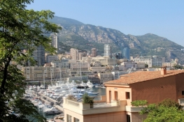
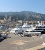
On road M6098 we continued to Monaco. In front of the Place de Canton we had to use one of the many tunnels in the city. But it was well lit and we came through as a cyclist well. A little later we went down to the harbour. Spontaneously, we decided to cycle up to the old town and the palace. On the road, which to use was suggested by the staff of the Tourist Information Point, we came to a parking garage, from where lifts lead to the hill. But: for bicycles prohibited! So we had to turn back. A piece of the way we pushed the bike up a footpath and then cycled on another road to the old town. The streets of the old town are narrow; we pushed the bikes carefully through the mass of pedestrians. Then we stood in front of the palace. From the edge of the hill there was a beautiful view of the port of Monaco and of the front of high-risers on the opposite mountain. Monaco is too small for the great demand for living and business space.
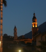
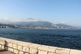
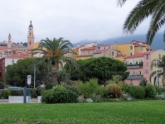
Back at the harbour we cycled close to the sea through Monaco and Monte-Carlo. At the end a strong climb up to road D6098. On this we continued to Cape Martin. On road D52 then through a mansion district downhill to the sea. In the light of the evening sun, the bay laid in front of us with Menton in the middle and Liguria at the right end.
Information about copyright | |
|---|---|
Rights characteristic / license | by-sa: CREATIVE COMMONS Attribution-ShareAlike |
Link to the description of the license | |
taken over / edited on | 25 Sep 2018
|
taken over / edited by |
|

Information about copyright | |
|---|---|
Rights owner | |
Rights characteristic / license | © all rights reserved. |
Image has been uploaded | by ThimbleU on 25 Sep 2018
|
Information about copyright | |
|---|---|
Rights owner | |
Rights characteristic / license | © all rights reserved. |
Image has been uploaded | by ThimbleU on 25 Sep 2018
|
Information about copyright | |
|---|---|
Rights owner | |
Rights characteristic / license | © all rights reserved. |
Image has been uploaded | by ThimbleU on 25 Sep 2018
|